Islay, Bowmore, General
Village (18th Century)
Site Name Islay, Bowmore, General
Classification Village (18th Century)
Canmore ID 37662
Site Number NR35NW 9
NGR NR 3111 5973
Datum OSGB36 - NGR
Permalink http://canmore.org.uk/site/37662
- Council Argyll And Bute
- Parish Killarow And Kilmeny
- Former Region Strathclyde
- Former District Argyll And Bute
- Former County Argyll
NR35NW 9 3111 5973
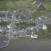
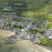
During October 1999, RCAHMS conducted a photographic survey of Bowmore and environs. The prupose of this survey was to enhance and augment the existing holdings of the National Monuments Record Scotland.
Visited by RCAHMS (MKO), October 1999.
PHOTOGRAPHS: NMRS copies of watercolours by W. Heath c.1829-1832 in possession of Hon. James Morrison.
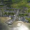
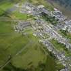
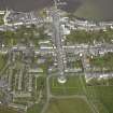
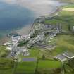
The village of Bowmore stands on a north-facing hillside on the E shore of Loch Indaal about 3.6km SW of Islay House.
It is a planned settlement of regular layout, founded in 1768 by Daniel Campbell of Shawfield and Islay as part of a scheme of estate reorganisation involving the removal of the old village of Kilarrow from the immediate vicinity of Islay House.(Statistical Account 1790) By 1793 one hundred and ten houses had been erected in the village, and gave accommodation for a total population of about 500. In 1891, the population stood at about 850, and a late 19th-century commentator complained that the village had 'been greatly disfigured by the medley character of its private houses, every builder having been allowed to please himself as to the material, shape and size of his structures'. (Ordnance Survey Gazetteer)
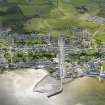
The axis of the layout is the wide Main Street which ascends southwards over a distance of about 300 m from the
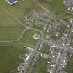
pier (Building-operations on a quay at Bowmore were in progress in 1750, Islay Stent Bk) to the circular parish church at the head. It is intersected by streets running E and W, and the grid is completed by N-S access-lanes on the periphery of the original settlement. Behind the street-frontages the interior of the village is taken up by garden ground, and the enclosed fields beyond, particularly to the S, probably reflect some of the original divisions of the associated lots. A distillery founded in 1779 occupies the NW quarter of the village, and in some parts of Bowmore the original pattern of building-feus has either remained incomplete or been interrupted by later developments.
A range of two-storeyed semi-domestic warehouses, which stand at the E foot of Main Street close to the pier, probably constitutes the oldest surviving group of buildings in the village, possibly even preceding its formal inauguration in 1768. They are constructed of limewashed rubble masonry with external forestairs to the upper floors, and have plain coped chimney-stacks. (THe buildings have been much altered, especially on the ground floor, and at the date of survey the N unit was in course of restoration as a dwelling-house) The single- and two-storeyed houses in the village are otherwise mainly of plain three-bay frontages which, despite later modifications, possess some degree of uniformity but are clearly not of standard design even within the same streets.
In the streets running E-W, the frontages on Flora Street are about 9.9m in average length, and the corresponding
dimension of the larger terraced units on Shore Street is 12.7m. Detached buildings like Bowmore House, which
stands on the S side of School Street opposite the distillery, are also of this larger category, and in this instance the feu
also incorporates the site of an adjacent kitchen at the W and a range of now-ruinous ancillary buildings at the rear. (Feu contracts of 1769, 1777 and 1781, registered September 1814)
The frontages generally are harled or rendered, and the roofs are mostly gabled and slate-covered. The last of the
once-numerous thatched buildings was a rope-thatched single-storeyed cottage which stood at 62 Jamieson Street
until some time after 1965, and there was also at that date a pantile-roofed ancillary building attached to the rear of a
house in Shore Street. (In 1793 forty out of 110 houses in the village were thatched, fifty were slated and twenty were tiled. [Statistical Account 1794])
Visited August 1977
RCAHMS 1984
Field Visit (August 1977)
The village of Bowmore stands on a north-facing hillside on the E shore of Loch Indaal about 3.6km SW of Islay House.
It is a planned settlement of regular layout, founded in 1768 by Daniel Campbell of Shawfield and Islay as part of a scheme of estate reorganisation involving the removal of the old village of Kilarrow from the immediate vicinity of Islay House.(Statistical Account 1790) By 1793 one hundred and ten houses had been erected in the village, and gave accommodation for a total population of about 500. In 1891, the population stood at about 850, and a late 19th-century commentator complained that the village had 'been greatly disfigured by the medley character of its private houses, every builder having been allowed to please himself as to the material, shape and size of his structures'. (Ordnance Survey Gazetteer)
The axis of the layout is the wide Main Street which ascends southwards over a distance of about 300 m from the pier (Building-operations on a quay at Bowmore were in progress in 1750, Islay Stent Bk) to the circular parish church at the head. It is intersected by streets running E and W, and the grid is completed by N-S access-lanes on the periphery of the original settlement. Behind the street-frontages the interior of the village is taken up by garden ground, and the enclosed fields beyond, particularly to the S, probably reflect some of the original divisions of the associated lots. A distillery founded in 1779 occupies the NW quarter of the village, and in some parts of Bowmore the original pattern of building-feus has either remained incomplete or been interrupted by later developments.
A range of two-storeyed semi-domestic warehouses, which stand at the E foot of Main Street close to the pier, probably constitutes the oldest surviving group of buildings in the village, possibly even preceding its formal inauguration in 1768. They are constructed of limewashed rubble masonry with external forestairs to the upper floors, and have plain coped chimney-stacks. (The buildings have been much altered, especially on the ground floor, and at the date of survey the N unit was in course of restoration as a dwelling-house) The single- and two-storeyed houses in the village are otherwise mainly of plain three-bay frontages which, despite later modifications, possess some degree of uniformity but are clearly not of standard design even within the same streets.
In the streets running E-W, the frontages on Flora Street are about 9.9m in average length, and the corresponding dimension of the larger terraced units on Shore Street is 12.7m. Detached buildings like Bowmore House, which stands on the S side of School Street opposite the distillery, are also of this larger category, and in this instance the feu also incorporates the site of an adjacent kitchen at the W and a range of now-ruinous ancillary buildings at the rear. (Feu contracts of 1769, 1777 and 1781, registered September 1814)
The frontages generally are harled or rendered, and the roofs are mostly gabled and slate-covered. The last of the once-numerous thatched buildings was a rope-thatched single-storeyed cottage which stood at 62 Jamieson Street until some time after 1965, and there was also at that date a pantile-roofed ancillary building attached to the rear of a house in Shore Street. (In 1793 forty out of 110 houses in the village were thatched, fifty were slated and twenty were tiled. [Statistical Account 1794])
Visited August 1977
RCAHMS 1984
Publication Account (1985)
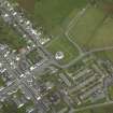
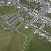
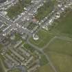
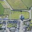
In 1768 in order to remove the village of Killarow from a position close to Islay House, Daniel Campbell of Shawfield and Islay founded the planned village of Bowmore on the east shore of Loch Indaal, perhaps on the site of an existing pier. The grid plan of the principal section of the village is well illustrated on the air photograph, with Main Street running from the imposing circular parish church to the pier just beyond the bottom of the picture. The more important axial streets are at right angles to Main Street, though Shore Street is curved for obvious reasons. The shape of many of the original feus is shown by the garden walls running back from the main frontages. The distillery founded in 1779 occupies the lower right of the photograph.
The parish church was built by Daniel Campbell in 1767 for the new village; it is circular on plan with a rectangular porch and tower looking down Main Street; the commanding position of the church has been compared to that of Inveraray. The interior retains a peW-layout of the latter part of the last century; there is also a dominant central timber column that supports a complex roof structure. A notable feature is the massive sarcophagus commemorating Lady Ellinor Campbell and WaIter Frederick Campbell on the east side of the interior.
Information from ‘Exploring Scotland’s Heritage: Argyll and the Western Isles’, (1985).


