
Islay, Port Ellen, General


Harbour (Period Unassigned), Village (Period Unassigned)
Site Name Islay, Port Ellen, General
Classification Harbour (Period Unassigned), Village (Period Unassigned)
Alternative Name(s) Port Ellen Village; Loch Leodamais
Canmore ID 37572
Site Number NR34NE 47
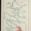
NGR NR 3676 4520
NGR Description Centred NR 3676 4520
Datum OSGB36 - NGR
Permalink http://canmore.org.uk/site/37572
Ordnance Survey licence number AC0000807262. All rights reserved.
Canmore Disclaimer.
© Bluesky International Limited 2025. Public Sector Viewing Terms
- Correction
- Favourite

DP 112401
General oblique aerial view of Port Ellen, taken from the SSE.
RCAHMS Aerial Photography Digital
3/5/2011
© Crown Copyright: HES

DP 142958
Oblique aerial view of Port Ellen, looking NW.
RCAHMS Aerial Photography Digital
11/7/2012
© Crown Copyright: HES

SC 1683241
Port Ellen. Aerial view from South East.
RCAHMS Aerial Photography
1977
© Crown Copyright: HES

DP 309432
Oblique aerial view.
Historic Environment Scotland
26/6/2019
© Copyright: HES

SC 2139380
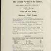
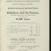
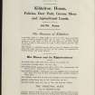
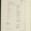
Estate Exchange. Kildalton and Oa Esatates. no. 1484 Sales Brochure. Includes details of 4 different lots: Corraray (lot 4), Lower Cragabus (lot 2), Castlehill, Duich (lot 4), Kilbride (lot 3), Machrie (lot 3) etc. Map and text. Title: 'The Kildalton and Oa Estates, Argyllshire. The Property of Iain Ramsay Esq. J.P.'
Collection of sale catalogues relating to Scottish estates
25/6/1914
© Courtesy of HES (Estates Exchange Collection)

SC 2139389
Estate Exchange. Kildalton and Oa Esatates. no. 1484 Sales Brochure. Includes details of 4 different lots: Corraray (lot 4), Lower Cragabus (lot 2), Castlehill, Duich (lot 4), Kilbride (lot 3), Machrie (lot 3) etc. Map and text. Title: 'The Kildalton and Oa Estates, Argyllshire. The Property of Iain Ramsay Esq. J.P.'
Collection of sale catalogues relating to Scottish estates
25/6/1914
© Courtesy of HES (Estates Exchange Collection)

SC 2139399
Estate Exchange. Kildalton and Oa Esatates. no. 1484 Sales Brochure. Includes details of 4 different lots: Corraray (lot 4), Lower Cragabus (lot 2), Castlehill, Duich (lot 4), Kilbride (lot 3), Machrie (lot 3) etc. Map and text. Title: 'The Kildalton and Oa Estates, Argyllshire. The Property of Iain Ramsay Esq. J.P.'
Collection of sale catalogues relating to Scottish estates
25/6/1914
© Courtesy of HES (Estates Exchange Collection)

SC 2139402
Estate Exchange. Kildalton and Oa Esatates. no. 1484 Sales Brochure. Includes details of 4 different lots: Corraray (lot 4), Lower Cragabus (lot 2), Castlehill, Duich (lot 4), Kilbride (lot 3), Machrie (lot 3) etc. Map and text. Title: 'The Kildalton and Oa Estates, Argyllshire. The Property of Iain Ramsay Esq. J.P.'
Collection of sale catalogues relating to Scottish estates
25/6/1914
© Courtesy of HES (Estates Exchange Collection)

SC 2139406
Estate Exchange. Kildalton and Oa Esatates. no. 1484 Sales Brochure. Includes details of 4 different lots: Corraray (lot 4), Lower Cragabus (lot 2), Castlehill, Duich (lot 4), Kilbride (lot 3), Machrie (lot 3) etc. Map and text. Title: 'The Kildalton and Oa Estates, Argyllshire. The Property of Iain Ramsay Esq. J.P.'
Collection of sale catalogues relating to Scottish estates
25/6/1914
© Courtesy of HES (Estates Exchange Collection)

SC 2139407
Estate Exchange. Kildalton and Oa Esatates. no. 1484 Sales Brochure. Includes details of 4 different lots: Corraray (lot 4), Lower Cragabus (lot 2), Castlehill, Duich (lot 4), Kilbride (lot 3), Machrie (lot 3) etc. Map and text. Title: 'The Kildalton and Oa Estates, Argyllshire. The Property of Iain Ramsay Esq. J.P.'
Collection of sale catalogues relating to Scottish estates
25/6/1914
© Courtesy of HES (Estates Exchange Collection)

SC 2139408
Estate Exchange. Kildalton and Oa Esatates. no. 1484 Sales Brochure. Includes details of 4 different lots: Corraray (lot 4), Lower Cragabus (lot 2), Castlehill, Duich (lot 4), Kilbride (lot 3), Machrie (lot 3) etc. Map and text. Title: 'The Kildalton and Oa Estates, Argyllshire. The Property of Iain Ramsay Esq. J.P.'
Collection of sale catalogues relating to Scottish estates
25/6/1914
© Courtesy of HES (Estates Exchange Collection)

SC 2139419
Estate Exchange. Kildalton and Oa Esatates. no. 1484 Sales Brochure. Includes details of 4 different lots: Corraray (lot 4), Lower Cragabus (lot 2), Castlehill, Duich (lot 4), Kilbride (lot 3), Machrie (lot 3) etc. Map and text. Title: 'The Kildalton and Oa Estates, Argyllshire. The Property of Iain Ramsay Esq. J.P.'
Collection of sale catalogues relating to Scottish estates
25/6/1914
© Courtesy of HES (Estates Exchange Collection)

SC 2139428
Estate Exchange. Kildalton and Oa Esatates. no. 1484 Sales Brochure. Includes details of 4 different lots: Corraray (lot 4), Lower Cragabus (lot 2), Castlehill, Duich (lot 4), Kilbride (lot 3), Machrie (lot 3) etc. Map and text. Title: 'The Kildalton and Oa Estates, Argyllshire. The Property of Iain Ramsay Esq. J.P.'
Collection of sale catalogues relating to Scottish estates
25/6/1914
© Courtesy of HES (Estates Exchange Collection)

SC 2139436
Estate Exchange. Kildalton and Oa Esatates. no. 1484 Sales Brochure. Includes details of 4 different lots: Corraray (lot 4), Lower Cragabus (lot 2), Castlehill, Duich (lot 4), Kilbride (lot 3), Machrie (lot 3) etc. Map and text. Title: 'The Kildalton and Oa Estates, Argyllshire. The Property of Iain Ramsay Esq. J.P.'
Collection of sale catalogues relating to Scottish estates
25/6/1914
© Courtesy of HES (Estates Exchange Collection)

SC 2139439
Estate Exchange. Kildalton and Oa Esatates. no. 1484 Sales Brochure. Includes details of 4 different lots: Corraray (lot 4), Lower Cragabus (lot 2), Castlehill, Duich (lot 4), Kilbride (lot 3), Machrie (lot 3) etc. Map and text. Title: 'The Kildalton and Oa Estates, Argyllshire. The Property of Iain Ramsay Esq. J.P.'
Collection of sale catalogues relating to Scottish estates
25/6/1914
© Courtesy of HES (Estates Exchange Collection)

SC 2139446
Estate Exchange. Kildalton and Oa Esatates. no. 1484 Sales Brochure. Includes details of 4 different lots: Corraray (lot 4), Lower Cragabus (lot 2), Castlehill, Duich (lot 4), Kilbride (lot 3), Machrie (lot 3) etc. Map and text. Title: 'The Kildalton and Oa Estates, Argyllshire. The Property of Iain Ramsay Esq. J.P.'
Collection of sale catalogues relating to Scottish estates
25/6/1914
© Courtesy of HES (Estates Exchange Collection)

SC 983517
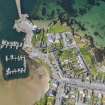
General oblique aerial view centred on Port Ellen village and harbour, Islay, with whisky distillery adjacent, taken from the SSE.
RCAHMS Aerial Photography
12/5/2005
© Crown Copyright: HES

DP 021146
General oblique aerial view centred on the remains of the fort with the village in the distance, taken from the NNE.
RCAHMS Aerial Photography Digital
2/11/2006
© Crown Copyright: HES

DP 046438
General oblique aerial view of Port Ellen village, Islay, taken from the SE.
RCAHMS Aerial Photography Digital
5/8/2008
© Crown Copyright: HES

SC 2139375
Estate Exchange. Kildalton and Oa Esatates. no. 1484 Sales Brochure. Includes details of 4 different lots: Corraray (lot 4), Lower Cragabus (lot 2), Castlehill, Duich (lot 4), Kilbride (lot 3), Machrie (lot 3) etc. Map and text. Title: 'The Kildalton and Oa Estates, Argyllshire. The Property of Iain Ramsay Esq. J.P.'
Collection of sale catalogues relating to Scottish estates
25/6/1914
© Courtesy of HES (Estates Exchange Collection)

SC 2139377
Estate Exchange. Kildalton and Oa Esatates. no. 1484 Sales Brochure. Includes details of 4 different lots: Corraray (lot 4), Lower Cragabus (lot 2), Castlehill, Duich (lot 4), Kilbride (lot 3), Machrie (lot 3) etc. Map and text. Title: 'The Kildalton and Oa Estates, Argyllshire. The Property of Iain Ramsay Esq. J.P.'
Collection of sale catalogues relating to Scottish estates
25/6/1914
© Courtesy of HES (Estates Exchange Collection)

SC 2139383
Estate Exchange. Kildalton and Oa Esatates. no. 1484 Sales Brochure. Includes details of 4 different lots: Corraray (lot 4), Lower Cragabus (lot 2), Castlehill, Duich (lot 4), Kilbride (lot 3), Machrie (lot 3) etc. Map and text. Title: 'The Kildalton and Oa Estates, Argyllshire. The Property of Iain Ramsay Esq. J.P.'
Collection of sale catalogues relating to Scottish estates
25/6/1914
© Courtesy of HES (Estates Exchange Collection)

SC 2139392
Estate Exchange. Kildalton and Oa Esatates. no. 1484 Sales Brochure. Includes details of 4 different lots: Corraray (lot 4), Lower Cragabus (lot 2), Castlehill, Duich (lot 4), Kilbride (lot 3), Machrie (lot 3) etc. Map and text. Title: 'The Kildalton and Oa Estates, Argyllshire. The Property of Iain Ramsay Esq. J.P.'
Collection of sale catalogues relating to Scottish estates
25/6/1914
© Courtesy of HES (Estates Exchange Collection)

SC 2139420
Estate Exchange. Kildalton and Oa Esatates. no. 1484 Sales Brochure. Includes details of 4 different lots: Corraray (lot 4), Lower Cragabus (lot 2), Castlehill, Duich (lot 4), Kilbride (lot 3), Machrie (lot 3) etc. Map and text. Title: 'The Kildalton and Oa Estates, Argyllshire. The Property of Iain Ramsay Esq. J.P.'
Collection of sale catalogues relating to Scottish estates
25/6/1914
© Courtesy of HES (Estates Exchange Collection)

SC 2139424
Estate Exchange. Kildalton and Oa Esatates. no. 1484 Sales Brochure. Includes details of 4 different lots: Corraray (lot 4), Lower Cragabus (lot 2), Castlehill, Duich (lot 4), Kilbride (lot 3), Machrie (lot 3) etc. Map and text. Title: 'The Kildalton and Oa Estates, Argyllshire. The Property of Iain Ramsay Esq. J.P.'
Collection of sale catalogues relating to Scottish estates
25/6/1914
© Courtesy of HES (Estates Exchange Collection)

SC 2139431
Estate Exchange. Kildalton and Oa Esatates. no. 1484 Sales Brochure. Includes details of 4 different lots: Corraray (lot 4), Lower Cragabus (lot 2), Castlehill, Duich (lot 4), Kilbride (lot 3), Machrie (lot 3) etc. Map and text. Title: 'The Kildalton and Oa Estates, Argyllshire. The Property of Iain Ramsay Esq. J.P.'
Collection of sale catalogues relating to Scottish estates
25/6/1914
© Courtesy of HES (Estates Exchange Collection)

SC 2139444
Estate Exchange. Kildalton and Oa Esatates. no. 1484 Sales Brochure. Includes details of 4 different lots: Corraray (lot 4), Lower Cragabus (lot 2), Castlehill, Duich (lot 4), Kilbride (lot 3), Machrie (lot 3) etc. Map and text. Title: 'The Kildalton and Oa Estates, Argyllshire. The Property of Iain Ramsay Esq. J.P.'
Collection of sale catalogues relating to Scottish estates
25/6/1914
© Courtesy of HES (Estates Exchange Collection)


DP 142957
Oblique aerial view of Port Ellen, looking NW.
RCAHMS Aerial Photography Digital
11/7/2012
© Crown Copyright: HES

SC 1683432
General oblique aerial view centred on the village and harbour with whisky distillery adjacent, taken from the SSE.
RCAHMS Aerial Photography
12/5/2005
© Crown Copyright: HES

SC 1683433
Oblique aerial view centred on the village and harbour, taken from the NNW.
RCAHMS Aerial Photography
12/5/2005
© Crown Copyright: HES

DP 309435
Oblique aerial view.
Historic Environment Scotland
26/6/2019
© Copyright: HES

DP 309436
Oblique aerial view.
Historic Environment Scotland
26/6/2019
© Copyright: HES

SC 2139376
Estate Exchange. Kildalton and Oa Esatates. no. 1484 Sales Brochure. Includes details of 4 different lots: Corraray (lot 4), Lower Cragabus (lot 2), Castlehill, Duich (lot 4), Kilbride (lot 3), Machrie (lot 3) etc. Map and text. Title: 'The Kildalton and Oa Estates, Argyllshire. The Property of Iain Ramsay Esq. J.P.'
Collection of sale catalogues relating to Scottish estates
25/6/1914
© Courtesy of HES (Estates Exchange Collection)

SC 2139385
Estate Exchange. Kildalton and Oa Esatates. no. 1484 Sales Brochure. Includes details of 4 different lots: Corraray (lot 4), Lower Cragabus (lot 2), Castlehill, Duich (lot 4), Kilbride (lot 3), Machrie (lot 3) etc. Map and text. Title: 'The Kildalton and Oa Estates, Argyllshire. The Property of Iain Ramsay Esq. J.P.'
Collection of sale catalogues relating to Scottish estates
25/6/1914
© Courtesy of HES (Estates Exchange Collection)

SC 2139396
Estate Exchange. Kildalton and Oa Esatates. no. 1484 Sales Brochure. Includes details of 4 different lots: Corraray (lot 4), Lower Cragabus (lot 2), Castlehill, Duich (lot 4), Kilbride (lot 3), Machrie (lot 3) etc. Map and text. Title: 'The Kildalton and Oa Estates, Argyllshire. The Property of Iain Ramsay Esq. J.P.'
Collection of sale catalogues relating to Scottish estates
25/6/1914
© Courtesy of HES (Estates Exchange Collection)

SC 2139397
Estate Exchange. Kildalton and Oa Esatates. no. 1484 Sales Brochure. Includes details of 4 different lots: Corraray (lot 4), Lower Cragabus (lot 2), Castlehill, Duich (lot 4), Kilbride (lot 3), Machrie (lot 3) etc. Map and text. Title: 'The Kildalton and Oa Estates, Argyllshire. The Property of Iain Ramsay Esq. J.P.'
Collection of sale catalogues relating to Scottish estates
25/6/1914
© Courtesy of HES (Estates Exchange Collection)

SC 2139400
Estate Exchange. Kildalton and Oa Esatates. no. 1484 Sales Brochure. Includes details of 4 different lots: Corraray (lot 4), Lower Cragabus (lot 2), Castlehill, Duich (lot 4), Kilbride (lot 3), Machrie (lot 3) etc. Map and text. Title: 'The Kildalton and Oa Estates, Argyllshire. The Property of Iain Ramsay Esq. J.P.'
Collection of sale catalogues relating to Scottish estates
25/6/1914
© Courtesy of HES (Estates Exchange Collection)

SC 2139410
Estate Exchange. Kildalton and Oa Esatates. no. 1484 Sales Brochure. Includes details of 4 different lots: Corraray (lot 4), Lower Cragabus (lot 2), Castlehill, Duich (lot 4), Kilbride (lot 3), Machrie (lot 3) etc. Map and text. Title: 'The Kildalton and Oa Estates, Argyllshire. The Property of Iain Ramsay Esq. J.P.'
Collection of sale catalogues relating to Scottish estates
25/6/1914
© Courtesy of HES (Estates Exchange Collection)

SC 2139413
Estate Exchange. Kildalton and Oa Esatates. no. 1484 Sales Brochure. Includes details of 4 different lots: Corraray (lot 4), Lower Cragabus (lot 2), Castlehill, Duich (lot 4), Kilbride (lot 3), Machrie (lot 3) etc. Map and text. Title: 'The Kildalton and Oa Estates, Argyllshire. The Property of Iain Ramsay Esq. J.P.'
Collection of sale catalogues relating to Scottish estates
25/6/1914
© Courtesy of HES (Estates Exchange Collection)

SC 2139415
Estate Exchange. Kildalton and Oa Esatates. no. 1484 Sales Brochure. Includes details of 4 different lots: Corraray (lot 4), Lower Cragabus (lot 2), Castlehill, Duich (lot 4), Kilbride (lot 3), Machrie (lot 3) etc. Map and text. Title: 'The Kildalton and Oa Estates, Argyllshire. The Property of Iain Ramsay Esq. J.P.'
Collection of sale catalogues relating to Scottish estates
25/6/1914
© Courtesy of HES (Estates Exchange Collection)

SC 2139423
Estate Exchange. Kildalton and Oa Esatates. no. 1484 Sales Brochure. Includes details of 4 different lots: Corraray (lot 4), Lower Cragabus (lot 2), Castlehill, Duich (lot 4), Kilbride (lot 3), Machrie (lot 3) etc. Map and text. Title: 'The Kildalton and Oa Estates, Argyllshire. The Property of Iain Ramsay Esq. J.P.'
Collection of sale catalogues relating to Scottish estates
25/6/1914
© Courtesy of HES (Estates Exchange Collection)

SC 2139425
Estate Exchange. Kildalton and Oa Esatates. no. 1484 Sales Brochure. Includes details of 4 different lots: Corraray (lot 4), Lower Cragabus (lot 2), Castlehill, Duich (lot 4), Kilbride (lot 3), Machrie (lot 3) etc. Map and text. Title: 'The Kildalton and Oa Estates, Argyllshire. The Property of Iain Ramsay Esq. J.P.'
Collection of sale catalogues relating to Scottish estates
25/6/1914
© Courtesy of HES (Estates Exchange Collection)

SC 2139435
Estate Exchange. Kildalton and Oa Esatates. no. 1484 Sales Brochure. Includes details of 4 different lots: Corraray (lot 4), Lower Cragabus (lot 2), Castlehill, Duich (lot 4), Kilbride (lot 3), Machrie (lot 3) etc. Map and text. Title: 'The Kildalton and Oa Estates, Argyllshire. The Property of Iain Ramsay Esq. J.P.'
Collection of sale catalogues relating to Scottish estates
25/6/1914
© Courtesy of HES (Estates Exchange Collection)

SC 2139438
Estate Exchange. Kildalton and Oa Esatates. no. 1484 Sales Brochure. Includes details of 4 different lots: Corraray (lot 4), Lower Cragabus (lot 2), Castlehill, Duich (lot 4), Kilbride (lot 3), Machrie (lot 3) etc. Map and text. Title: 'The Kildalton and Oa Estates, Argyllshire. The Property of Iain Ramsay Esq. J.P.'
Collection of sale catalogues relating to Scottish estates
25/6/1914
© Courtesy of HES (Estates Exchange Collection)

SC 2139447
Estate Exchange. Kildalton and Oa Esatates. no. 1484 Sales Brochure. Includes details of 4 different lots: Corraray (lot 4), Lower Cragabus (lot 2), Castlehill, Duich (lot 4), Kilbride (lot 3), Machrie (lot 3) etc. Map and text. Title: 'The Kildalton and Oa Estates, Argyllshire. The Property of Iain Ramsay Esq. J.P.'
Collection of sale catalogues relating to Scottish estates
25/6/1914
© Courtesy of HES (Estates Exchange Collection)

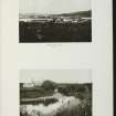
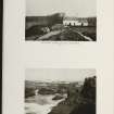
SC 2524350
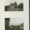
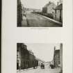
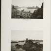
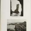
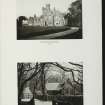
Fisher Row, Port Ellen. View from North.
Records of the Royal Commission on the Ancient and Historical Monuments of Scotland (RCAHMS), Edinbu
1981
© RCAHMS

DP 090527
Oblique aerial view of Port Ellen, Islay, taken from the S.
RCAHMS Aerial Photography Digital
29/6/2010
© Crown Copyright: HES

SC 2139394
Estate Exchange. Kildalton and Oa Esatates. no. 1484 Sales Brochure. Includes details of 4 different lots: Corraray (lot 4), Lower Cragabus (lot 2), Castlehill, Duich (lot 4), Kilbride (lot 3), Machrie (lot 3) etc. Map and text. Title: 'The Kildalton and Oa Estates, Argyllshire. The Property of Iain Ramsay Esq. J.P.'
Collection of sale catalogues relating to Scottish estates
25/6/1914
© Courtesy of HES (Estates Exchange Collection)

SC 2139401
Estate Exchange. Kildalton and Oa Esatates. no. 1484 Sales Brochure. Includes details of 4 different lots: Corraray (lot 4), Lower Cragabus (lot 2), Castlehill, Duich (lot 4), Kilbride (lot 3), Machrie (lot 3) etc. Map and text. Title: 'The Kildalton and Oa Estates, Argyllshire. The Property of Iain Ramsay Esq. J.P.'
Collection of sale catalogues relating to Scottish estates
25/6/1914
© Courtesy of HES (Estates Exchange Collection)

SC 2139405
Estate Exchange. Kildalton and Oa Esatates. no. 1484 Sales Brochure. Includes details of 4 different lots: Corraray (lot 4), Lower Cragabus (lot 2), Castlehill, Duich (lot 4), Kilbride (lot 3), Machrie (lot 3) etc. Map and text. Title: 'The Kildalton and Oa Estates, Argyllshire. The Property of Iain Ramsay Esq. J.P.'
Collection of sale catalogues relating to Scottish estates
25/6/1914
© Courtesy of HES (Estates Exchange Collection)

SC 2139416
Estate Exchange. Kildalton and Oa Esatates. no. 1484 Sales Brochure. Includes details of 4 different lots: Corraray (lot 4), Lower Cragabus (lot 2), Castlehill, Duich (lot 4), Kilbride (lot 3), Machrie (lot 3) etc. Map and text. Title: 'The Kildalton and Oa Estates, Argyllshire. The Property of Iain Ramsay Esq. J.P.'
Collection of sale catalogues relating to Scottish estates
25/6/1914
© Courtesy of HES (Estates Exchange Collection)

SC 2139421
Estate Exchange. Kildalton and Oa Esatates. no. 1484 Sales Brochure. Includes details of 4 different lots: Corraray (lot 4), Lower Cragabus (lot 2), Castlehill, Duich (lot 4), Kilbride (lot 3), Machrie (lot 3) etc. Map and text. Title: 'The Kildalton and Oa Estates, Argyllshire. The Property of Iain Ramsay Esq. J.P.'
Collection of sale catalogues relating to Scottish estates
25/6/1914
© Courtesy of HES (Estates Exchange Collection)

SC 2139427
Estate Exchange. Kildalton and Oa Esatates. no. 1484 Sales Brochure. Includes details of 4 different lots: Corraray (lot 4), Lower Cragabus (lot 2), Castlehill, Duich (lot 4), Kilbride (lot 3), Machrie (lot 3) etc. Map and text. Title: 'The Kildalton and Oa Estates, Argyllshire. The Property of Iain Ramsay Esq. J.P.'
Collection of sale catalogues relating to Scottish estates
25/6/1914
© Courtesy of HES (Estates Exchange Collection)

SC 2523991
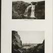
Kilbride, Port Ellen. Cross-marked stone. IB 194.
Records of the Royal Commission on the Ancient and Historical Monuments of Scotland (RCAHMS), Edinbu
1983

DP 090528
Oblique aerial view of Port Ellen, Islay, taken from the S.
RCAHMS Aerial Photography Digital
29/6/2010
© Crown Copyright: HES

DP 142952
General oblique aerial view of Port Ellen, looking NE.
RCAHMS Aerial Photography Digital
11/7/2012
© Crown Copyright: HES

SC 1683435
General oblique aerial view centred on the whisky distillery with the village and harbour adjacent, taken from the NNW.
RCAHMS Aerial Photography
12/5/2005
© Crown Copyright: HES

SC 2139373
Estate Exchange. Kildalton and Oa Esatates. no. 1484 Sales Brochure. Includes details of 4 different lots: Corraray (lot 4), Lower Cragabus (lot 2), Castlehill, Duich (lot 4), Kilbride (lot 3), Machrie (lot 3) etc. Map and text. Title: 'The Kildalton and Oa Estates, Argyllshire. The Property of Iain Ramsay Esq. J.P.'
Collection of sale catalogues relating to Scottish estates
25/6/1914
© Courtesy of HES (Estates Exchange Collection)

SC 2139381
Estate Exchange. Kildalton and Oa Esatates. no. 1484 Sales Brochure. Includes details of 4 different lots: Corraray (lot 4), Lower Cragabus (lot 2), Castlehill, Duich (lot 4), Kilbride (lot 3), Machrie (lot 3) etc. Map and text. Title: 'The Kildalton and Oa Estates, Argyllshire. The Property of Iain Ramsay Esq. J.P.'
Collection of sale catalogues relating to Scottish estates
25/6/1914
© Courtesy of HES (Estates Exchange Collection)

SC 2139384
Estate Exchange. Kildalton and Oa Esatates. no. 1484 Sales Brochure. Includes details of 4 different lots: Corraray (lot 4), Lower Cragabus (lot 2), Castlehill, Duich (lot 4), Kilbride (lot 3), Machrie (lot 3) etc. Map and text. Title: 'The Kildalton and Oa Estates, Argyllshire. The Property of Iain Ramsay Esq. J.P.'
Collection of sale catalogues relating to Scottish estates
25/6/1914
© Courtesy of HES (Estates Exchange Collection)

SC 2139386
Estate Exchange. Kildalton and Oa Esatates. no. 1484 Sales Brochure. Includes details of 4 different lots: Corraray (lot 4), Lower Cragabus (lot 2), Castlehill, Duich (lot 4), Kilbride (lot 3), Machrie (lot 3) etc. Map and text. Title: 'The Kildalton and Oa Estates, Argyllshire. The Property of Iain Ramsay Esq. J.P.'
Collection of sale catalogues relating to Scottish estates
25/6/1914
© Courtesy of HES (Estates Exchange Collection)

SC 2139391
Estate Exchange. Kildalton and Oa Esatates. no. 1484 Sales Brochure. Includes details of 4 different lots: Corraray (lot 4), Lower Cragabus (lot 2), Castlehill, Duich (lot 4), Kilbride (lot 3), Machrie (lot 3) etc. Map and text. Title: 'The Kildalton and Oa Estates, Argyllshire. The Property of Iain Ramsay Esq. J.P.'
Collection of sale catalogues relating to Scottish estates
25/6/1914
© Courtesy of HES (Estates Exchange Collection)

SC 2139398
Estate Exchange. Kildalton and Oa Esatates. no. 1484 Sales Brochure. Includes details of 4 different lots: Corraray (lot 4), Lower Cragabus (lot 2), Castlehill, Duich (lot 4), Kilbride (lot 3), Machrie (lot 3) etc. Map and text. Title: 'The Kildalton and Oa Estates, Argyllshire. The Property of Iain Ramsay Esq. J.P.'
Collection of sale catalogues relating to Scottish estates
25/6/1914
© Courtesy of HES (Estates Exchange Collection)

SC 2139409
Estate Exchange. Kildalton and Oa Esatates. no. 1484 Sales Brochure. Includes details of 4 different lots: Corraray (lot 4), Lower Cragabus (lot 2), Castlehill, Duich (lot 4), Kilbride (lot 3), Machrie (lot 3) etc. Map and text. Title: 'The Kildalton and Oa Estates, Argyllshire. The Property of Iain Ramsay Esq. J.P.'
Collection of sale catalogues relating to Scottish estates
25/6/1914
© Courtesy of HES (Estates Exchange Collection)

SC 2139450
Estate Exchange. Kildalton and Oa Esatates. no. 1484 Sales Brochure. Includes details of 4 different lots: Corraray (lot 4), Lower Cragabus (lot 2), Castlehill, Duich (lot 4), Kilbride (lot 3), Machrie (lot 3) etc. Map and text. Title: 'The Kildalton and Oa Estates, Argyllshire. The Property of Iain Ramsay Esq. J.P.'
Collection of sale catalogues relating to Scottish estates
25/6/1914
© Courtesy of HES (Estates Exchange Collection)

SC 2524348
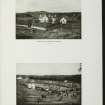
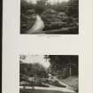
Port Ellen. General view from South with dingy in foreground.
Records of the Royal Commission on the Ancient and Historical Monuments of Scotland (RCAHMS), Edinbu
1981
© RCAHMS

SC 416759
General view of Port Ellen across bay from South East, with couple sitting on bench in foreground.
Records of the Royal Commission on the Ancient and Historical Monuments of Scotland (RCAHMS), Edinbu
© RCAHMS

DP 046435
Oblique aerial view of Port Ellen village, Islay, taken from the S.
RCAHMS Aerial Photography Digital
5/8/2008
© Crown Copyright: HES

DP 046436
Oblique aerial view of Port Ellen village, Islay, taken from the S.
RCAHMS Aerial Photography Digital
5/8/2008
© Crown Copyright: HES

DP 142960
General oblique aerial view of Port Ellen, looking SW.
RCAHMS Aerial Photography Digital
11/7/2012
© Crown Copyright: HES

DP 309439
Oblique aerial view.
Historic Environment Scotland
26/6/2019
© Copyright: HES

DP 309443
Oblique aerial view.
Historic Environment Scotland
26/6/2019
© Copyright: HES

SC 2139379
Estate Exchange. Kildalton and Oa Esatates. no. 1484 Sales Brochure. Includes details of 4 different lots: Corraray (lot 4), Lower Cragabus (lot 2), Castlehill, Duich (lot 4), Kilbride (lot 3), Machrie (lot 3) etc. Map and text. Title: 'The Kildalton and Oa Estates, Argyllshire. The Property of Iain Ramsay Esq. J.P.'
Collection of sale catalogues relating to Scottish estates
25/6/1914
© Courtesy of HES (Estates Exchange Collection)

SC 2139382
Estate Exchange. Kildalton and Oa Esatates. no. 1484 Sales Brochure. Includes details of 4 different lots: Corraray (lot 4), Lower Cragabus (lot 2), Castlehill, Duich (lot 4), Kilbride (lot 3), Machrie (lot 3) etc. Map and text. Title: 'The Kildalton and Oa Estates, Argyllshire. The Property of Iain Ramsay Esq. J.P.'
Collection of sale catalogues relating to Scottish estates
25/6/1914
© Courtesy of HES (Estates Exchange Collection)

SC 2139388
Estate Exchange. Kildalton and Oa Esatates. no. 1484 Sales Brochure. Includes details of 4 different lots: Corraray (lot 4), Lower Cragabus (lot 2), Castlehill, Duich (lot 4), Kilbride (lot 3), Machrie (lot 3) etc. Map and text. Title: 'The Kildalton and Oa Estates, Argyllshire. The Property of Iain Ramsay Esq. J.P.'
Collection of sale catalogues relating to Scottish estates
25/6/1914
© Courtesy of HES (Estates Exchange Collection)

SC 2139390
Estate Exchange. Kildalton and Oa Esatates. no. 1484 Sales Brochure. Includes details of 4 different lots: Corraray (lot 4), Lower Cragabus (lot 2), Castlehill, Duich (lot 4), Kilbride (lot 3), Machrie (lot 3) etc. Map and text. Title: 'The Kildalton and Oa Estates, Argyllshire. The Property of Iain Ramsay Esq. J.P.'
Collection of sale catalogues relating to Scottish estates
25/6/1914
© Courtesy of HES (Estates Exchange Collection)

SC 2139411
Estate Exchange. Kildalton and Oa Esatates. no. 1484 Sales Brochure. Includes details of 4 different lots: Corraray (lot 4), Lower Cragabus (lot 2), Castlehill, Duich (lot 4), Kilbride (lot 3), Machrie (lot 3) etc. Map and text. Title: 'The Kildalton and Oa Estates, Argyllshire. The Property of Iain Ramsay Esq. J.P.'
Collection of sale catalogues relating to Scottish estates
25/6/1914
© Courtesy of HES (Estates Exchange Collection)

SC 2139412
Estate Exchange. Kildalton and Oa Esatates. no. 1484 Sales Brochure. Includes details of 4 different lots: Corraray (lot 4), Lower Cragabus (lot 2), Castlehill, Duich (lot 4), Kilbride (lot 3), Machrie (lot 3) etc. Map and text. Title: 'The Kildalton and Oa Estates, Argyllshire. The Property of Iain Ramsay Esq. J.P.'
Collection of sale catalogues relating to Scottish estates
25/6/1914
© Courtesy of HES (Estates Exchange Collection)

SC 2139414
Estate Exchange. Kildalton and Oa Esatates. no. 1484 Sales Brochure. Includes details of 4 different lots: Corraray (lot 4), Lower Cragabus (lot 2), Castlehill, Duich (lot 4), Kilbride (lot 3), Machrie (lot 3) etc. Map and text. Title: 'The Kildalton and Oa Estates, Argyllshire. The Property of Iain Ramsay Esq. J.P.'
Collection of sale catalogues relating to Scottish estates
25/6/1914
© Courtesy of HES (Estates Exchange Collection)

SC 2139430
Estate Exchange. Kildalton and Oa Esatates. no. 1484 Sales Brochure. Includes details of 4 different lots: Corraray (lot 4), Lower Cragabus (lot 2), Castlehill, Duich (lot 4), Kilbride (lot 3), Machrie (lot 3) etc. Map and text. Title: 'The Kildalton and Oa Estates, Argyllshire. The Property of Iain Ramsay Esq. J.P.'
Collection of sale catalogues relating to Scottish estates
25/6/1914
© Courtesy of HES (Estates Exchange Collection)

SC 2139432
Estate Exchange. Kildalton and Oa Esatates. no. 1484 Sales Brochure. Includes details of 4 different lots: Corraray (lot 4), Lower Cragabus (lot 2), Castlehill, Duich (lot 4), Kilbride (lot 3), Machrie (lot 3) etc. Map and text. Title: 'The Kildalton and Oa Estates, Argyllshire. The Property of Iain Ramsay Esq. J.P.'
Collection of sale catalogues relating to Scottish estates
25/6/1914
© Courtesy of HES (Estates Exchange Collection)

SC 2139434
Estate Exchange. Kildalton and Oa Esatates. no. 1484 Sales Brochure. Includes details of 4 different lots: Corraray (lot 4), Lower Cragabus (lot 2), Castlehill, Duich (lot 4), Kilbride (lot 3), Machrie (lot 3) etc. Map and text. Title: 'The Kildalton and Oa Estates, Argyllshire. The Property of Iain Ramsay Esq. J.P.'
Collection of sale catalogues relating to Scottish estates
25/6/1914
© Courtesy of HES (Estates Exchange Collection)

SC 2139449
Estate Exchange. Kildalton and Oa Esatates. no. 1484 Sales Brochure. Includes details of 4 different lots: Corraray (lot 4), Lower Cragabus (lot 2), Castlehill, Duich (lot 4), Kilbride (lot 3), Machrie (lot 3) etc. Map and text. Title: 'The Kildalton and Oa Estates, Argyllshire. The Property of Iain Ramsay Esq. J.P.'
Collection of sale catalogues relating to Scottish estates
25/6/1914
© Courtesy of HES (Estates Exchange Collection)


DP 046439
General oblique aerial view of Port Ellen village, Islay, taken from the ESE.
RCAHMS Aerial Photography Digital
5/8/2008
© Crown Copyright: HES

DP 142959
General oblique aerial view of Port Ellen, looking SW.
RCAHMS Aerial Photography Digital
11/7/2012
© Crown Copyright: HES

SC 1683240
Port Ellen. Aerial view from South.
RCAHMS Aerial Photography
1977
© Crown Copyright: HES

DP 309444
Oblique aerial view.
Historic Environment Scotland
26/6/2019
© Copyright: HES

DP 309445
Oblique aerial view.
Historic Environment Scotland
26/6/2019
© Copyright: HES

SC 2139374
Estate Exchange. Kildalton and Oa Esatates. no. 1484 Sales Brochure. Includes details of 4 different lots: Corraray (lot 4), Lower Cragabus (lot 2), Castlehill, Duich (lot 4), Kilbride (lot 3), Machrie (lot 3) etc. Map and text. Title: 'The Kildalton and Oa Estates, Argyllshire. The Property of Iain Ramsay Esq. J.P.'
Collection of sale catalogues relating to Scottish estates
25/6/1914
© Courtesy of HES (Estates Exchange Collection)

SC 2139378
Estate Exchange. Kildalton and Oa Esatates. no. 1484 Sales Brochure. Includes details of 4 different lots: Corraray (lot 4), Lower Cragabus (lot 2), Castlehill, Duich (lot 4), Kilbride (lot 3), Machrie (lot 3) etc. Map and text. Title: 'The Kildalton and Oa Estates, Argyllshire. The Property of Iain Ramsay Esq. J.P.'
Collection of sale catalogues relating to Scottish estates
25/6/1914
© Courtesy of HES (Estates Exchange Collection)

SC 2139393
Estate Exchange. Kildalton and Oa Esatates. no. 1484 Sales Brochure. Includes details of 4 different lots: Corraray (lot 4), Lower Cragabus (lot 2), Castlehill, Duich (lot 4), Kilbride (lot 3), Machrie (lot 3) etc. Map and text. Title: 'The Kildalton and Oa Estates, Argyllshire. The Property of Iain Ramsay Esq. J.P.'
Collection of sale catalogues relating to Scottish estates
25/6/1914
© Courtesy of HES (Estates Exchange Collection)

SC 2139417
Estate Exchange. Kildalton and Oa Esatates. no. 1484 Sales Brochure. Includes details of 4 different lots: Corraray (lot 4), Lower Cragabus (lot 2), Castlehill, Duich (lot 4), Kilbride (lot 3), Machrie (lot 3) etc. Map and text. Title: 'The Kildalton and Oa Estates, Argyllshire. The Property of Iain Ramsay Esq. J.P.'
Collection of sale catalogues relating to Scottish estates
25/6/1914
© Courtesy of HES (Estates Exchange Collection)

SC 2139426
Estate Exchange. Kildalton and Oa Esatates. no. 1484 Sales Brochure. Includes details of 4 different lots: Corraray (lot 4), Lower Cragabus (lot 2), Castlehill, Duich (lot 4), Kilbride (lot 3), Machrie (lot 3) etc. Map and text. Title: 'The Kildalton and Oa Estates, Argyllshire. The Property of Iain Ramsay Esq. J.P.'
Collection of sale catalogues relating to Scottish estates
25/6/1914
© Courtesy of HES (Estates Exchange Collection)

SC 2139433
Estate Exchange. Kildalton and Oa Esatates. no. 1484 Sales Brochure. Includes details of 4 different lots: Corraray (lot 4), Lower Cragabus (lot 2), Castlehill, Duich (lot 4), Kilbride (lot 3), Machrie (lot 3) etc. Map and text. Title: 'The Kildalton and Oa Estates, Argyllshire. The Property of Iain Ramsay Esq. J.P.'
Collection of sale catalogues relating to Scottish estates
25/6/1914
© Courtesy of HES (Estates Exchange Collection)

SC 2139440
Estate Exchange. Kildalton and Oa Esatates. no. 1484 Sales Brochure. Includes details of 4 different lots: Corraray (lot 4), Lower Cragabus (lot 2), Castlehill, Duich (lot 4), Kilbride (lot 3), Machrie (lot 3) etc. Map and text. Title: 'The Kildalton and Oa Estates, Argyllshire. The Property of Iain Ramsay Esq. J.P.'
Collection of sale catalogues relating to Scottish estates
25/6/1914
© Courtesy of HES (Estates Exchange Collection)

SC 2139441
Estate Exchange. Kildalton and Oa Esatates. no. 1484 Sales Brochure. Includes details of 4 different lots: Corraray (lot 4), Lower Cragabus (lot 2), Castlehill, Duich (lot 4), Kilbride (lot 3), Machrie (lot 3) etc. Map and text. Title: 'The Kildalton and Oa Estates, Argyllshire. The Property of Iain Ramsay Esq. J.P.'
Collection of sale catalogues relating to Scottish estates
25/6/1914
© Courtesy of HES (Estates Exchange Collection)

SC 2139442
Estate Exchange. Kildalton and Oa Esatates. no. 1484 Sales Brochure. Includes details of 4 different lots: Corraray (lot 4), Lower Cragabus (lot 2), Castlehill, Duich (lot 4), Kilbride (lot 3), Machrie (lot 3) etc. Map and text. Title: 'The Kildalton and Oa Estates, Argyllshire. The Property of Iain Ramsay Esq. J.P.'
Collection of sale catalogues relating to Scottish estates
25/6/1914
© Courtesy of HES (Estates Exchange Collection)

SC 2139443
Estate Exchange. Kildalton and Oa Esatates. no. 1484 Sales Brochure. Includes details of 4 different lots: Corraray (lot 4), Lower Cragabus (lot 2), Castlehill, Duich (lot 4), Kilbride (lot 3), Machrie (lot 3) etc. Map and text. Title: 'The Kildalton and Oa Estates, Argyllshire. The Property of Iain Ramsay Esq. J.P.'
Collection of sale catalogues relating to Scottish estates
25/6/1914
© Courtesy of HES (Estates Exchange Collection)


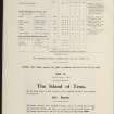


First 100 images shown. See the Collections panel (below) for a link to all digital images.
- Council Argyll And Bute
- Parish Kildalton And Oa
- Former Region Strathclyde
- Former District Argyll And Bute
- Former County Argyll
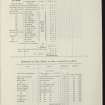
NR34NE 47.00 centred 3676 4520
NR34NE 47.01 Cancelled: see NR34NE 96.
NR34NE 47.02 Cancelled: see NR34NE 81.
NR34NE 47.03 Cancelled: see NR34NE 97.
NR34NE 47.04 Cancelled: see NR34NE 98.
NR34NE 47.05 Cancelled: see NR34NE 85.
NR34NE 47.06 Cancelled: see NR34NE 85.
NR34NE 47.07 Cancelled: see NR34NE 99.
NR34NE 47.08 Cancelled: see NR34NE 100.
NR34NE 47.09 Cancelled.
NR34NE 47.10 Cancelled: see NR34NE 101.
NR34NE 47.11 Cancelled: see NR34NE 102.
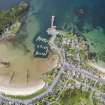
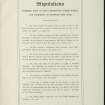
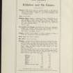
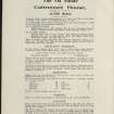
Port Ellen Harbour:
ENGINEERS: L.Gordon and L.Hill - improvements 1845
PLANS: Copy of plan in possession of Mrs Ramsay of Kildalton.
(Undated) unformation in NMRS.
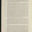
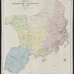
This village was founded in 1821 by Walter Frederick Campbell and was named Port Ellinor or Eleanor in honour
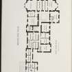
of his wife, the name being later abbreviated to Ellen. (Storrie 1981; MacNeill) It was established principally as a herring fishery and the planned settlement was formed around the natural haven of Loch Leodamais. According to Lord Teignmouth, the expectations of a successful fishery along this coast were initially disappointed, and in 1836 he noted that although 'several tradesmen have settled, . . . none of them thrive as yet, except masons and wrights, who are employed in building the houses'. (Teignmouth) However, as a local centre of communications which served a number of distilleries in the district. Port Ellen grew thereafter to become the largest single community on the island, having a population of about one thousand for the rest of the 19th century. (New Statistical Account 1845; Groome, Ordnance Gazetteer; Islay Stent Book; MacNeill) The layout of the village in its early stages can best be appreciated by reference to a plan which was drawn up in 1838. (Islay Estate Papers)
The layout comprises a series of terraced rows of houses ranged around the shore of Loch Leodamais; two
principal roads, Charlotte Street and New Street (later Lennox Street), radiate NW and NE respectively from this
crescent, and a lane gives access to the quay on the W side of the bay. Individual house-frontages are shown as
conforming to a standard width of about 10.2m and most of them are associated with an area of garden ground at the
rear. Access-lanes ran behind the rear garden-walls, and the four-acre lots lay mainly to the E and NE of the village.'
There is much evidence of later developments in and around this original scheme, but a number of early houses
still survive relatively unaltered in external appearance, especially on either side of Charlotte Street. These are for the most part plain two-storeyed structures with symmetrical three-bay frontages, measuring up to about 10.6m in width
and constructed of harled or rendered rubble masonry with painted margins and slated roofs. The only group of early
single-storeyed cottages that survives relatively intact forms part of a stepped terrace, originally known as 'Fisher Row',
on the E side of the bay. Each cottage has a high wall-head to accommodate a loft.
RCAHMS 1984, visited August 1977.

