
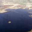
Islay, Loch Gorm


Building (Post Medieval), Causeway (Post Medieval), Crannog (Period Unknown)(Possible), Island (Period Unknown), Ard (Stone)(Iron Age)
Site Name Islay, Loch Gorm
Classification Building (Post Medieval), Causeway (Post Medieval), Crannog (Period Unknown)(Possible), Island (Period Unknown), Ard (Stone)(Iron Age)
Canmore ID 37388
Site Number NR26NW 16
NGR NR 2406 6581
NGR Description NR 24202 65854 and NR 24056 65836
Datum OSGB36 - NGR
Permalink http://canmore.org.uk/site/37388


- Council Argyll And Bute
- Parish Kilchoman
- Former Region Strathclyde
- Former District Argyll And Bute
- Former County Argyll
Field Visit (25 May 1978)
NR 2406 6581. This island is not apparently artificial and there is no visible evidence of a crannog. Near the centre of the island are the turf-covered footings of a rectangular building. It is 6.0m by 5.0m over walling 0.8m wide and 0.3m high; its origin and purpose are no longer apparent. A scattered line of boulders 130.0m long and up to 3.5m wide forms a causeway (of doubtful antiquity) which terminates at a sandbank approximately 50.0m short of the island. An Iron Age stone ploughshare found in 1970 from a crannog in Loch Gorm is displayed in Islay Museum (information from Islay Museum display card) (Acc. No. IMT 1977-72)
Visited by OS (T R G) 25 May 1978.
Desk Based Assessment (1978)
NR26NW 16 2406 6581
NR 241 658. A causeway was exposed in Loch Gorm by drought in August, when it could be seen that it passed over an earlier dry ridge which led to a small round island, about 30ft in diameter ringed with stones. In the bed of the loch around this are three large branches cut from trees, still retaining bark and one long beam stripped of bark. This may be a crannog.
Source: F Newall 1968.
This possible crannog is not prehistoric, but may be historic. The causeway is visible on air photographs.
Information from RCAHMS to OS.
There are traces of building on this island.
Source: F Celoria 1959.
Field Visit (1996)
NR 2405 6583 Located 136m N of a small spur of land, which juts out into the E end of Loch Gorm. The site is accessed from the E by a causeway of large boulders and medium-sized stone which have been placed in a double row to form a platform measuring 3.4m in average width. The causeway is 97m long but terminated 30m short of the E shore of Loch Gorm and 61m short of the artificial island at the time of survey. A large sand-bar has formed between the E side of the site and the E shore of Loch Gorm.
Although the suspected artificial island is located 181m from the E shore of Loch Gorm, it can be easily waded to without the water ever reaching above the knees. The suspected artificial island is an oval islet which measures 107m N-S by 77m E-W at its base. The outer margin of the islet is ringed by a 20m wide spread of large and medium-sized stone which sharply contrasts the surrounding sandy loch bed. The sides of the islet are composed of a scatter of small stones, which rises up gradually at a 4 degree angle from the loch bed to form an oval platform, measuring 63m N-S by 38m E-W. The surface of the islet was heavily vegetated and covered with dense clumps of willow, briars and turfs of long grass at the time of survey.
Sponsors: Edinburgh University Archaeology Department, Holley & Associates.
M W Holley 1996.

