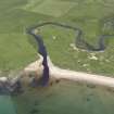
Islay, Cnoc Eabriic
Fort (Prehistoric)
Site Name Islay, Cnoc Eabriic
Classification Fort (Prehistoric)
Canmore ID 37310
Site Number NR25NE 7
NGR NR 29165 55446
Datum OSGB36 - NGR
Permalink http://canmore.org.uk/site/37310
- Council Argyll And Bute
- Parish Killarow And Kilmeny
- Former Region Strathclyde
- Former District Argyll And Bute
- Former County Argyll
NR25NE 7 2916 5544.
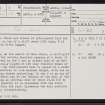
NR 292 554 ?Dun: There are traces of interrupted turf and stone walling, on top of a cliff about 25ft high, N of the mouth of the River Laggan.
I D Shanks 1973
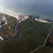
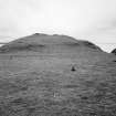
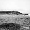
At NR 2917 5544, on the summit of Cnoc Ebric, a cliff-girt headland, are the severly depleted remains of a fort. It is best-preserved in the N arc at either side of an entrance gap centrally placed at the only feasible means of approach; here the turf-covered wall is spread to a width of 4.5m, and survives to 1.0m maximum height, with one or two outer facing stones protruding. In the S is an arc of rubble stones which may be the remains of the wall of the fort, suggesting an internal size of about 28.0m N-S by 17.0m E-W, or possibly it is clearance from the later cultivation within the fort. Elsewhere the wall material is visible only intermittently.
Surveyed at 1:10 000.
Visited by OS (NKB) 18 March 1979
Field Visit (June 1976)
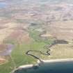
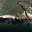
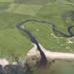
NR 291 554. This fort is situated 600 m E of Laggan on the almost level summit of Cnoc Eabriic, the headland that rises 19m above the sea at the mouth of the River Laggan. The W side and the S end of the headland are sheer cliffs and on the E there are steep slopes; only from the N is there easy access over gently rising ground. For much of its circuit the wall follows the margin of the summit area; no inner facing-stones survive, but some short stretches of the lowest course of the outer face are visible. As it crosses the neck of the promontory on the N, the rubble core of the wall is still standing to a height of 1.2m externally and 0.8m internally; a gap near the centre of this sector marks the position of the entrance.
The interior, which has been greatly disturbed by former cultivation, contains an arc of grass-grown rubble about
0.5m high; its relationship to the fort is unclear and it may even be associated with a small turf-and-stone enclosure of
no great age situated just inside the line of the wall on the E.
RCAHMS 1984, visited June 1976
Measured Survey (1981)
RCAHMS surveyed this fort using plane-table and alidade at a scale of 1:400. The resultant plan was redrawn in ink and published at a reduced scale (RCAHMS 1984, fig. 84A).
Note (24 September 2014 - 23 May 2016)
This small fort occupies a rocky knoll forming a promontory on the W side of the mouth of the Laggan River. Oval on plan, the wall can be traced cutting over the crest of the hillock on the N and returning along the flank facing the river on the E to enclose an area measuring about 51m from N to S by 23m transversely (0.09ha). The wall is spread up to 4.5m in breadth by 1.2m in external height where it crosses the neck of the promontory on the N; there are short runs of outer facing stones on the NW and on the E. The entrance is on the N. The only features visible within the interior are a later pen on the E and a band of rubble towards the S, though the date and original purpose of the latter are unknown.
Information from An Atlas of Hillforts of Great Britain and Ireland – 23 May 2016. Atlas of Hillforts SC2085


