Pricing Change
New pricing for orders of material from this site will come into place shortly. Charges for supply of digital images, digitisation on demand, prints and licensing will be altered.
Drumtroddan 11
Cup And Ring Marked Rock (Neolithic) - (Bronze Age)
Site Name Drumtroddan 11
Classification Cup And Ring Marked Rock (Neolithic) - (Bronze Age)
Canmore ID 368487
Site Number NX34SE 141
NGR NX 36261 44734
Datum OSGB36 - NGR
Permalink http://canmore.org.uk/site/368487
- Council Dumfries And Galloway
- Parish Mochrum
- Former Region Dumfries And Galloway
- Former District Wigtown
- Former County Wigtownshire
Note (2 May 2019)
Date Fieldwork Started: 02/05/2019
Compiled by: ScRAP Team
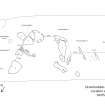
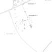
Location Notes: Drumtroddan 11 is part of a group of cup-and-ring marked rocks (Drumtroddan 8 - 13) located within a fenced-off area in a field approximately 200m S of Drumtroddan Farm. Further rock art panels are located within a similarly fenced-off enclosure approximately 20m to the SE (Drumtroddan 1 – 4), and within a wooded area approximately 70m to the W (Drumtroddan 5 – 7). Drumtroddan 8-13 are part of the same Canmore ID (62751) and HER record (MDG2423) and, together with the panels in the other fenced-off enclosure and within the wooded area, are included within the same scheduled monument designation (SM90101), and are properties in care.
The two enclosures within the field are part of a large area of outcropping rock. There are views in all directions, and particularly to the N, E and W, with the Galloway hills visible in the distance to the NE. Drumtroddan standing stones (Canmore ID: 62762) are approximately 400m to the S. The enclosure within which Drumtroddan 11 is located, measures approximately 8m x 16m. All the panels within this group are found on a single area of exposed outcrop ridge running broadly NW-SE certain parts of which are turf-covered.
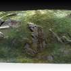
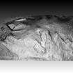
Drumtroddan 11 is located within the middle part of the grouping. Drumtroddan 8 lies approximately 0.9 m to the E and Drumtroddan 12 0.9m to the W.


