Pricing Change
New pricing for orders of material from this site will come into place shortly. Charges for supply of digital images, digitisation on demand, prints and licensing will be altered.
Erskine's Knap
Barrow (Late Neolithic) - (Early Bronze Age)(Possible), Motte (Medieval)(Possible)
Site Name Erskine's Knap
Classification Barrow (Late Neolithic) - (Early Bronze Age)(Possible), Motte (Medieval)(Possible)
Alternative Name(s) Scotston
Canmore ID 36526
Site Number NO77SW 17
NGR NO 73799 73455
Datum OSGB36 - NGR
Permalink http://canmore.org.uk/site/36526
- Council Aberdeenshire
- Parish Laurencekirk
- Former Region Grampian
- Former District Kincardine And Deeside
- Former County Kincardineshire
NO77SW 17 7379 7344
(NO 7379 7344) Erskine's Knap (NAT)
OS 6" map, (1971)
Possible motte or cairn.
Visible on OS air photographs 67/287/049-50, flown 27 July 1967.
Erskine's Knap is circular, and apparently artificial, measuring some 40m in diameter and 1.8m in height, much spread by ploughing. There is no trace of a ditch.
Surveyed at 1:2500.
Visited by OS (R L) 13 December 1967.
Listed.
Scottish Castle Survey 1988; N Bogdan and I B D Bryce 1991.
Scheduled as Erskine's Knap, burial mound 600m SE of Scotston.
Information from Historic Scotland, scheduling document dated October 1991.
(Classified as site of cairn/cropmark). Air photographs: AAS/94/16/G30/29-30.
NMRS, MS/712/21.
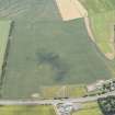
(Name cited as Erskine's Knap and location as NO 7378 7345). Air photography (AAS/82/15/R24/6, flown 24 July 1982 and AAS/89/07/S20/5-7, flown 24 July 1989) has recorded the site of a ploughed out barrow or cairn. The cropmark of a circular ditch may be distinguished, within which there is a possible internal feature.
The monument is situated in arable ground on a gentle slope at an altitude of 95m OD.
NMRS, MS/712/107.
Field Visit (March 1982)
Erskine's Knap NO 737 734 NO77SW 17
Erskine's Knap, a large mound about 600m SE of Scotston farmhouse, is probably a barrow; it measures 40m in diameter and 1.8m in height.
RCAHMS 1982, visited March 1982


