Traprain Law
Pit (Modern)
Site Name Traprain Law
Classification Pit (Modern)
Alternative Name(s) 'Souterrain'
Canmore ID 362533
Site Number NT57SE 204
NGR NT 57934 74618
Datum OSGB36 - NGR
Permalink http://canmore.org.uk/site/362533
- Council East Lothian
- Parish Prestonkirk
- Former Region Lothian
- Former District East Lothian
- Former County East Lothian
Field Visit (28 June 2017)
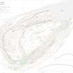
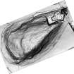
A drystone-lined rectangular pit, superficially resembling a prehistoric souterrain, is situated on the western terrace of Traprain Law, some 235m WSW of the redundant OS triangulation pillar on the summit. The pit measures internally at least 6.2m from NNW to SSE by 1m transversely and is at least 0.5m in depth. It is lined along both sides with coursed drystone walling, and is partly capped with intermittent thin stone slabs. This feature was first recorded during the survey of Traprain Law in April 1955 and it is depicted on the published plan (Feachem 1958). It was described in an accompanying notebook as a ‘foxhole’ (HES: MS36/181).
The date and function of the pit are not known. However, the fact that it lies within the area that was thoroughly excavated by Curle and Cree between 1914 and 1923 (e.g. Curle 1915; Cree 1924), and does not feature on their plans (cf. Hogg 1951; Smith 1990, figs. 5.2-5.4), suggests that it has been constructed within the backfill of the excavations and therefore post-dates them. There is no evidence to support its interpretation as a souterrain (e.g. Coppens 2012).
Visited by HES Survey and Recording (GFG, AMcC) 28 June 2017.
(TPR57)


