Traprain Law Archaeological Survey


Date February 2017 - December 2018
Event ID 1021036
Category Project
Type Project
Permalink http://canmore.org.uk/event/1021036
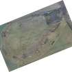
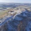
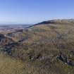
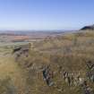
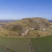
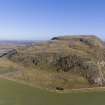
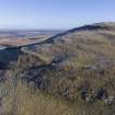
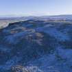
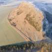
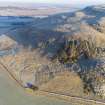
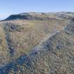
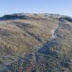
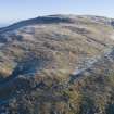
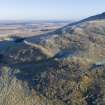
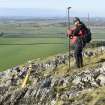
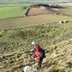
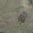
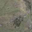
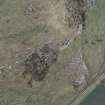
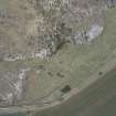
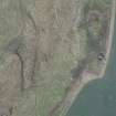
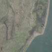
An archaeological survey of Traprain Law was undertaken by HES Survey and Recording between February 2017 and December 2018 at the behest of East Lothian Council, in order to provide an up-to-date baseline archaeological survey of the hill. The initial phase of fieldwork included the collection of high resolution oblique aerial photographs and dGPS ground control in order to facilitate the production of a 25cm resolution image-based model (HES Archive: TM 000210). A second phase involved the analysis and digitisation of that model, and the collection (over about 3 weeks of discontinuous fieldwork) of dGPS data for each feature. Brief notes on 71 features were collated in a database (DT 000143), and 32 more detailed written descriptions were developed to record more significant elements of the site. Each description was peer-reviewed before entry into Canmore, and a site-area polygon was created for all individual entries. The project built on the results of the survey undertaken by RCAHMS in April 1955 (DES 1955, 34; Feachem 1958), reviewing each individual feature and the development sequence proposed, and on a wide variety of other material, ranging from excavation reports to aerial photographs, both published and unpublished (held in the HES Archive).
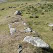
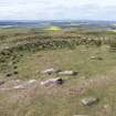
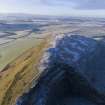
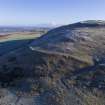
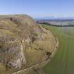
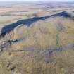
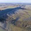
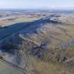
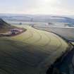
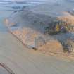
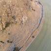
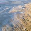
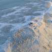
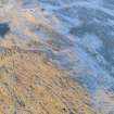
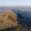
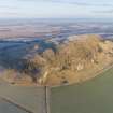
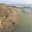
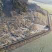
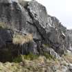
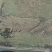
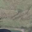
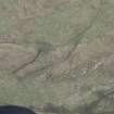
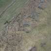
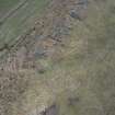
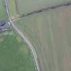
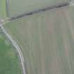
The lower slopes of Traprain Law have escaped modern cultivation and a series of archaeological features have been recorded here for the first time (cf. Feachem 1958). These include extensive evidence of quarrying along the NNW flank in particular, but also on the SW and SE flanks. To this can be added a small field system (Canmore ID 360625), possibly later prehistoric in date, which clings to the SE flank, and a pair of possible house platforms (361399). Other features include a plot of rig and furrow, turf enclosures and the remnants of a small farmstead, all of which are probably relicts of post-medieval activity. Also on the SE flank of the hill there is an early trackway as well as extensive evidence for negative lynchets which represent the high watermark of cultivation prior to the establishment of the modern boundary dykes.
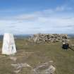
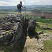
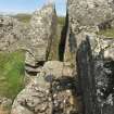
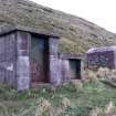
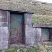
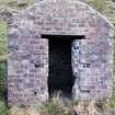
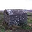
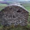
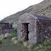
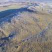
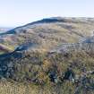
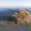
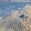
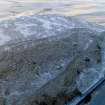
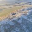
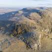
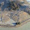
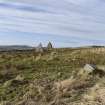
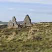
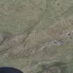
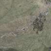
The higher slopes of the hill bear witness to successive phases of defence, and although the first mention of ‘an old dyke or wall’ was made by Rev. John Ewan in the late 18th century (Stat. Acct. 2, 349-50), the defences by-and-large lay unrecognised until the early 20th century (but see Maclagan 1875, 48-9). The description of the fort itself (56374) includes an account of the development of these defences, but it is worth noting here that there are significant difficulties in working out the phasing of the defensive system where the evidence comprises barely discernible surface traces and the results of excavations undertaken before 1950. Few early excavators recognised the potential complexity of the walls they exposed, nor reached their foundations. Six entrances through the terraced rampart that have been postulated, each of which has been modified by subsequent activity. These later works also include the establishment of what is probably a medieval farmstead (360144) on the N shoulder of the hill, beside a well (360145) that no doubt provided the best source of water, as well as the construction of a series of enclosures on the summit, now obscured by later structures. While excavation in recent years has demonstrated that much of the interior of the fort contains complex later prehistoric and medieval deposits, which reflect settlement, metalworking and funerary activity (e.g. Rees and Hunter 2000; Armit et al 2005), the surface remains within the interior betray little of the underlying archaeology. In contrast to other forts such as North Berwick Law (56699), or the comparable site at Eildon Hill North (55668), there are few house platforms or roundhouses on Traprain, and the most prominent remains comprise a number of indistinct platforms on the W flank of the hill, some of which retain evidence for rectangular buildings.
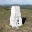
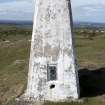
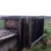
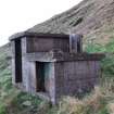
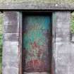
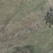
This paucity of evidence for contemporary structures within the fort might simply mean that the area has been subject to continued phases of subsequent occupation and cultivation. The most recent features on the summit include as many as three stone-walled plantation enclosures – remains of attempts by 18th century landowners to grow trees in implausible locations. To these can be added the now redundant Ordnance Survey triangulation pillar, moved as late as 1943, which has proved an important node in surveys of the county and nation since the mid-19th century. Indeed, the modern quarry itself represents only the culmination of an industry that has grossly modified the NW and SW flanks of the hill.
Information from HES Survey and Recording (GFG) 29 January 2019.