Traprain Law
Quarry (Period Unknown)
Site Name Traprain Law
Classification Quarry (Period Unknown)
Canmore ID 361398
Site Number NT57NE 279
NGR NT 58494 74814
Datum OSGB36 - NGR
Permalink http://canmore.org.uk/site/361398
- Council East Lothian
- Parish Haddington
- Former Region Lothian
- Former District East Lothian
- Former County East Lothian
Field Visit (10 November 2017)
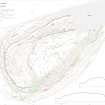
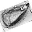
This quarry has been dug into the unimproved slope that lies immediately below the steep crags that form the SE flank of Traprain Law. Oval on plan, it measures about 14m from NE to SW by 11m and about 3m in depth. A smaller pit, 4m in diameter, has been set into the quarry floor.
Visited by HES (GFG, AM) 10 November 2017.
(TPR23)


