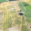
Accessibility

Font Size

100% 150% 200%

Background Colour

Default Contrast
Close Reset

Pricing Change

New pricing for orders of material from this site will come into place shortly. Charges for supply of digital images, digitisation on demand, prints and licensing will be altered. 


Dirleton New Mains

Field Boundary (Post Medieval)

Site Name Dirleton New Mains

Classification Field Boundary (Post Medieval)

Canmore ID 360919

Site Number NT58SW 220

NGR NT 51493 84774

NGR Description 5

Datum OSGB36 - NGR

Permalink http://canmore.org.uk/site/360919

Ordnance Survey licence number AC0000807262. All rights reserved.
Canmore Disclaimer. © Bluesky International Limited 2025. Public Sector Viewing Terms

Toggle Aerial | View on large map

Digital Images

Collections

Administrative Areas

  • Council East Lothian
  • Parish Dirleton
  • Former Region Lothian
  • Former District East Lothian
  • Former County East Lothian

Activities

Aerial Photography (17 July 2018)

References

MyCanmore Image Contributions


Contribute an Image

MyCanmore Text Contributions