Traprain Law
Spoil Heap (Modern)
Site Name Traprain Law
Classification Spoil Heap (Modern)
Canmore ID 360068
Site Number NT57SE 178
NGR NT 58273 74835
Datum OSGB36 - NGR
Permalink http://canmore.org.uk/site/360068
- Council East Lothian
- Parish Prestonkirk
- Former Region Lothian
- Former District East Lothian
- Former County East Lothian
Field Visit (15 May 2018)
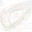
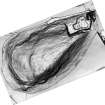
A large mound, which appears to overly the fort wall (NT57SE 1), is situated on the N flank of the Law, about 20m W of the quarry fence and 195m NE of the summit. It measures about 18m from N to S by 23m transversely and is about 4m in height. When it was surveyed by RCAHMS in 1955 it was noted as a ‘quarry tip of top soil and sods from farther [east]’ (DP250018). This is still the preferred explanation.
Visited by HES Survey and Recording (GFG) 15 May 2018.
(TPR11)


