Westside
Field Boundary (Post Medieval), Geological Cropmark(S) (Period Unassigned)
Site Name Westside
Classification Field Boundary (Post Medieval), Geological Cropmark(S) (Period Unassigned)
Canmore ID 35998
Site Number NO66NW 65
NGR NO 6162 6639
Datum OSGB36 - NGR
Permalink http://canmore.org.uk/site/35998
- Council Angus
- Parish Edzell
- Former Region Tayside
- Former District Angus
- Former County Angus
NO66NW 65 6162 6639.
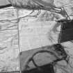
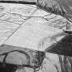
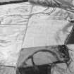
A field boundary has been recorded as cropmarks on oblique aerial photography (RCAHMSAP 2000) extending the line of an existing field boundary to the SSE, before turning to the WSW-ENE. Palaeochannels can be seen as cropmarks across the field.
Information from RCAHMS (KMM) 20 August 2004


