Accessibility

Font Size

100% 150% 200%

Background Colour

Default Contrast
Close Reset

Sanday, Lopness House

House (Period Unassigned)

Site Name Sanday, Lopness House

Classification House (Period Unassigned)

Canmore ID 3595

Site Number HY74SE 21

NGR HY 75909 43738

Datum OSGB36 - NGR

Permalink http://canmore.org.uk/site/3595

Ordnance Survey licence number AC0000807262. All rights reserved.
Canmore Disclaimer. © Bluesky International Limited 2025. Public Sector Viewing Terms

Toggle Aerial | View on large map

Digital Images

Oblique aerial view of Huntington centred on the cropmarks of a settlement and barrow, taken from the NW.
Oblique aerial view of Huntington centred on the cropmarks of a settlement and barrow, taken from the NW.Oblique aerial view centred on the radar station with the farmstead adjacent, taken from the SW.Oblique aerial view centred on the radar station with the farmstead adjacent, taken from the NNE.Oblique aerial view of Sanday, Whale Head (Lopness) Radar Station, taken from the SSEOblique aerial view centred on the radar station with the farmstead adjacent, taken from the NNW.Oblique aerial view centred on the radar station with the farmstead adjacent, taken from the NE.Sanday, Lopness House, HY74SE 21, Ordnance Survey index card, RectoOblique aerial view centred on the radar station with the farmstead adjacent, taken from the SSW.Oblique aerial view centred on the radar station with the farmstead adjacent, taken from the SE.Oblique aerial view of Sanday, Whale Head (Lopness) Radar Station, taken from the E.Oblique aerial view centred on the radar station with the farmstead adjacent, taken from the ENE.

Administrative Areas

  • Council Orkney Islands
  • Parish Lady
  • Former Region Orkney Islands Area
  • Former District Orkney
  • Former County Orkney

Archaeology Notes

HY74SE 21 75909 43738

For dovecot at HY 759 437, see HY74SE 22.

Activities

Field Visit (1999)

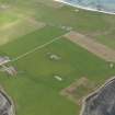
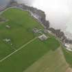
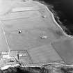
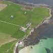
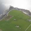
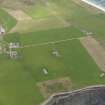
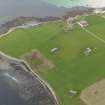
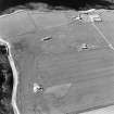
An occupied house stands at the head of a stony bay. A channel for boats has been cleared through the intertidal area to the south side of the house.

Coastal Zone Assessment Survey, 1999

References

MyCanmore Image Contributions


Contribute an Image

MyCanmore Text Contributions