Pricing Change
New pricing for orders of material from this site will come into place shortly. Charges for supply of digital images, digitisation on demand, prints and licensing will be altered.
Upcoming Maintenance
Please be advised that this website will undergo scheduled maintenance on the following dates:
Thursday, 9 January: 11:00 AM - 3:00 PM
Thursday, 23 January: 11:00 AM - 3:00 PM
Thursday, 30 January: 11:00 AM - 3:00 PM
During these times, some functionality such as image purchasing may be temporarily unavailable. We apologise for any inconvenience this may cause.
Balmakewan
Enclosure(S) (Period Unknown), Linear Feature(S) (Period Unknown), Pit(S) (Period Unknown), Rig And Furrow (Medieval) - (Post Medieval), Souterrain (Prehistoric)(Possible)
Site Name Balmakewan
Classification Enclosure(S) (Period Unknown), Linear Feature(S) (Period Unknown), Pit(S) (Period Unknown), Rig And Furrow (Medieval) - (Post Medieval), Souterrain (Prehistoric)(Possible)
Alternative Name(s) Balmakewan House Policies
Canmore ID 35871
Site Number NO66NE 14
NGR NO 6610 6640
NGR Description Centred on NO 6610 6640
Datum OSGB36 - NGR
Permalink http://canmore.org.uk/site/35871
- Council Aberdeenshire
- Parish Marykirk
- Former Region Grampian
- Former District Kincardine And Deeside
- Former County Kincardineshire
Field Visit (September 1981)
Balmakewan NO 661 664 NO66NE
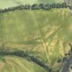
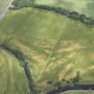
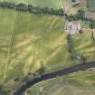
The crop marks of an enclosure (measuring about 14m square), three sides of what was probably a second, slightly larger, enclosure, and an arc of ditch are revealed 400m WNW of Balmakewan house. The SW ditch of the Roman temporary camp NO66NE 5 passes between the two enclosures. Nothing is visible on the ground.
RCAHMS 1982, visited September 1981


