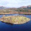
Eilean Fhianain, South And South West Platforms
Grave Marker(S) (Post Medieval), Gravestone (19th Century), Platform(S) (Period Unassigned), Slag (Period Unassigned)
Site Name Eilean Fhianain, South And South West Platforms
Classification Grave Marker(S) (Post Medieval), Gravestone (19th Century), Platform(S) (Period Unassigned), Slag (Period Unassigned)
Alternative Name(s) Platforms 27-36
Canmore ID 356246
Site Number NM76NE 1.16
NGR NM 75185 68228
Datum OSGB36 - NGR
Permalink http://canmore.org.uk/site/356246
- Council Highland
- Parish Arisaig And Moidart
- Former Region Highland
- Former District Lochaber
- Former County Inverness-shire
Field Visit (5 September 2017)
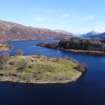
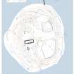
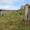
This group of 10 platforms is situated downslope from the summit area at the S and SW of Eilean Fhianain in an area dominated by a large natural terrace. The six platforms at the E end of the group (27-33) were probably constructed as borrow pits or as simple terraces to contain burials, and they contain 36 simple grave markers and one prominent gravestone to Dougald Cameron d.1886 and his daughter Annie d.1901. A short section of path leads from the shore to the burial ground between platforms 28 and 29, and another section survives to the W of platform 36.
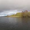
The shoreline adjacent to the terrace is dotted with numerous fragments of slag suggesting that this area was also a focus of small industry, presumably in the 17th and 18th century. Hammerscale, charcoal and slag have formerly been recovered from platform 34 (J Kirkby pers. comm.) and this may have been a focus of industrial activity, as it is in the area of the island most distant from the settlement.
27. NM 75252 68211: This grass and reed-grown oval platform, which is cut back into the steeply rising slope on the SSE side of the island, measures 7.4m from E to W by 5.7m transversely, with a rear scarp 1m high.
28. NM 75242 68214: This grass, reed and bramble-grown oval platform, which is cut back into the steeply rising slope on the SSE side of the island, measures 7.4m from ENE to WSW by 5.3m transversely. It is occupied by at least three stone grave-markers, in addition to a scatter stones.
29. NM 75232 68205: This grass and reed-grown platform, which is cut back into the steeply rising slope on the S side of the island, measures 10.1 from ENE to WSW by 7.8m transversely, with a rear scarp 0.5m. It is occupied by a headstone commemorating Donald Cameron d.1886 and his daughter, Annie. Iron slag was noted just above the foot of the S facing scarp.
30. NM 75228 68218: This grass and reed-grown platform, which is cut back into the steeply rising slope on the S side of the island, measures 6.2m from E to W by 3m transversely, with a rear scarp 1m high.
31. NM 75219 68207: This grass-grown platform, which is cut back into the steeply rising slope on the S side of the island, measures 11.4m from WNW to ESE by 7.7m transversely, with a rear scarp 0.4m high. It is occupied by at least four small stone grave-markers at its NW end.
32. NM 75208 68210: This grass-grown platform, which is cut back into the steeply rising slope on the SSW side of the island, measures 9m from WNW to ESE by 7.9m transversely, with a rear scarp 0.8m high. It is occupied by at least one small stone grave-marker at the rear of the NW end.
33. NM 75209 68218: This grass, reed and hawthorn-grown platform, which is cut back into the steeply rising slope on the SW side of the island, measures 6m from NW to SE by 4.5m transversely, with a rear scarp 0.5m high. It is occupied by at least two small stone grave-markers.
34. NM 75193 68227: This grass reed and hawthorn-grown platform, which is cut back into the steeply rising slope on the SW side of the island, measures 10.8m from NW to SE by 9m transversely, with a rear scarp 1m high, with a rear scarp 1m high. It is occupied by at least one small cairn.
35. NM 75176 68246: This grass, reed and azalea-grown platform, which is cut back into the steeply rising slope on the WSW side of the island, measures 13m from NW to SE by 12.5m transversely, with a rear scarp 1m high. It is occupied by at least one small cairn and a scatter of stones.
36. NM 75165 68251: This grass, reed and fern-grown platform, which is cut back into the steeply rising slope on the WSW side of the island, measures 8.2m from NNW to SSE by 6.8m transversely, with a rear scarp 0.3m high. It is accessed by a ramp from the NW up to 2.3m broad. Fragments of iron slag occur in section on the WSW, where the scarp in front of the platform is being actively eroded and also on the shore below.
Visited by HES, Archaeological Survey (ATW, GFG) 5 September 2017


