Eilean Fhianain Special Survey


Date 2016 - 2017
Event ID 1030670
Category Project
Type Project
Permalink http://canmore.org.uk/event/1030670
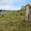
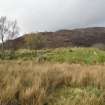
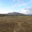
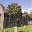
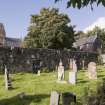
An archaeological survey of Eilean Fhianain was undertaken by HES Survey and Recording in 2016 and 2017 as part of the Special Survey programme (Project ID 109). The island was surveyed by George Geddes and Adam Welfare in partnership with members of Moidart Historical Group and with the logistical support of Forestry Commission Scotland. In advance of fieldwork, existing records were revised and enhanced, and the relevant HES Collection material was catalogued and digitised. Eilean Fhianain was the site of the medieval parish church and burial ground of Sunart, used at one time by the chiefs of the Clanranald Macdonalds, whose residence at Castle Tioram is situated 10km to the WNW (Canmore ID 22511). The later use of the island has included settlement, cultivation and a little industry, while burial continues to the present day.
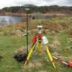
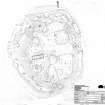
Following a reconnaissance, fieldwork took place in 2016 and 2017 with the principal aim of surveying each of the archaeological features on the island in order to provide a much-enhanced record for Canmore. The survey was undertaken with dGPS equipment, supplemented by information taken from aerial photographs, an image-based 3D model, and more traditional techniques – the final result being a plan of the whole island at a scale of 1:500. The island was also recorded with UAV, aerial and ground photography, and professional flash-lit images of particular funerary monuments were captured. A plan of the church was prepared at 1:100 by alidade and plane-table survey. The survey recorded more than 700 individual features, ranging from large burial enclosures and standing buildings, to simple grave markers. These have been recorded in Canmore under 22 individual site records, which range from single features to larger groups of gravestones or platforms. A site-area polygon was created for each record.
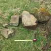
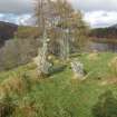
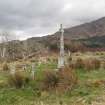
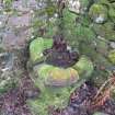
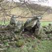
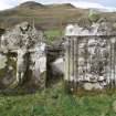
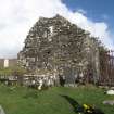
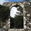
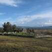
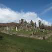
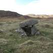
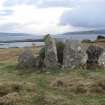
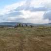
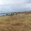
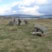
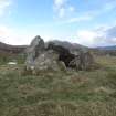
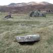
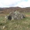
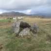
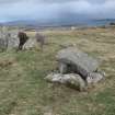
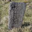
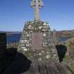
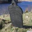
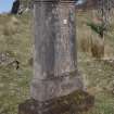
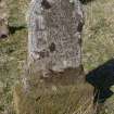
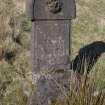
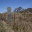
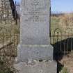
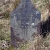
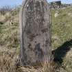
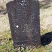
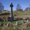
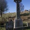
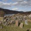
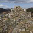
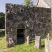
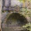
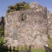
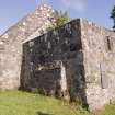
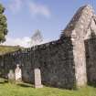
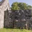
The earliest features on the island include the bell (Canmore ID 355516) and a small corpus of sculpture, including two stones bearing incised crosses (319525; 319526) and another -- a cross in relief (350810), all of early medieval type (see Fisher 2001 for comparanda). The origins of the church (22686) are obscure but the earliest historical reference dates to the 14th century, a period that seems appropriate for the surviving medieval fabric and a small collection of architectural fragments (356105). To this can be added three West Highland late medieval gravestones — one depicting a female figure (355419), another a sword (355509) and the third (also 355509), which is fragmentary, a simple edge carving (See Steer and Bannerman 1977 for comparanda). A range of different types of gravemarker attributable to a later date (some 650 in total) cover the upper part of the island. These include simple uncarved stones, small cairns, table tombs, flat slabs, burial enclosures, crosses, headstones and a burial aisle. The mound on the high point in the NW part of the island (108579) may have formed an initial focus for burial, while those nearer the church include some of 18th century date. By contrast those burials in the NE and SE enclosures, for Catholics and Protestants respectively, are presumed to be of later date (see 355511 and 356229).
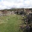
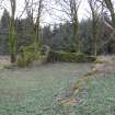
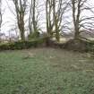
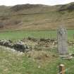
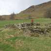
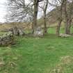
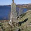
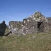
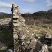
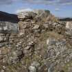
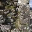
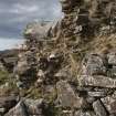
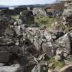
Apart from burial there are distinct indications of settlement in the form of building platforms and the vestiges of buildings at the NE edge of the island (356244). The size and shape of these buildings, and the relatively good preservation of the platforms, combines with documentary evidence to suggest that they are probably late-medieval or post-medieval in date. A blacksmith, a sexton and a minister lived and worked here at various times. The remaining platforms elsewhere around the fringes of the island (356245, 356246, 356247) bring the total to 41, providing evidence for a variety of activities. In contrast to those constructed as building platforms, some are simply small quarry scoops dug to provide additional soil for burials. Others, including a very large terrace immediately E of the church and a small number around the island fringe, seem to have been constructed to allow burials to be made on relatively level ground. Finally, there is little doubt that some were used for industrial activity, especially metalworking. Documentary references record the activities of the blacksmith in the early 18th century and large quantities of slag are a notable feature of the SW shoreline (356246) — an area that is as distant from the settlement as possible. To this can be added the discovery of a crucible in 2014 (351583) and finds of iron fragments and charcoal.
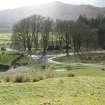
Other features on the island include a small plot of lazy beds partly overlying the SE burial enclosure, a bait hole (356269) and two jetties. The jetty (356104) now submerged on the E side of the island may have provided access to the NE and SE burial enclosures and is likely to be of post-medieval date. The N jetty (355594) was constructed in the 19th century and forms a pair with another on the N shore of the loch (118462).
Information from HES Survey and Recording (GFG, ATW) December 2017