
Newbarns


Field Boundary(S) (Period Unknown)(Possible), Field System (Period Unknown)
Site Name Newbarns
Classification Field Boundary(S) (Period Unknown)(Possible), Field System (Period Unknown)
Canmore ID 35427
Site Number NO64NE 47
NGR NO 68630 49550
Datum OSGB36 - NGR
Permalink http://canmore.org.uk/site/35427


- Council Angus
- Parish Inverkeilor
- Former Region Tayside
- Former District Angus
- Former County Angus
NO64NE 47 68630 49550
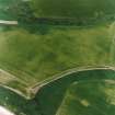
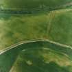
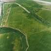
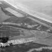
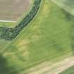
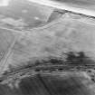
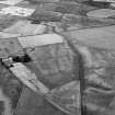
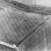
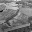
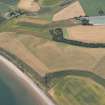
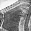
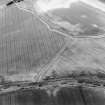
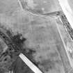
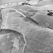
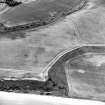
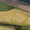
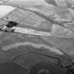
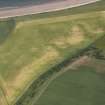
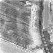
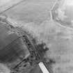
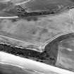
What may be the ploughed down remains of field boundaries have been recorded on oblique aerial photography (RCAHMSAP 1982, 1988, 1998) about 450m NE of Newbarns.
Information from RCAHMS (KMM) 8 January 2004.
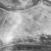
Aerial Photographic Transcription (24 February 1994 - 21 April 1994)
An aerial transcription was produced from oblique aerial photographs. Information from Historic Environment Scotland (BM) 31 March 2017.

