Newbarns
Enclosure (Medieval) - (Post Medieval)
Site Name Newbarns
Classification Enclosure (Medieval) - (Post Medieval)
Canmore ID 35393
Site Number NO64NE 17
NGR NO 68380 49340
Datum OSGB36 - NGR
Permalink http://canmore.org.uk/site/35393
- Council Angus
- Parish Inverkeilor
- Former Region Tayside
- Former District Angus
- Former County Angus
NO 680 490 (centre) A programme of trial trenching was carried out on adjoining fields, one Scheduled and one unscheduled, to the N of Newbarns Farm.
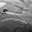
A trench was opened over the NE corner of a rectilinear enclosure (NO64NE 17) measuring c 30 x 30m. A break in the ditch defining the enclosure formed the only visible entrance. The ditch was 1.35m wide and 0.5m deep. A line of small post-holes was visible c 1.2m inside the ditch, possibly indicating the presence of a retaining revetment wall for an upcast bank. Inside the excavated part of the enclosure, three pits were arranged in a semi-circle. Outside the enclosure were several post-holes. There were no finds from this trench.
A detailed report will be lodged with the NMRS.
Sponsors: Historic Scotland, University of Edinburgh.
C McGill 1998
NO 683 492 The second season of a programme of trial trenching was carried out to the W of Newbarns Farm (McGill 1998). The field is rich in cropmarks of varying forms, some of which are Scheduled.
Eleven trenches were excavated: three within the Scheduled area and eight outside it. Of this total, only two trenches were devoid of archaeological features.
The excavated features comprised pits, linear ditches, natural ice wedges, a truncated ring-ditch house, a sub-rectangular enclosure (possibly a Dark Age timber hall), and a possible square barrow. No features produced any artefactual dating evidence, and provisional dates can only be applied to three feature groups (the ring-ditch house, timber hall and square barrow-type feature) on the basis of their morphology. The results supported the conclusions from the previous year's work at Newbarns that the clarity of cropmarks is the result of a combination of topography, ploughsoil depth, subsoil, feature depth, size and nature of fill, with the principal deciding factor being geomorphological considerations. There was considerable evidence across the site for plough-scoring of subsoil and features, suggesting that active truncation is occurring.
A detailed report will be lodged with NMRS.
Sponsors: Historic Scotland, University of Edinburgh.
C McGill 1999
Field Visit (March 1978)
New Barns 1 NO 683 493 NO64NE
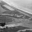
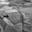
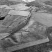
In a field N of New Barns, the crop-mark of an enclosure, which measures about 30m square, has been recorded.
RCAHMS 1978, visited March 1978
Aerial Photographic Transcription (24 February 1994 - 21 April 1994)
An aerial transcription was produced from oblique aerial photographs. Information from Historic Environment Scotland (BM) 31 March 2017.


