
Eigg, Cnoc Oilletig


Building(S) (19th Century), Lime Kiln(S) (19th Century)
Site Name Eigg, Cnoc Oilletig
Classification Building(S) (19th Century), Lime Kiln(S) (19th Century)
Alternative Name(s) Iltaig
Canmore ID 352612
Site Number NM48NE 31.09
NGR NM 47531 88978
Datum OSGB36 - NGR
Permalink http://canmore.org.uk/site/352612


- Council Highland
- Parish Small Isles
- Former Region Highland
- Former District Lochaber
- Former County Inverness-shire
Field Visit (9 June 2001)
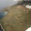
There are two buildings and a limekiln about 5m to the NW of the No.8 Cleadale at Cnoc Oilletaig. The larger building (162) measures 5.2m from NW to SE by 4.7m transversely over rubble walls about 1m in thickness and 0.5m in height. The interior is choked with rubble. Immediately to the NW there is a second slightly smaller building (163) aligned from E to W. To the SW of this there is a kiln with a bowl that measures 1m in diameter with a flue opening to the NNE.
The roofed building at No.8 is depicted on the 1st edition of the OS 6-inch map (Inverness-shire Sheet LXXI, 1879). The smaller building noted above (163) is shown on the 2nd edition of the map (1903) as is what may be another kiln about 15m to the E of No. 8.
EIGG01 161-163
Visited by RCAHMS (AGCH) 9 June 2001

