Mains Of Edzell
Fort (Iron Age), Palisade (Prehistoric), Pit(S) (Prehistoric)
Site Name Mains Of Edzell
Classification Fort (Iron Age), Palisade (Prehistoric), Pit(S) (Prehistoric)
Alternative Name(s) Edzell Castle
Canmore ID 34987
Site Number NO56NE 26
NGR NO 5886 6920
NGR Description Centred on NO 5890 6920
Datum OSGB36 - NGR
Permalink http://canmore.org.uk/site/34987
- Council Angus
- Parish Edzell
- Former Region Tayside
- Former District Angus
- Former County Angus
NO56NE 26 centred on 5890 6920
NO56NE 26.01 and NO56NE 26.02 Cancelled sites
NO56NE 60 centred on 5898 6918 Rig
Note (1983)
Mains of Edzell NO 588 691 NO56NE
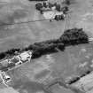
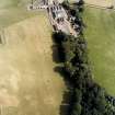
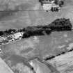
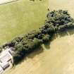
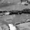
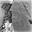
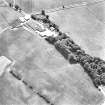
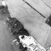
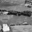
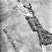
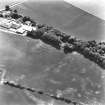
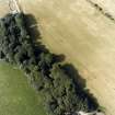
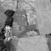
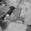
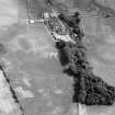
Cropmarks reveal the site of an earthwork, probably a settlement, on a low hill immediately NW of Mains of Edzell steading. It measures 90m by at least 45m over double ditches set 10m apart; within the interior there is possibly a third ditch, and the entrance is on the NNE.
RCAHMS 1983.
Aerial Photographic Transcription (12 December 1989)
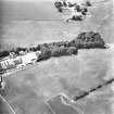
An aerial transcription was produced from oblique aerial photographs. Information from Historic Environment Scotland (BM) 31 March 2017.
Field Visit (26 September 1989)
Nothing is visible of the triple-ditched enclosure revealed by cropmarks on the NE side of a plantation 100m NW of Edzell Mains nor of the rig elsewhere in the field.
Visited by RCAHMS (PJD) 26 September 1989.
This enclosure is situated on a low knoll and measures about 40m from NW to SE, within the inner ditch. What may be an original gap in the middle and outer ditches is visible on both the N and SE, the gap in the middle ditch being 5m to 6m wide. The width of the ditches varies considerably probably due to the differential processes of plough damage. Nothing is visible of the ditches either in the field or the plantation.
Visited by RCAHMS (PJD) 26 September 1989.
Aerial Photographic Interpretation (25 February 1993)
A cropmark described above and classified as an enclosure, has now been confirmed and classified by recent aerial photographs as a fort. (RCAHMSAP 1990).
Information from RCAHMSAP (DS) 25 February 1993.
Excavation (1998)
NO 5885 6919 An archaeological excavation was undertaken on a scheduled cropmark enclosure site (NMRS NO56NE 26) in September 1998. The objectives were to examine the effects of agricultural attrition, rabbit erosion, tree root action and quarry erosion of the site. The aerial photographic evidence showed the enclosure to comprise three ditches encircling the northern part of the small hill. There were no indications of features within the enclosure, nor that the cropmark continued into the wooded area. Excavation confirmed the presence of the features noted as cropmarks to the S within a wooded area and uncovered a number of features inside the enclosure. The three ditches were shown not to run concentrically, nor did they symmetrically encircle the hilltop. The inner ditch displayed an entrance on the E side with several related structural components. The middle was the largest of the three ditches and significant deposits of burnt material were found in all sections of this ditch. It seems likely that the three ditches were not contemporaneous. Internal features included clay and stone-lined pits, a palisade slot, pits and post-holes. The ground level on the arable side of the hill was approximately 1m lower than its equivalent on the woodland side, probably as a result of horizontal truncation from ploughing. It was thought that the greater accumulations of hilltop deposits within the wooded area would provide a better preservation environment for underlying features. However, initial comparative analysis of the erosion patterns resulting from the different land-uses on the hilltop suggests that better preservation occurs on the farmed side of the hill. This is probably a result of tree root penetration and rabbit burrowing.
A detailed report will be lodged with the NMRS.
Sponsors: Historic Scotland, University of Edinburgh.
J Hamilton 1998
Note (1 June 2015 - 18 May 2016)
Cropmarks have revealed a small fortification situated on a low hillock immediately to the NW of Mains of Edzell steading. Only the NE half of the circuit is visible on the photographs, the rest lying within a deciduous plantation, but this exhibits three roughly concentric ditches. the projected arc of the innermost enclosing an area some 40m in diameter (0.12ha). Excavations in 1998, however, failed to locate this ditch on its projected line, though whether the result of plough truncation or by design is unclear. Nevertheless, the two outer ditches, which are set about 10m apart, enclose an oval area measuring some 70m from E to W by 50m transversely (0.27ha) and may well have formed a free-standing enclosure with at least two entrances, one on the NE and the other on the SE, though in both cases the gaps are slightly staggered to create an oblique axis, one to expose the visitor's left side and the other the right side. Radiocarbon dates from samples of what was thought to be in situ burning in both theses ditches fall in the period 800-200 BC. When allowance is made for the presence of an inner rampart, the interior extended to about 0.2ha and the scatter of features located in the excavation within the line of the innermost ditch included a palisade trench, both clay- and stone-lined pits, other pits, and post-holes.
Information from An Atlas of Hillforts of Great Britain and Ireland – 18 May 2016. Atlas of Hillforts SC3086


