Accessibility

Font Size

100% 150% 200%

Background Colour

Default Contrast
Close Reset

St Kilda, Soay, 29

Bothy (Post Medieval)

Site Name St Kilda, Soay, 29

Classification Bothy (Post Medieval)

Canmore ID 347921

Site Number NA00SE 115

NGR NA 06819 01361

NGR Description Handheld dGPS

Datum OSGB36 - NGR

Permalink http://canmore.org.uk/site/347921

Ordnance Survey licence number AC0000807262. All rights reserved.
Canmore Disclaimer. © Bluesky International Limited 2025. Public Sector Viewing Terms

Toggle Aerial | View on large map

Digital Images

Mary Harman's plan of structures on Soay, St Kilda.
Mary Harman's plan of structures on Soay, St Kilda.St Kilda, Soay. Bothy 29 interior W wallSt Kilda, Soay. View to bothy 29 and cleits 1 and 17 from WSt Kilda, Soay. Bothy 29 interior from NSt Kilda, Soay. Bothy 29 from the south.Mary Harman's plans of selected structures on Soay, St Kilda.Soay village, close up of the bothy, 7 February (photo. S Bain).Soay: close up of the bothy 29, above left of the drop.Photomerge showing structures on Soay and site numbers

Administrative Areas

  • Council Western Isles
  • Parish Harris
  • Former Region Western Isles Islands Area
  • Former District Western Isles
  • Former County Inverness-shire

Activities

Note (8 July 2015)

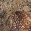
This subrectangular bothy provided accommodation for the women of Hirta while harvesting birds and working with the sheep.

(Soay 29)

Information from RCAHMS (ARG) 8 July 2015

References

MyCanmore Image Contributions


Contribute an Image

MyCanmore Text Contributions