St Andrews, The Scores, St Andrews Castle
Castle (Medieval)
Site Name St Andrews, The Scores, St Andrews Castle
Classification Castle (Medieval)
Canmore ID 34314
Site Number NO51NW 3
NGR NO 51260 16935
Datum OSGB36 - NGR
Permalink http://canmore.org.uk/site/34314




























First 100 images shown. See the Collections panel (below) for a link to all digital images.
- Council Fife
- Parish St Andrews And St Leonards
- Former Region Fife
- Former District North East Fife
- Former County Fife
NO51NW 3.00 51260 16935
NO51NW 3.01 5126 1693 Beaker
NO51NW 3.02 5126 1690 Mine and Countermine
(NO 5126 1693) Castle (NR) (Ruins of) (NAT)
OS 6" map (1912/38)
For full description and history, see MoW Official Guide.
S Cruden 1951
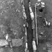
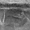
6 profile pits were excavated as assessment of proposed visitor centre site. Three pits W of West Wall had ditch fill with anthropic material. The fill was overlain by 2m of builders' rubble in turn overlain by sand as foundations of a croquet area. 2 pits in the area of the Block House on the West Wall revealed robber trenches with remaining wall foundations, lying directly onto rock. Soil horizons contained much disturbed material. A pit on the line of a putative wall running to the Swallow Port revealed some 2m of sand under garden soil, but no indications of the wall.
I D Mate and C E Lowe 1988
Within four trial trenches to the W of the castle's modern boundary were substantial wall foundations (perhaps part of the castle's outer defences), an area of well laid metalling (probably a road), a shell midden and a possible sandstone hearth. More extensive investigation is in progress.
J Lewis 1988
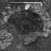
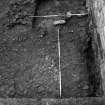
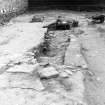
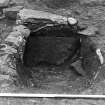
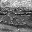
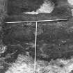
A series of excavations was carried out between October 1988 and January 1990 before work commenced on a new visitor centre to the W of the castle. The chosen site was an area left untouched when much of the garden was dug out in the later 19th century to accommodate a sunken bowling green. The somewhat irregular area of excavation measured c40m EW by 10m to 15m NS. The principal findings, which were extensive and complex, can be divided into: prehistoric features; medieval timber structures; medieval masonry buildings and associated features; a series of large pits; other, smaller pits; and structures post-dating the occupation of the site.
Prehistoric features
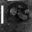
Several small, linear and curvilinear trenches, varying in length from 1.35m to 2.7m, were cut to a depth of 0.2m to 0.55m into the sandy subsoil. All were infilled with redeposited subsoil enclosing deposits of pink-brown silty sand. Within one of these trenches were the base and several body sherds of a vessel provisionally identified as a cord zoned beaker of Early Bronze Age date.
Timber structures
Sealing the putative Bronze Age features and covering most of the excavation area, was a deposit of sandy loam, up to 0.45m deep, into which were cut numerous post-holes and post-pits and several beam slots. Few structures have been identified from these many post-settings other than from a series of pits that extended from E to W across most of the length of the site. On the evidence of its length and the apparent absence of a return, this line may define a boundary rather than a timber building. In all likelihood, however, many of the post-settings and beam slots were associated with timber buildings yet to be identified.
Masonry buildings
There were two stone buildings, both aligned EW, near to the S wall of the garden.
Building 1, at the E end of the site, was outwith the area ultimately designated for development and, consequently, was only partially excavated. Substantial rubble foundations survived on the E, S and W sides of the 13m long (EW) building but all traces of its N wall had been destroyed by stone-robbing, landscaping and gardening. Internally there was evidence of a stone partition wall, a circular stone-lined hearth, three under-floor drains and vestiges of a metalled floor. More extensive and compact metalling, covering a large area outside the S and E of the building, may be evidence of a road or perhaps a courtyard. Building 2, situated to the immediate W of Building 1, was very fragmentary, the only positively identified elements being short lengths of its E and S walls. Nothing remained of the N side of the building, the position of its W wall remains unclear and neither floor surface nor occupation debris was found. Towards the W end of the bulding (or perhaps beyond it) was a badly eroded sandstone hearth. This feature was overlain and surrounded by a thick layer of ash and burnt soils, measuring c3m square and bounded by three narrow linear cuts, which perhaps represented the walls of a flimsy timber structure. The ashy deposit may have been contemporary with a nearby clay-lined trough, both features perhaps being associated with an industrial, rather than a domestic, process.
Large pits
None of the four large rectangular and sub-rectangular pits that cut the subsoil on the N side of the site could be linked stratigraphically with any of the timber or masonry structures. One of the pits is thought to be a cess pit from which an overflow channel led northwards into another pit that measured 2.4m by 1.4m and 1.1m deep. This pit and those further E, which had similar dimensions, all had very straight sides, suggesting they had been lined, probably with timber, and the linings removed immediately prior to backfilling. At least some of these pits are believed to have been associated with the tanning of leather. Enormous quantities of pottery and large amounts of fishbones and butchered mammal bones were retrieved from the infills.
Miscellaneous smaller pits.
Distributed throughout the site were several rectangular, sub-rectangular and sub-circular pits: some were probably sand quarries, some perhaps associated with various industrial processes and others of unnknown functions.
Later features
A shallow EW robber trench, post-dating both stone buildings and extending for at least 30m across the site, is thought to echo the line of a boundary wall depicted in an illustration by John Geddy and dated to c1550-80.
Sponsor: HBM.
J Lewis 1989a; 1990c.
Information from RCAHMS (DE) 8 March 1996.
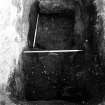
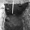
NO 512 169 A small excavation was carried out in February 2004 to evaluate the nature of deposits around the sides of the steps leading down to the counter mine entrance. The intrusive works were restricted to the N and W sides of the steps down to a level equivalent to the walkway on the E side of the structure. Two trenches were cut into modern backfill within the area of the construction pit. The edges of this pit were not revealed, and must be further than the 1.1m maximum width of the trenches.
Archive to be deposited in the NMRS.
Sponsor: HS.
C Shaw 2004
Site recorded by Maritime Fife during the Coastal Assessment Survey for Historic Scotland, Fife Ness to Newburgh 1996
NO51NW 3.00 51260 16935
REFERENCE
SCOTTISH RECORD OFFICE
1802-3
St Andrews Castle. Letters and papers concerning repairs undertaken by Principal James Playfair (7 items), including:
1. Estimate by Robert Coldstream for repairing 'the breaches in the front', 11 sept. 1802.
2-3. Letter from Playfair enclosing petition for approval of estimate, 14 Sept. 1802.
7. Letter from Playfair announcing completion of work; he has been 'sufficiently economical insomuch that the mason reckons it is a sorry job', 16 April 1803.
8. Letter from Playfair mentioning that he has 'prevailed on a young gentleman to undertake a description of our venerable remains, which I hope will soon be submitted to the publick', 20 Sept. 1803.
SRO/E342/28
1833-7
St Andrews. Papers relating to work at castle, cathedral, priory and parish church (5 items), including:
2. Memorandum concerning imprest for repairs to priory in December 1809, 30 Nov. 1833.
3. Account of Sir Henry Jardine of sums imprested to him for repairs on [parish] church, castle and cathedral, 1802-5, 1833.
4. Letter from clerk to heritors, requesting payment of crown's proportion of expenditure on repairs to parish church, 12 May 1837.
SRO/E342/41
Field Visit (31 May 1926)
The Castle.
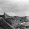
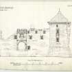
The Castle of St. Andrews was the residence of the bishop or, later, archbishop of the diocese. Its ruins (Fig. 413 [SC 1108779]) stand west of the Cathedral and the harbour on a headland overlooking the low-water haven known as the Hind Lake. The site is washed by the sea on its northern and eastern sides, while elsewhere it has been isolated by a ditch, cut in places out of the rock. Where the ditch debouches on the eastern shore, there seems to have been a natural re-entrant, the cliff being composed of layers of sandstone which dip steeply from north to south and present abruptly broken faces where exposed to erosion. Westwards of this re-entrant the southern stretch is entirely artificial. It was cleared out about 50 years ago. The western stretch, on the other hand, is completely filled up, but the top of the escarpment is believed to lie 4 feet below the present ground-line. The area thus defined, which is in shape an irregular pentagon, has been enclosed by buildings. At the angle on the south face is a salient, the Fore Tower, in which at one period was the entrance. The "janitor of the outer gate" is mentioned in the Rentale Sancti Andree (S.H.S.) in 1543-4, and an illustration of 1642 in the Bannatyne Miscellany, vol. iii, p. 24, shows a walled enclosure west and south of the castle with a forework and gate on the south.
For the most part the buildings now seen date only from the 16th century, but they overlie and incorporate remains of older structures, mere fragments that bear witness to the vicissitudes the place underwent and the thorough nature of the demolitions to which from time to time it was subjected.
[See RCAHMS 1933, 250-257, for a detailed architectural description]
RCAHMS 1933, visited 31 May 1926.
Photographic Survey (1955 - 1956)
Photographs of buildings in St Andrews, Fife, by the Scottish National Buildings Record between 1955 and 1956.
Publication Account (1981)
The castle (the Bishop's Palace of St. Andrews) is not known to have existed until 1200 (Cant, 1971 2). Its ruins stand west of the cathedral and harbour, on a headland overlooking the low-water haven known as Hind Lake. The site is protected by the sea on the east and north, while elsewhere it has been isolated from attack by the creation of a large ditch, in some places cut into the rock. The majority of the standing remains date from the sixteenth century but overlie and incorporate remains of older structures {RCAM, 1933, 250).
In 1336 the castle was rebuilt by the English, having been seriously damaged during the Wars of Independence. However, it appears that in the following year the Regent Moray caused widespread destruction to the structure which was not rebuilt until the episcopacy of Bishop Traill {1385-1401). The next important phase of building work did not occur until the first half of the sixteenth century when the Fore Tower (dating from the 1336 reconstruction) was blocked up and a new entrance introduced midway along the south-west curtain wall. A massive circular blockhouse rose at the south-western corner of the castle. Cardinal Beaton was engaged on building works at the time of his assassination. The bombardment by French troops in May 1547 caused widespread damage, and succeeded in knocking down the newly-erected south-west blockhouse. Although Beaton's successor carried out repairs on the structure, he made no effort to reclaim the blockhouse. One of the more interesting survivals from this period is the series of mines and counter-mines executed during the siege of 1546-7 (RCAM, 1933, 252-3).
After the Reformation, the Archbishops of St. Andrews chose to live in the Novum Hospitium of the Priory. The castle came into the crown's possession in 1587 but in 1612 was once again offered to the archbishops. Some Civil War prisoners captured at Philliphaugh were lodged in the castle prior to their execution in 1646. The castle was clearly uninhabitable by 1654 when the town council ordered the sale of its slates and timber for harbour repair (Roger, 1849, 91).
Information from ‘Historic St Andrews: The Archaeological Implications of Development’ (1981).
Publication Account (1987)
St Andrews Castle is a dramatically-sited ruin of a courtyard castle apparently utilising the cliffs to the north and east as part of the defences. Originally the building was sited at some distance from the cliff edge but over the years erosion has increased the dramatic effect. The castle has strong ecclesiastical connections, having been the residence of the bishops and, later, archbishops of St Andrews, who used it as a palace, fortress and prison. It has a long history of demolition and rebuilding since its first erection around 1200.
The existing ruin dates mainly from the last rebuilding undertaken by Archbishop John Hamilton between 1549 and 1571. Hamilton's work has a strong Renaissance character more in keeping with the building's function as a palace than with a military fortress. The building declined in importance after the Reformation and in 1654 the St Andrews Town Council ordered part of the building fabric to be used for the repair of the harbour walls.
One of the most interesting features of the castle is a very rare survival of a medieval siege technique. This comprises a mine and counter-mine dating from the siege of 1546-7. The Earl of Arran's forces established the mine with the intention of undermining the walls to the castle courtyard. A gallery, 1.8 m wide and 2.1 m high, was cut through the solid rock from the side of the ditch, south-east of the Fore Tower, to a minehead 8.2 m from the tower from which branches could run to breach the wall foundations at a number of places. This gallery had to slope down to pass under the ditch. The attempt was foiled by the defenders who drove a counter-mine from the east of the Fore Tower to intercept the mine and broke through into the minehead from a higher level. The counter mine follows an uncertain route possibly resulting from trying to estimate the course being taken by the enemy sappers in the mine by calculation and sound. Visitors can traverse both the mine and counter-mine in safety as these are now lit by electricity.
Information from ‘Exploring Scotland’s Heritage: Fife and Tayside’, (1987).
Excavation (October 1988 - January 1990)
A series of excavations was carried out between October 1988 and January 1990 before work commenced on a new visitor centre to the W of the castle. The chosen site was an area left untouched when much of the garden was dug out in the later 19th century to accommodate a sunken bowling green. The somewhat irregular area of excavation measured c40m EW by 10m to 15m NS. The principal findings, which were extensive and complex, can be divided into: prehistoric features; medieval timber structures; medieval masonry buildings and associated features; a series of large pits; other, smaller pits; and structures post-dating the occupation of the site.
Prehistoric features
Several small, linear and curvilinear trenches, varying in length from 1.35m to 2.7m, were cut to a depth of 0.2m to 0.55m into the sandy subsoil. All were infilled with redeposited subsoil enclosing deposits of pink-brown silty sand. Within one of these trenches were the base and several body sherds of a vessel provisionally identified as a cord zoned beaker of Early Bronze Age date.
Timber structures
Sealing the putative Bronze Age features and covering most of the excavation area, was a deposit of sandy loam, up to 0.45m deep, into which were cut numerous post-holes and post-pits and several beam slots. Few structures have been identified from these many post-settings other than from a series of pits that extended from E to W across most of the length of the site. On the evidence of its length and the apparent absence of a return, this line may define a boundary rather than a timber building. In all likelihood, however, many of the post-settings and beam slots were associated with timber buildings yet to be identified.
Masonry buildings
There were two stone buildings, both aligned EW, near to the S wall of the garden.
Building 1, at the E end of the site, was outwith the area ultimately designated for development and, consequently, was only partially excavated. Substantial rubble foundations survived on the E, S and W sides of the 13m long (EW) building but all traces of its N wall had been destroyed by stone-robbing, landscaping and gardening. Internally there was evidence of a stone partition wall, a circular stone-lined hearth, three under-floor drains and vestiges of a metalled floor. More extensive and compact metalling, covering a large area outside the S and E of the building, may be evidence of a road or perhaps a courtyard. Building 2, situated to the immediate W of Building 1, was very fragmentary, the only positively identified elements being short lengths of its E and S walls. Nothing remained of the N side of the building, the position of its W wall remains unclear and neither floor surface nor occupation debris was found. Towards the W end of the bulding (or perhaps beyond it) was a badly eroded sandstone hearth. This feature was overlain and surrounded by a thick layer of ash and burnt soils, measuring c3m square and bounded by three narrow linear cuts, which perhaps represented the walls of a flimsy timber structure. The ashy deposit may have been contemporary with a nearby clay-lined trough, both features perhaps being associated with an industrial, rather than a domestic, process.
Large pits
None of the four large rectangular and sub-rectangular pits that cut the subsoil on the N side of the site could be linked stratigraphically with any of the timber or masonry structures. One of the pits is thought to be a cess pit from which an overflow channel led northwards into another pit that measured 2.4m by 1.4m and 1.1m deep. This pit and those further E, which had similar dimensions, all had very straight sides, suggesting they had been lined, probably with timber, and the linings removed immediately prior to backfilling. At least some of these pits are believed to have been associated with the tanning of leather. Enormous quantities of pottery and large amounts of fishbones and butchered mammal bones were retrieved from the infills.
Miscellaneous smaller pits.
Distributed throughout the site were several rectangular, sub-rectangular and sub-circular pits: some were probably sand quarries, some perhaps associated with various industrial processes and others of unnknown functions.
Later features
A shallow EW robber trench, post-dating both stone buildings and extending for at least 30m across the site, is thought to echo the line of a boundary wall depicted in an illustration by John Geddy and dated to c1550-80.
Sponsor: HBM.
J Lewis 1989a; 1990c.
Excavation (3 February 2004 - 5 February 2004)
NO 512 169 A small excavation was carried out in February2004 to evaluate the nature of deposits around the sides of the steps leading down to the counter mine entrance. The intrusive works were restricted to the N and W sides of the steps down to a level equivalent to the walkway on the E side of the structure.Two trenches were cut into modern backfill within the area of the construction pit. The edges of this pit were not revealed, and must be further than the 1.1m maximum width of the trenches.
C Shaw 2004
Sponsor: Historic Scotland
Kirkdale Archaeology
Watching Brief (11 June 2010)
As part of the Call-Off contract with Historic Scotland Kirkdale Archaeology was contracted to perform a watching brief at St Andrew's Castle during the excavation of a service trench. More information about this event can be found in the Kirkdale Archive.
G Ewart 2010
Sponsor: Historic Scotland
Kirkdale Archaeology
Watching Brief (10 February 2011)
NO 5125 1695 A watching brief was carried out on 10 February 2011 during repairs on a faulty electricity cable/junction box located within the E stair of the Sea Tower in St Andrews Castle. The cabling had been cut into a deep trench which underlay the S wall of the Sea Tower and the contents of the trench represented the redeposited back fill of this cut. This suggested that the insertion of the cable trench had seen the removal of substantial masonry and footing elements from the S wall of the Sea Tower, or that there were no defined footings and the masonry sits on made ground. The latter hypothesis seems more likely and in turn implies that the remodelling of the Sea Tower, in the later 16th century, saw changes in ground level immediately S of the earlier 14th-century tower. The present Sea Tower has been much restored, but the creation of a double suite of rooms at ground and first floor levels, apparently with the express purpose of creating a dungeon on the E side, may be related to the fall of the bedrock. However, it is also possible that the Bottle Dungeon was excavated out of the relatively soft bedrock, perhaps enhancing a natural downward slope.
Archive: RCAHMS (intended)
Funder: Historic Scotland
Kirkdale Archaeology, 2011
Information also reported in Oasis (kirkdale1-123793) 26 March 2013
Watching Brief (12 October 2011)
NO 5125 1695 In October 2011 a watching brief carried out at St Andrews Castle, this was a direct follow up to watching brief was carried out on 10 February 2011 during repairs on a faulty electricity cable/
junction box located within the E stair of the Sea Tower in
St Andrews Castle. The work lasted for one day.
G Ewart 2011
Sponsor: Historic Scotland
Kirkdale Archaeology
Project (22 March 2018 - 24 March 2018)
NO 51260 16935 A geophysical survey was undertaken, 22 – 24 March 2018, across a 0.6ha area within the current grounds of St Andrews Castle. Resistance and ground penetrating radar (GPR) surveys were undertaken within the Properties in Care (PIC) area, excluding areas of previous evaluation/excavation. The survey results were dominated by presumed natural responses and anomalies thought to be associated with modern landscaping. No anomalies clearly suggestive of archaeologically significant remains were detected.
There was evidence to suggest the possible remnants of a western limit of the ditch surrounding the castle and a possible annex. Although a mine has been detected near the entrance within the ditch, it has not been identified along its full course within the PIC area due to its depth being beyond the range of the 250MHz GPR system.
Archive: Rose Geophysical Consultants
Funder: CFA Archaeology on behalf of HES
Susan Ovenden – Rose Geophysical Consultants
(Source: DES Vol 19)
OASIS Id: cfaarcha1-435436
Ground Penetrating Radar (22 March 2018 - 24 March 2018)
NO 51260 16935 Resistance survey.
Archive: Rose Geophysical Consultants
Funder: CFA Archaeology on behalf of HES
Susan Ovenden – Rose Geophysical Consultants
(Source: DES Vol 19)
OASIS Id: cfaarcha1-435436
Earth Resistance Survey (22 March 2018 - 24 March 2018)
NO 51260 16935 Resistivity.
Archive: Rose Geophysical Consultants
Funder: CFA Archaeology on behalf of HES
Susan Ovenden – Rose Geophysical Consultants
(Source: DES Vol 19)
OASIS Id: cfaarcha1-435436
Watching Brief (15 March 2021 - 17 March 2021)
NO 5126 1693 A watching brief was required to monitor ground- breaking works for the installation of up to twelve new floodlights, associated cabling and stone plinths, and an electrical distribution box. The work took place on 15–17 March 2021. A small section of sandstone wall, most likely from the 19th century, was identified and recorded but not impacted upon. The wall is recorded on the 1st Edition OS map of 1896. No other significant archaeology was identified.
Archive: NRHE (intended)
Funder: Historic Environment Scotland
Harry Francis – CFA Archaeology Ltd
(Source: DES Vol 22)
OASIS Id: cfaarcha1-419484


