Sanday, Pool
Midden (Iron Age) - (Early Medieval), Pictish Symbol Stone (Pictish), Settlement (Iron Age) - (Early Medieval), Comb (Bone)(Period Unassigned), Pin(S) (Bone)(Period Unassigned)
Site Name Sanday, Pool
Classification Midden (Iron Age) - (Early Medieval), Pictish Symbol Stone (Pictish), Settlement (Iron Age) - (Early Medieval), Comb (Bone)(Period Unassigned), Pin(S) (Bone)(Period Unassigned)
Alternative Name(s) Pool Bay
Canmore ID 3422
Site Number HY63NW 17
NGR HY 61956 37843
NGR Description Centred at HY 61956 37843
Datum OSGB36 - NGR
Permalink http://canmore.org.uk/site/3422
- Council Orkney Islands
- Parish Cross And Burness
- Former Region Orkney Islands Area
- Former District Orkney
- Former County Orkney
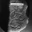
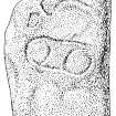
Pool 1, Sanday, Orkney, Pictish symbol stone
Measurements: H 0.76m, W 0.40m, D 0.09m
Stone type: sandstone
Place of discovery: HY 6194 3785
Present location: The Orkney Museum, Kirkwall (OM 1997.33)
Evidence for discovery: found during excavation in 1985 of a Pictish settlement, face down in use as a paving stone.
Present condition: worn.
Description
A natural undressed slab, this bears pecked ornament on one broad face: roughly delineated are a double-disc symbol and a curvilinear motif ending in a circle which may be part of an intended Z-rod.
Date: the archaeological context of the stone is radiocarbon dated to the mid sixth century.
References: Hunter 2007, 114-15; Fraser 2008, no 171; Scott & Ritchie 2014, no 11.
Compiled by A Ritchie 2017
Pool 2, Sanday, Orkney, ogham-inscribed fragment
Measurements: H 0.85m, W 0.50m, D 0.60m
Stone type: sandstone
Place of discovery: HY 6194 3785
Present location: The Orkney Museum, Kirkwall (OM 1997)
Evidence for discovery: found during excavation in 1985 of a Pictish settlement, erected as an orthostat and probably reused as such.
Present condition: worn.
Description
An irregular rectilinear slab, this is incised on one broad face with ogham letters on a stem set horizontally to the upright orthostat. It is a graffito rather than a formal inscription, consists of seven letters and may be incomplete.
Date: the archaeological context of the stone is radiocarbon dated to the mid sixth century.
References: Hunter 2007, 100-1, 106; Forsyth forthcoming.
Compiled by A Ritchie 2017
HY63NW 17 6194 3785
For comparable settlements at Skara Brae (Mainland), Barnhouse (Mainland) and Rinyo (Rousay), see HY21NW 12.00, HY31SW 61-2, and HY43SW 20 respectively.
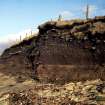
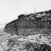
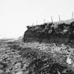
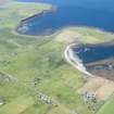
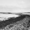
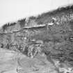
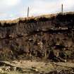
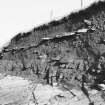
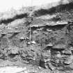
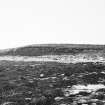
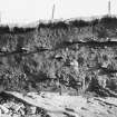
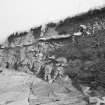
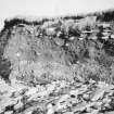
(Area : HY 619 378) A kitchen midden is exposed in the face of a low cliff which rises from the beach immediately north of the house of Pool. A Viking comb, now in Kirkwall Museum, was found here some years before 1928. The site has not been visited.
S Grieg 1940; RCAHMS 1946.
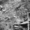
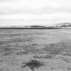
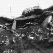
At HY 6194 3785 drystone walling of indeterminate type and large kitchen midden deposits including limpet shells, animal bones coarse pot sherds 3/4" thick, and burnt stones, are exposed in the shore for about 60.0m. A bone borer; three bone pins, one flat-ended, and one of ? walrus ivory with a crude incised decoration of dots; a perforated bone implement and three spindle-whorls were picked up at the site about twenty years ago by Mr W Skea, farmer, North Mire. They are still in his possession.
Visited by OS (RL) 7 July 1970.
Found in the course of the excavation of a multi-period settlement site, an undressed slab of Rousay flagstone (0.77m by 0.43m and 0.09m thick), re-used as a paving stone inside a pre-Norse structure, bears pecked symbols including a double-disc and circular motifs. Information provided by Dr J Hunter.
RCAHMS 1985.
Class I symbol stone bearing a double-disc.
A Mack 1997.
Field Visit (August 1979)
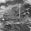
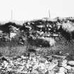
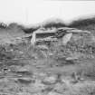
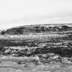
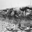
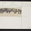
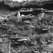
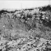
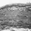
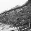
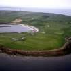
A very large and rich site being seriously and rapidly damaged by sea erosion. Buildings and middens are interspersed for whole of 60m length of exposure. Walls and floors of various stone buildings are founded at substantially varying levels. At about mid point of the exposure, what appears to be an underground passage or souterrain, partly blocked, is in section, in the cliff, low down on the bedrock. The deposit is about 2m thick. On the surface, the site shows as a mound corresponding in length to the exposure, and at least 30m wide measured back from the edge. There is copious evidence of recent major falls of material; 3 sherds were picked out of the fallen midden material. The soft cliff is only 6m back from MHWOST and there is only an evenly-shleving wave-cut platform offering no protection in NW gales. Mr Skea remembers the land extending much further seaward as a ness, and is losing more land year by year. This is a strong local tradition that the 'pool' or bay below the site, was an important Viking harbour.
Information from Orkney SMR (RGL) Aug 79.
Orkney Smr Note (September 1979)
Comb - stated to be from a 'kjmkkenmmdding' in Sanday - illustrated. [R1]
Viking-period bone comb 'mainly of the type Rygh 447, but without the offsets at both ends of the type specimen'. Stated to be 'find from a kitchen-midden in Sanday'. [R2]
Kitchen-midden exposed in face of low cliff which rises from the beach immediately N of the house of Pool. Stated to be find-spot of Viking comb. [R3]
The comb is now on display in Tankerness House Museum, Kirkwall.
Information from Orkney SMR (RGL) Sep 79
Drystone walling and large kitchen-midden depsoit of limpet shells, coarse pottery, animal bone, burnt stones, exposed in shore for about 60m. A bone borer, 3 bone pins, a perforated bone implement and 3 whorls picked up about 20 years ago by Mr Skea and retained by him.
OS visit Jul 70, Mr Skea, farmer, North Mire.
Note (1980)
Pool, Sanday HY 6194 3785 HY63NW 17
A very extensive and rich site showing deposits, up to 2m thick, along a shore length of 60m. Stone structures seen at various levels including what is either a Buckquoy-type Pictish house or an early Norse house. Iron Age and Norse finds. This is one of the most actively eroding sites in Orkney; damage is sustained, rapid and very serious.
RCAHMS 1980
(Bragger 1930, 136; Greig 1940, 150; RCAHMS 1946, ii, p. 362 appendix, No. 2; OR 290)
Excavation (May 1987 - July 1987)
Continued excavation of this coastally eroded mound took place between May and July 1987.
In the S part of the site work was concerned with the investigation of the earliest Neolithic tip deposits where particular emphasis was placed on botanical sampling and on the conservation of the well-stratified Grooved Ware pottery. The pottery also provided the basis for a thermoluminescence dating programme undertaken in conjunction with SURRC.
In the northern part of the site excavation revealed part of a cellular late Iron Age structure revetted into the earlier Neolithic tip deposits. The interior was of approximately 6m in diameter and contained a number of stone arrangements and fittings. The structure appears to have become redundant by the time of the Pictish/Norse interface period. Subsequent building on the site was represented by a rectangular post-supported Norse form which may have acted as a barn.
J R Hunter 1987.
Excavation (July 1988 - August 1988)
The final season of excavation took place during July and August 1988. Work was concerned with the identification of the primary Iron Age deposits and with the understanding of the earlier Neolithic formation processes. The former were represented by a souterrain-type structure of which little had survived other than a flagged access way. This lay in association with a small agricultural/animal-related structure excavated in a previous season. Both were eventually replaced around the 5th century AD by a part-subterranean cellular complex created by revetting back the extant Neolithic tips.
The major part of the effort, however, was directed towards these Neolithic levels, and selective excavation revealed a number of structural forms sealed within the midden deposits. These demonstrated that the site had been continuously occupied approximately between 3500 BC and 2000 BC. The developed mound was tell-like in appearance with the main bulk component being a matrix of light, sandy ashy deposits, arguably the result of burning turf as a domestic fuel. Within these tips few of the structural remains had survived to any height but the foundation levels were adequate to identify a number of architectural innovations for the period. Excavation also revealed an earlier mound at the north of the site, underlying these tip deposits. A geophysical survey and sampling strategy were implemented.
J R Hunter 1988.


