|
Photographs and Off-line Digital Images |
A 77370 |
Records of the Ordnance Survey, Southampton, Hampshire, England |
OS |
1970 |
Item Level |
|
|
Prints and Drawings |
ORD 180/1 |
Records of the Society of Antiquaries of Scotland, Edinburgh, Scotland |
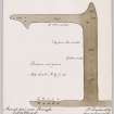
Plan of 'The Danes Pier', Stronsay. |
1879 |
Item Level |
|
|
Prints and Drawings |
ORD 180/2 |
|
Plan of ancient pier copied from Dryden & Petrie SAS |
1930 |
Item Level |
|
|
Photographs and Off-line Digital Images |
O 101/1 |
|
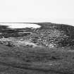
General view. |
|
Item Level |
|
|
Photographs and Off-line Digital Images |
O 101/2 |
|
General view. |
|
Item Level |
|
 |
On-line Digital Images |
DP 143090 |
RCAHMS Aerial Photography Digital |
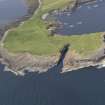
Oblique aerial view centred on Lamb Head, Stronsay, looking NNW. |
18/7/2012 |
Item Level |
|
 |
On-line Digital Images |
DP 149328 |
Records of the Society of Antiquaries of Scotland, Edinburgh, Scotland |
Plan of 'The Danes Pier', Stronsay. |
1879 |
Item Level |
|
 |
On-line Digital Images |
SC 1922823 |
Records of the Ordnance Survey, Southampton, Hampshire, England |
OS |
1970 |
Item Level |
|
 |
On-line Digital Images |
SC 2343766 |
Records of the Ordnance Survey, Southampton, Hampshire, England |
Stronsay, 'The Danes Pier', HY62SE 9, Ordnance Survey index card, page number 1, Recto |
c. 1958 |
Item Level |
|
 |
On-line Digital Images |
SC 2343767 |
Records of the Ordnance Survey, Southampton, Hampshire, England |
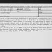
Stronsay, 'The Danes Pier', HY62SE 9, Ordnance Survey index card, page number 2, Verso |
c. 1958 |
Item Level |
|
 |
On-line Digital Images |
SC 2343768 |
Records of the Ordnance Survey, Southampton, Hampshire, England |
Stronsay, 'The Danes Pier', HY62SE 9, Ordnance Survey index card, Recto |
c. 1958 |
Item Level |
|
 |
On-line Digital Images |
SC 2343769 |
Records of the Ordnance Survey, Southampton, Hampshire, England |
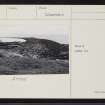
Stronsay, 'The Danes Pier', HY62SE 9, Ordnance Survey index card, Recto |
c. 1958 |
Item Level |
|
 |
On-line Digital Images |
SC 2343770 |
Records of the Ordnance Survey, Southampton, Hampshire, England |
Stronsay, 'The Danes Pier', HY62SE 9, Ordnance Survey index card, Recto |
c. 1958 |
Item Level |
|
 |
On-line Digital Images |
SC 2343771 |
Records of the Ordnance Survey, Southampton, Hampshire, England |
Stronsay, 'The Danes Pier', HY62SE 9, Ordnance Survey index card, Recto |
c. 1958 |
Item Level |
|
 |
On-line Digital Images |
SC 2343772 |
Records of the Ordnance Survey, Southampton, Hampshire, England |
Stronsay, 'The Danes Pier', HY62SE 9, Ordnance Survey index card, Recto |
c. 1958 |
Item Level |
|
|
All Other |
551 166/1/1 |
Records of the Ordnance Survey, Southampton, Hampshire, England |
Archaeological site card index ('495' cards) |
1947 |
Sub-Group Level |
|