Accessibility

Font Size

100% 150% 200%

Background Colour

Default Contrast
Close Reset

Dundee, East Camperdown Street, King George V Wharf

Transit Shed(S) (19th Century) - (20th Century), Wharf (Period Unassigned)

Site Name Dundee, East Camperdown Street, King George V Wharf

Classification Transit Shed(S) (19th Century) - (20th Century), Wharf (Period Unassigned)

Alternative Name(s) Dundee Harbour; Port Of Dundee; River Tay; Firth Of Tay; King George V Wharf Road

Canmore ID 33461

Site Number NO43SW 111

NGR NO 41677 30500

Datum OSGB36 - NGR

Permalink http://canmore.org.uk/site/33461

Ordnance Survey licence number AC0000807262. All rights reserved.
Canmore Disclaimer. © Bluesky International Limited 2025. Public Sector Viewing Terms

Toggle Aerial | View on large map

Digital Images

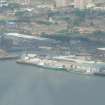
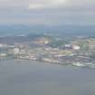
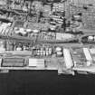
Low angle aerial view of part of Dundee waterfront backed by the historic Cowgate Port (aka East Port) area of the city, looking N.
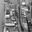
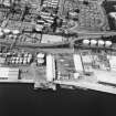
Low angle aerial view of part of Dundee waterfront backed by the historic Cowgate Port (aka East Port) area of the city, looking N.Oblique aerial view centred on the wharf, taken from the ENE.Oblique aerial view of Camperdown Dock and King George V Wharf, looking ENE.Dundee, Dundee Harbour, Camperdown Dock.
Oblique aerial view from South-East of Camperdown Dock and King George V Wharf.Dundee, Dundee Harbour, Caledon West Wharf.
Oblique aerial view.King George V Wharf, view from NE showing Stothert and Pitt travelling keyside cranes
Photographed 28 July 1987General oblique aerial view of the harbour area of Dundee centred on Camperdown Dock and King V Wharf, looking E.King George V Wharf, view from NE showing Stothert and Pitt electric powered 7 ton travelling keyside cranes built in 1971. Dock crane nos. 49 and 50.
Photographed 28 July 1987General oblique aerial view of the harbour area of Dundee centred on Camperdown Dock and King V Wharf, looking E.Dundee, Dundee Harbour, Caledon West Wharf.
Oblique aerial view.Dundee, Dundee Harbour, Caledon West Wharf.
Oblique aerial view.Dundee, Dundee Harbour, Camperdown Dock.
Oblique aerial view from South-East of Camperdown Dock and King George V Wharf.King George V Wharf, view from NE showing Stothert and Pitt electric powered 7 ton travelling keyside cranes built in 1971. Dock crane nos. 49 and 50
Photographed 28 July 1987King George V Wharf, detail of Stothert and Pitt travelling keyside crane
Photographed 28 July 1987General oblique aerial view of the harbour area, centred on the Camperdown Dock taken from the ENE.General oblique aerial view of the harbour area, centred on the Camperdown Dock taken from the NE.General oblique aerial view of the harbour area of Dundee centred on Camperdown Dock and King V Wharf, looking NNE.General oblique aerial view of the harbour area, centred on the Camperdown Dock taken from the NNE.Oblique aerial view of the W part of Dundee waterfront, the city centre and Dundee Law, backed by the Sidlaw Hills, looking NW.Dundee, East Camperdown Street, King George V Wharf, NO43SW 111, Ordnance Survey index card, RectoDundee, Dundee Harbour, Caledon West Wharf.
Scanned image of oblique aerial view.Oblique aerial view of Camperdown Oil Works and King George V Wharf, looking NW.Dundee, Dundee Harbour, Caledon West Wharf.
Oblique aerial view.

Administrative Areas

  • Council Dundee, City Of
  • Parish Dundee (Dundee, City Of)
  • Former Region Tayside
  • Former District City Of Dundee
  • Former County Angus

Archaeology Notes

NO43SW 111.00 41677 30500

Location formerly cited as NO 414 304.

NO43SW 111.01 NO 415 304 Cranes

For general summary of Dundee Harbour and the Port of Dundee, see NO43SW 109.

King George V Wharf [NAT]

OS (GIS) AIB, April 2006.

This wharf occupies a length of the N bank of the River Tay to the E of the entrance to Camperdown and Victoria Docks (NO 4139 3046). A travelling crane system (NO43SW 111.01) runs along its length.

The location assigned to this record defines the centre of the length of the wharf. The available map evidence indicates that it extends from NO 41485 30423 to NO 41901 30591.

Information from RCAHMS (RJCM), 18 April 2006.

References

MyCanmore Image Contributions


Contribute an Image

MyCanmore Text Contributions