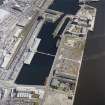
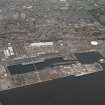
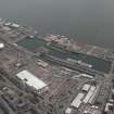
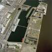
Dundee, Marine Parade, Queen Elizabeth Wharf
Transit Shed (19th Century) - (20th Century), Wharf (Period Unassigned)
Site Name Dundee, Marine Parade, Queen Elizabeth Wharf
Classification Transit Shed (19th Century) - (20th Century), Wharf (Period Unassigned)
Alternative Name(s) Dundee Harbour; Camperdown West Wharf; Port Of Dundee; River Tay; Firth Of Tay
Canmore ID 33460
Site Number NO43SW 110
NGR NO 41310 30331
Datum OSGB36 - NGR
Permalink http://canmore.org.uk/site/33460
- Council Dundee, City Of
- Parish Dundee (Dundee, City Of)
- Former Region Tayside
- Former District City Of Dundee
- Former County Angus
NO43SW 110.00 41310 30331
Queen Elizabeth Wharf [NAT]
OS (GIS) AIB, April 2006.
NO43SW 110.01 Centred NO 413 303 Cranes
For general summary of Dundee Harbour and the Port of Dundee, see NO43SW 109.
Location formerly entered as Centred NO 4131 3036.
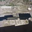
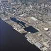
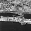
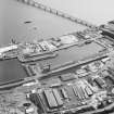
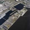
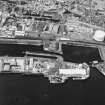
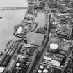
This wharf occupies a length of the N bank of the River Tay to the W of the entrance to Camperdown and Victoria Docks (NO 4139 3046). A travelling crane system (NO43SW 110.01) runs along its length.
The location assigned to this record defines the centre of the length of the wharf. The available map evidence indicates that it extends from NO 41227 30285 to NO 41395 30378.
Information from RCAHMS (RJCM), 18 April 2006.
Desk Based Assessment (2001)
The site is part of the important Dundee Harbour area; an outstanding example of a Victorian industrial and harbour complex, containing 11 listed buildings… None of the listed buildings lie within the proposed City Quay development and the existing buildings on the site are recent and of little importance… The Camperdown, Victoria and East Graving Docks are considered of outstanding importance, while the dock gates of Camperdown Dock, and the quay at Queen Elizabeth Wharf are considered important, although the wooden extension to the latter is considered neutral… No dockside furniture of importance is noted…
Nevertheless, the various alterations to the river frontage quaysides (the original dockside frontage of 1859, the Low Water Jetty of 1884, and the Camperdown West Wharf of 1893) could lie behind the existing Queen Elizabeth Wharf, as could the original south-west corner of Camperdown Dock. The sites of the five former slipways and the foundations of the Victorian warehouses (Sheds L, M, P, Q), of the crane at the original south-west corner of Camperdown Dock, and of the two sites of the harbour lights at the entrance to the dock may also lie under the present ground surface. Original setts of the dockside surface survive in places and the course of the railway lines may be apparent in them.
A desk-based assessment was conducted for this area, and the site was visited by representatives of SUAT Ltd on 17th January 2001. This rapid walk-over survey allowed SUAT Ltd to ascertain what features of importance were visible on the surface. Whilst it is true to say this area of the docks has suffered very badly from previous development and clearance works, a few important features were still visible. These included several small expanses of cobbled setts. Their distribution suggested that they were surviving in-between areas occupied by roads and old building footings. Around the Pump House, not affected by this phase of development, lay a well-preserved area of cobbled track, which provided an example of the original nature of these surfaces. Some rail lines were still visible adjacent to the area marked as 'compound'… The remains of two slipways could be seen in the quay wall where they would originally have exited into the Tay. These had been filled in.
Information from unpublished SUAT Reports, 2001
City Quay, Dundee: Archaeological Survey.
Desk-Based Assessment of a Development at City Quay, Dundee.


