Following the launch of trove.scot in February 2025 we are now planning the retiral of some of our webservices. Canmore will be switched off on 24th June 2025. Information about the closure can be found on the HES website: Retiral of HES web services | Historic Environment Scotland
Laws Of Monifieth
Broch (Iron Age)(Possible), Cup And Ring Marked Stone (Neolithic), Fort (Iron Age), Vitrified Stone (Prehistoric)
Site Name Laws Of Monifieth
Classification Broch (Iron Age)(Possible), Cup And Ring Marked Stone (Neolithic), Fort (Iron Age), Vitrified Stone (Prehistoric)
Alternative Name(s) Laws Hill, Drumsturdy
Canmore ID 33450
Site Number NO43SE 7
NGR NO 4916 3489
Datum OSGB36 - NGR
Permalink http://canmore.org.uk/site/33450
- Council Angus
- Parish Monifieth (Angus)
- Former Region Tayside
- Former District City Of Dundee
- Former County Angus
NO43SE 7 4916 3489.
(NO 491 349) Fort and Broch (NR).
OS 1:10,000 map, (1974).
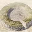
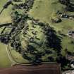
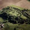
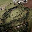
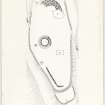
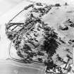
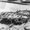
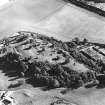
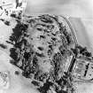
The fort is oval measuring c 400' by 200' within the ruin of a wall 30' thick. The faces of the wall are of large carefully-laid blocks and the core of rubble, in which considerable quantities of vitrified stone have been noted.
An outer wall of the same character, but not so thick covers either end of the fort and a third is added on the SW.
The broch, now very much robbed and overgrown, is 35' in diameter within a wall 16' thick.
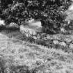
The whole summit is mutilated and bears four ruined ornamental structures apparently of recent origin.
Visited by OS(JLD) 16 May 1958.
R W Feachem 1963.
Bronze spiral finger-ring.
E J MacKie 1971.
Field Visit (23 April 1957)
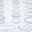
This site was included within the RCAHMS Marginal Land Survey (1950-1962), an unpublished rescue project. Site descriptions, organised by county, are available to view online - see the searchable PDF in 'Digital Items'. These vary from short notes, to lengthy and full descriptions. Contemporary plane-table surveys and inked drawings, where available, can be viewed online in most cases - see 'Digital Images'. The original typecripts, notebooks and drawings can also be viewed in the RCAHMS search room.
Information from RCAHMS (GFG) 19 July 2013.
Publication Account (2007)
NO43 2 LAWS HILL (‘Laws of Monifieth’, ‘The Laws’, Drumsturdy’)
NO/491349
This probable broch in Monifieth stands on, and is apparently later than, the ruins of a much larger stone-walled fort. The site was apparently looted of stone for building for a long time before 1834 before being extensively dug over by James Neish in the early 1860s in a praiseworthy early attempt to make sense of the site [2, 3, 4]:
“The writer has ample proof, from conversing with workmen, that for a long period previous to 1834 the top of the hill has been generally resorted to when stones were required for dykes, drains, etc.; and David Rennie, land steward, who died in 1856 in his 103rd year, and who had resided in the neighbourhood for upwards of eighty years, told him that his plan was, first to discover a wall, and then to work it out, so far as the stones were suitable for his purpose, leaving the large stones lower down. During these workings, rude stone graves were found, lined and covered with flag stones, containing human skeletons.” [2, 441]
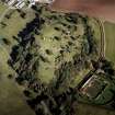
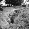
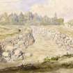
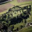
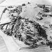
The wallheads seem to have been levelled and consolidated but the site has never been the target of modern systematic excavation. For this reason the amount of useful information available about the site is minimal. The stump of the broch-like structure appears as a mere ring of solid masonry a few feet high, the wall being 4.9m (16 ft) thick and enclosing a court 10.7m (35 ft) in diameter. The site is much overgrown.
Finds
Various finds were made by Neish [5, 322] but in the absence of any kind of stratigraphical context their chronological meaning for the site is limited. A list of those given to the National Museums is available [4] and three are illustrated here (Illus. 10.10). A bronze spiral finger-ring and an iron ring-headed pin of northern type suggest a middle Iron Age occupation appropriate for a broch or broch-like building but the bronze crook-headed pin is an a rare Scottish example of an early Iron Age form which in southern England would be dated to the 7th/6th centuries BC or thereabouts. This may mean that the hillfort is much older than the broch. Its rarity suggests that the site had a special status and makes one regret even more the destruction that its archaeological levels have sustained. There is also a fragmentary iron penannular brooch – another rare object (GN 34) and an iron needle.
Sources: 1. NMRS site no. NO 43 SE 7: 2. Neish 1862: 3. Neish 1865: 4. Donations of finds, Proc Soc Antiq Scot 17 (1882-83), 300-2: 5. Feachem 1963, 106. A number of other passing references are given in [1].
E W MacKie 2007
Note (27 May 2015 - 19 October 2016)
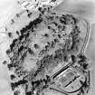
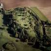
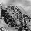
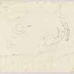
This fort is situated on the summit of Laws Hill, Drumsturdy. Heavily robbed in the late 18th and early 19th centuries, subsequently about 1834 landscaped and planted with trees, and then subjected to a campaign of excavations by James Neish from the late 1850s (1859; 1864), the exact plan of the defences and their composition is difficult to discern on the ground, though the whole of the internal wall-face and entrance of the broch that was also disinterred within the interior is exposed. The scale of the defences is most easily appreciated on the E, where excavation has revealed two massive walls, the inner 9m in thickness by up to 1.5m in height and faced with large blocks and boulders, and the outer some 3m in thickness by 1.5m in height and diverging in its line towards the S. Elsewhere a band of stones extends along the margins of the summit, and a long run of inner wall-face is exposed on the W, but while these are assumed to be the remains of the outer and inner walls respectively, this cannot be demonstrated without excavation; indeed, if this is the case, the inner wall must be considerably thinner at the W end, where the distance from this inner face to the lip of the band of rubble is less than its overall thickness on the E. Nevertheless, extending some 12m beyond the band of rubble at the SW end traces of another wall can be seen, and all of the walls contain considerable quantities of vitrifaction. There are trackways leading up onto the summit on both the N and the S, but it is uncertain that either is original. According to the plan drawn up in 1859 by James Salmond, Neish seems to have traced out the line of the inner face of the inner wall further than is now visible, enclosing an area measuring about 120m from NE to SW by up to 45m transversely (0.45ha). In addition to the broch, which contained several layers of paving within its interior, Neish found numerous traces of other structures and evidence of occupation in the deeply stratified deposits within the interior. In addition to a double sided comb, a piece of lead, a spindle whorl, an iron pin, an iron 'buckle' and a crushed bronze armlet found within the broch (1864), two iron axes, an iron chain, an iron 'sword', a bronze spiral ring, a stone cup, and a bronze enamelled pin. According to Neish the inner wall at the E end 'was built upon rubbish' (1859, 442), implying that the defences may well represent several periods of construction.
Information from An Atlas of Hillforts of Great Britain and Ireland – 19 October 2016. Atlas of Hillforts SC3081


