
Pricing Change
New pricing for orders of material from this site will come into place shortly. Charges for supply of digital images, digitisation on demand, prints and licensing will be altered.
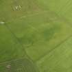
Northbreck


Field Boundary (Period Unassigned)
Site Name Northbreck
Classification Field Boundary (Period Unassigned)
Canmore ID 331806
Site Number HY21SW 34
NGR HY 2461 1360
Datum OSGB36 - NGR
Permalink http://canmore.org.uk/site/331806


- Council Orkney Islands
- Parish Stromness
- Former Region Orkney Islands Area
- Former District Orkney
- Former County Orkney

