Pricing Change
New pricing for orders of material from this site will come into place shortly. Charges for supply of digital images, digitisation on demand, prints and licensing will be altered.
Parbroath Castle
Castle (Medieval)
Site Name Parbroath Castle
Classification Castle (Medieval)
Canmore ID 31473
Site Number NO31NW 6
NGR NO 32157 17617
Datum OSGB36 - NGR
Permalink http://canmore.org.uk/site/31473
- Council Fife
- Parish Creich (North East Fife)
- Former Region Fife
- Former District North East Fife
- Former County Fife
NO31NW 6 32157 17617.
(NO 3215 1761) Parbroath Castle (NR) (Remains of)
OS 6"map, (1959)
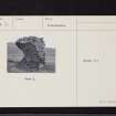
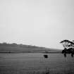
The only remnant of Parbroath Castle is a fragment of a vault standing in a field 300 yards SW of Parbroath farm. However, the ditch of a roughly triangular bailey that has enclosed the castle is visible as a crop-mark on air photographs (Visible on RAF air photographs 541/A/474: 4010-11). It measures 600' long by 400' max width with one corner S of the main Newburgh-Cupar road. In 1512 the estate of Parbroath became royal property through non-entry for 50 years, and James IV then gave it to John Seton, and numerous charters were dated from the mansion in the 15th and 16th centuries.
RCAHMS 1933, visited 1925; A H Millar 1895; Information from notes by K A Steer, 1954.
The remains of Parbroath Castle consist of a wall fragment of freestone, 8.0m long by 3.0m high and 0.8m thick at base, showing the commencement of a barrel vault. Some small stones are scattered about 12.0m E of the wall, but there are no definite traces of foundations. Course of bailey plotted from air photographs, no trace on ground.
Visited by OS (D S) 2 November 1956.
No change.
Visited by OS (R D) 26 May 1970.
Field Visit (9 June 1925)
Parbroath Castle.
This building is represented only by a fragment of a vault standing in a field 300 yards south-west of Parbroath farm, 3 ½ miles south-west of Cupar.
RCAHMS 1933, visited 9 June 1925.
Aerial Photographic Interpretation (25 April 1951)
This site was included within the RCAHMS Marginal Land Survey (1950-1962), an unpublished rescue project. Site descriptions, organised by county, are available to view online - see the searchable PDF in 'Digital Items'. These vary from short notes, to lengthy and full descriptions. Contemporary plane-table surveys and inked drawings, where available, can be viewed online in most cases - see 'Digital Images'. The original typecripts, notebooks and drawings can also be viewed in the RCAHMS search room.
Information from RCAHMS (GFG) 19 July 2013.


