Pricing Change
New pricing for orders of material from this site will come into place shortly. Charges for supply of digital images, digitisation on demand, prints and licensing will be altered.
Balgarvie
Castle (Medieval)
Site Name Balgarvie
Classification Castle (Medieval)
Alternative Name(s) Balgarvie House
Canmore ID 31424
Site Number NO31NE 4
NGR NO 353 156
Datum OSGB36 - NGR
Permalink http://canmore.org.uk/site/31424
- Council Fife
- Parish Monimail
- Former Region Fife
- Former District North East Fife
- Former County Fife
NO31NE 4 353 156.
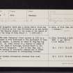
At Balgarvie there was a strong Castle which was taken and levelled by Sir John Pettsworth as he was marching with the English forces to the siege of the Castle of Cupar, in the reign of King Robert I. (1306-1329) R Sibbald 1803.
The name 'Balgarvy' first appears in 1293 in a list of lands in Fife delivered to the parliament of John Balliol at Lanark. A charter of James IV (Reg Mag Sig Reg Scot anno 1505, No. 2940) refers to a charter of James II granting the lands of Burleigh, Kinross-shire to Sir John Balfour of Balgarvie. (Not in Reg Magni Sig Reg Scot 1984)
No vestige of this castle remains nor is there any trace of its existence in contemporary records.
A H Millar 1895.
No further information obtained from local enquiries.
Visited by OS (R D L) 22 May 1964.
Balgarvie is depicted on the OS 2nd Edition map (Fifeshire, sheet VII, 1896). It was demolished c.1938-40.
Information from RCAHMS (HMLB), December 2001.
NMRS REFERENCE:
Balgarvie House was demolished c. 1938-48. Information from Demolitions catalogue held in RCAHMS library.


