Bute, Rothesay, Kirk Dam
Dam (18th Century), Sluice(S) (19th Century)
Site Name Bute, Rothesay, Kirk Dam
Classification Dam (18th Century), Sluice(S) (19th Century)
Alternative Name(s) Robert Thom's Water Cuts
Canmore ID 304564
Site Number NS06SE 429
NGR NS 08430 63732
Datum OSGB36 - NGR
Permalink http://canmore.org.uk/site/304564
- Council Argyll And Bute
- Parish Rothesay
- Former Region Strathclyde
- Former District Argyll And Bute
- Former County Buteshire
NS06SE 429 08430 63732.
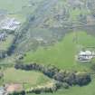
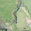
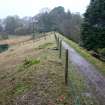
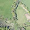
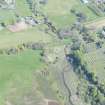
This dam, situated on the burn that runs from Loch Fad NNE to the sea and 200m W of St Mary’s Chapel (NS06SE 1), was built in the late 18th century to create a reservoir of water that would power the Rothesay Cotton Mills (NS06SE 5), established in 1779. It was raised in the early 19th century as part of the Robert Thom’s work to supplement the water supply to the mills (Maclagan 1996). Part of a ‘miln dam’ is depicted on May’s estate map of Craigberoch and Barone Park, surveyed in 1781. A dam and two sluices are shown on the 1st edition of the OS 6-inch map (Buteshire 1869, Sheet CCIV).
Information from RCAHMS (GFG) 18 May 2010.
Aerial Photography (1935 - 1938)
An collection of aerial photographs taken by Andrew P Hunter from 1935 to 1938. Digitised by Andrew B Wilson in 2008.
Watching Brief (7 August 2006)
A watching brief was undertaken at Kirk Dam, Rothesay, during the proposed conversion of sections of an 11kv electrical distribution system on the Isle of Bute from an overhead line to an underground cable.
The area of investigation was situated in the Kirk Dam, one component of a Scheduled Ancient Monument known as Thom’s Water Cuts, aqueduct and dam, Little Barone to Kirk Dam which stretches east/west from NS 8363 6406 to NS 8457 6380, a total distance of some 1200m. It is located on the southern outskirts of Rothesay, on the Isle of Bute, Argyll. The dam lies at the north end of a linear reservoir, which stretches some distance south of Rothesay, and towards the east end of the scheduled monument. It is centred on approximately NS 844 637, to the immediate north of St Mary’s Church.
The watching brief was commissioned by Scottish & Southern Energy (SSE) and undertaken by Robin Murdoch of Scotia Archaeology on 7th August 2006.
Desk Based Assessment (18 May 2010)
This dam, situated on the burn that runs from Loch Fad NNE to the sea and 200m W of St Mary’s Chapel (NS06SE 1), was built in the late 18th century to create a reservoir of water that would power the Rothesay Cotton Mills (NS06SE 5), established in 1779. It was raised in the early 19th century as part of the Robert Thom’s work to supplement the water supply to the mills (Maclagan 1996). Part of a ‘miln dam’ is depicted on May’s estate map of Craigberoch and Barone Park, surveyed in 1781. A dam and two sluices are shown on the 1st edition of the OS 6-inch map (Buteshire 1869, Sheet CCIV).
Information from RCAHMS (GFG) 18 May 2010.
Measured Survey (15 October 2010 - 26 October 2010)
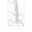
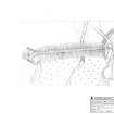
RCAHMS surveyed the Kirk Dam, Rothesay in October 2010 with local volunteers. The survey, undertaken with plane table and self-reducing alidade, produced a plan of the site at a scale of 1:500.


