
Bute, Kilmory Dam


Mill Dam (Period Unassigned)
Site Name Bute, Kilmory Dam
Classification Mill Dam (Period Unassigned)
Alternative Name(s) Robert Thom's Water Cuts
Canmore ID 304541
Site Number NS05NE 121
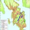
NGR NS 05462 59940
Datum OSGB36 - NGR
Permalink http://canmore.org.uk/site/304541


- Council Argyll And Bute
- Parish North Bute
- Former Region Strathclyde
- Former District Argyll And Bute
- Former County Buteshire
NS05NE 121 05462 59940
There is a dam on the W side of Quien Hill that once fed into the Scalpsie section of Thom's Cut (NS05NE 79). It measures over 40m from E to W by up to 5m in height and it has been breached in order to prevent localised flooding. The dam is depicted on the 1st edition of the OS 6-inch map (Buteshire 1869, sheet CCXV).
Visited by RCAHMS (LD, GB) 2 April 2009.
Field Visit (2 April 2009)
There is a dam on the W side of Quien Hill that once fed into the Scalpsie section of Thom's Cut (NS05NE 79). It measures over 40m from E to W by up to 5m in height and it has been breached in order to prevent localised flooding. The dam is depicted on the 1st edition of the OS 6-inch map (Buteshire 1869, sheet CCXV).
Visited by RCAHMS (LD, GB) 2 April 2009.

