Pricing Change
New pricing for orders of material from this site will come into place shortly. Charges for supply of digital images, digitisation on demand, prints and licensing will be altered.
Upcoming Maintenance
Please be advised that this website will undergo scheduled maintenance on the following dates:
Thursday, 9 January: 11:00 AM - 3:00 PM
Thursday, 23 January: 11:00 AM - 3:00 PM
Thursday, 30 January: 11:00 AM - 3:00 PM
During these times, some functionality such as image purchasing may be temporarily unavailable. We apologise for any inconvenience this may cause.
Rait, Old Parish Church And Churchyard
Burial Ground (17th Century) - (18th Century), Church (17th Century)
Site Name Rait, Old Parish Church And Churchyard
Classification Burial Ground (17th Century) - (18th Century), Church (17th Century)
Alternative Name(s) Rait Church; Rait Churchyard; Annet; Glen Of Raid
Canmore ID 30442
Site Number NO22NW 3
NGR NO 22747 26855
Datum OSGB36 - NGR
Permalink http://canmore.org.uk/site/30442
- Council Perth And Kinross
- Parish Kilspindie
- Former Region Tayside
- Former District Perth And Kinross
- Former County Perthshire
NO22NW 3 22747 26855.
(NO 2274 2685) Rait Church (NR) (Remains of)
OS 6" map (1901)
For present (Kilspindie) parish church (at NO 2199 2575), see NO22NW 3.
The parish of Rait was united to that of Kilspindie in the early part of the 17th century, and the church was, in consequence, dismantled.
Name Book 1861
The remains of an ancient chapel.
A H Millar 1890
Cowan and Easson record evidence of the presence of an 'Abbot of Kilspindie'. There is no evidence of a monastery and this office may be derived from an earlier Celtic foundation.
I B Cowan and D E Easson 1976
Publication Account (1926)
The name 'Annet' at Glen of Raid may be an 'Annat' name indicating the possible presence of an early church.
W J Watson 1926
Field Visit (9 October 1963)
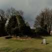
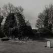
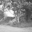
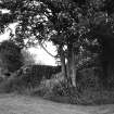
The ivy-covered walls of Rait Church, other than the east gable end which stands to roof height, have a maximum height of 2.5m and are 0.8m thick. A doorway is discernible in the south wall near the SW corner, and there are also two windows on this side and one in the east gable end.
Visited by OS (RDL) 9 October 1963.
Field Visit (June 1990)
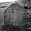
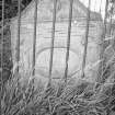
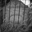
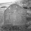
This church, now a roofless ruin, served the former parish of Rait. Rectangular on plan, it measures 20.1m from E to W by 6.1m transversely over walls 0.9m in thickness; the E gable stands to its full height and elsewhere the walls are up to 2.5m in height. All the openings appear to have been square-headed, their surrounds wrought with broad (0.55m) chamfers. In the E wall there are two windows, one at ground-floor level, the other possibly lighting a loft. In the S wall there are two doorways and a centrally placed window; the doorway to the W is complete, but of that to the E and the window only the W jambs survive. Whilst all of these features are likely to be of post-Reformation date, it is possible that the fabric may or may not incorporate earlier work. Within the burial-ground there are a number of 18th-century gravestones. On record by c.1120, when it was a chapel of the priory of Scone (later Scone Abbey NO12NW 9.03).
Rait probably attained parochial status in the 15th century. The parish of Rait was united with Kilspindie before 1634.
Visited by RCAHMS (PC) June 1990.
OSA 1791-9; L Melville 1939; I B Cowan 196
Project (5 May 2007 - 23 May 2007)
NO 2274 2685 Magnetic and resistivity surveys were carried out in the accessible portion of the churchyard surrounding the heavily overgrown church ruins between 5–23 May 2007. Evidence was found for some form of NE-SW trending structure or enclosure parallel to the eastern churchyard fence together with a rectangular, (10m x 7m), high resistivity feature by the NE corner of the church. The most recent graves to the N of the
church are marked by strong negative magnetic anomalies.
Archive deposited with RCAHMS. A copy of the report has been deposited with Perth and Kinross SMR.
Magnetometry (5 May 2007 - 23 May 2007)
NO 2274 2685 Magnetic and resistivity surveys were carried out in the accessible portion of the churchyard surrounding the heavily overgrown church ruins between 5–23 May 2007.
Archive deposited with RCAHMS. A copy of the report has been deposited with Perth and Kinross SMR.
Resistivity (5 May 2007 - 23 May 2007)
NO 2274 2685 Magnetic and resistivity surveys were carried out in the accessible portion of the churchyard surrounding the heavily overgrown church ruins between 5–23 May 2007.
Archive deposited with RCAHMS. A copy of the report has been deposited with Perth and Kinross SMR.
Watching Brief (26 January 2017)
NO 22747 26855 (NO22NW 3) A watching brief was undertaken, 26 January 2017, during consolidation and repair work at the church. A minimal amount of levelling work, consisting of the removal of mounds of earth and stone, took place within the perimeter of the church walls. The material contained a moderate assemblage of 19th/20thcentury-pottery and glass fragments, indicating the modern nature of these mounds.
Archive: NRHE
Funder: Tay Landscape Partnership
Donald Wilson – Headland Archaeology Ltd
(Source: DES, Volume 18)


