
St Kilda, Hirta, Village Bay, Blackhouse Q


Blackhouse (19th Century)
Site Name St Kilda, Hirta, Village Bay, Blackhouse Q
Classification Blackhouse (19th Century)
Canmore ID 300978
Site Number NF19NW 21.50
NGR NF 10019 99338
Datum OSGB36 - NGR
Permalink http://canmore.org.uk/site/300978


- Council Western Isles
- Parish Harris
- Former Region Western Isles Islands Area
- Former District Western Isles
- Former County Inverness-shire
NF19NW 21.50 10019 99338
Field Visit (August 2014)
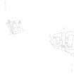
This ruinous blackhouse stands on croft 12. It was occupied by Norman Gillies and his family in 1858 (SAS Mss 158; Lawson 1993). The building, which is set into the natural slope to a depth of 1m on the N, measures 6.46m from N to S by 2.73m transversely within much-repaired walls between 1.6m and 2.2m in thickness and 1.8m in height. There is an obliquely angled doorway and a window in the E wall. The edge of the building’s last roof is indicated by a line of turf along the top of the N end-wall and a line of stones along the top of the W side-wall. A straight joint within the NE corner and the continuation of footings N of both side-walls, coupled with the orientation of the enclosure wall to the NW, suggests the building has been shortened or at least altered. A straight joint between the W side-wall and the S end-wall may indicate reconstruction of the W side, linked to the construction of House 12.
Visited by RCAHMS (GFG, AM, JM) August 2014.
Measured Survey (28 August 2014)
RCAHMS surveyed Blackhouse Q (NF19 NW 21.50), Village Bay, St Kilda on 28 August 2014 with plane-table and alidade at a scale of 1:100. The resultant plan was redrawn in vector graphics software.

