
Inchmarnock, Southpark


Rock Shelter (Iron Age)
Site Name Inchmarnock, Southpark
Classification Rock Shelter (Iron Age)
Canmore ID 300178
Site Number NS05NW 42
NGR NS 02196 58325
Datum OSGB36 - NGR
Permalink http://canmore.org.uk/site/300178


- Council Argyll And Bute
- Parish North Bute
- Former Region Strathclyde
- Former District Argyll And Bute
- Former County Buteshire
NS05NW 42 02196 58325.
Site 16. This is a small cave or rock shelter, roughly 10m wide at the mouth, 2m wide at the rear and 6m deep, located in the cliff face above the old raised beach at the south end of the island. The site was partially excavated in 2002, following an earlier investigation in 2000 which had established that it contained evidence of both Iron Age and early medieval activity. primary deposits in the cave had been radiocarbon dated to the period cal AD 679-888 (AA-39968).
Lowe 2008
This rock-shelter, which is situated in a SW-facing cliff at the rear of the raised beach at the southern tip of Inchmarnock, is as previously described. Another shelter (NS05NW 35) is situated some 180m to the W.
Visited by RCAHMS (GFG, MM, GB) 3 June 2009.
Project (1999 - 2004)
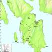
NS 020 600 (island centre) The Archaeology of Inchmarnock Research Project, initated by the island's new owner, Lord Smith, was undertaken over the period 1999 to 2004 with the aim of providing as complete a record as possible of the island's archaeology; of identifying and understanding better what was there, precisely where it was, and how it might be preserved for future generations.
The overarching objectives of the project were to consider how Inchmarnock's inhabitants made use of their island landscape in the medieval and later period and how the island itself related to the wider world.
The preliminary results of each season's fieldwork, together with assessments of the artefacts and environmental remains recovered, were reported on an annual basis. In tandem with this was an extensive radiocarbon-dating programme, providing the chronological framework for the investigation.
Sponsor: Sir Robert Smith
Headland Archaeology, C Lowe 2008
Archaeological Evaluation (May 2000 - September 2000)
NS 020 600 (island centre) An archaeological survey and evaluation was carried out on the island of Inchmarnock. Both prehistoric and medieval aspects of the island's past were explored. Building surveys were completed for the three farm steadings of Northpark, Midpark and Southpark.
Full reports have been lodged with the NMRS.
Sponsor: Sir Robert Smith
Headland Archaeology, S Halliday, 2000
Archaeological Evaluation (May 2000)
NS 020 600 (island centre) Evaluation of the large cairn (Site 1) at the north end of the island revealed a stone kerb, reinforcing its interpretation as a funerary monument. It may, however, have been augmented with field clearance stones at a later date. The cup-and-ring marked stone (Site 3), near Northpark, was found to be a discrete slab, rather than part of a rock outcrop. Meanwhile, a series of upright stones (Site 7), in the woodland south of Southpark, may represent the lines of old field dykes, long since robbed of their stone.
A detailed survey of St Marnock’s chapel and its immediate environs was undertaken. Excavations in the field to the west of the chapel failed to find any evidence of the cemetery mentioned in the documentary records. A ditch, however, was located. It may represent the line of an old enclosure around the site.
Medieval corn-drying may be indicated by the robbed structures at Site 8. These, together with the two clearance cairns and old dyke at Site 11, may represent outlying elements of the small medieval or later settlement at Site 5, surveyed here for the first time. Meanwhile, evidence from the caves at the south end of the island (Sites 16A & 16B) suggests they were resorted to on a temporary basis in the medieval period.
Finally, one site (Site 9), previously identified as a possible structure, was found to be a natural feature.
Sponsor: Sir Robert Smith
Headland Archaeology, Stuart Halliday and Christopher Lowe, 2000
Archaeological Evaluation (May 2000)
Excavation (2002)
Excavation (2002)
NS 022 582 Cave 16B. Evaluation in 2000 (DES 2000, 17-18) had revealed deposits of Iron Age and Early Christian date. Full excavation in 2002 revealed that the Iron Age deposits represented the earliest occupation of the cave. A period of abandonment was followed by a series of hearths and associated deposits relating to the Early Christian period. The cave continued to be used sporadically until relatively recent times.
Archive to be deposited in the NMRS.
Sponsor: Sir Robert Smith.
R Conolly, E Jones, C Lowe 2002
Field Visit (3 June 2009)
This rock-shelter, which is situated in a SW-facing cliff at the rear of the raised beach at the southern tip of Inchmarnock, is as previously described. Another shelter (NS05NW 35) is situated some 180m to the W.
Visited by RCAHMS (GFG, MM, GB) 3 June 2009.

