Cnoc A' Ghiubhais
Boundary Marker (Period Unassigned), Cairn (Period Unassigned), Pen (Period Unassigned)
Site Name Cnoc A' Ghiubhais
Classification Boundary Marker (Period Unassigned), Cairn (Period Unassigned), Pen (Period Unassigned)
Canmore ID 296242
Site Number NC27SE 46
NGR NC 26671 70138
Datum OSGB36 - NGR
Permalink http://canmore.org.uk/site/296242
- Council Highland
- Parish Durness
- Former Region Highland
- Former District Sutherland
- Former County Sutherland
Field Visit (2008)
NC27SE 46 26671 70138
See also NC27SE 11.
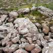
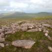
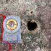
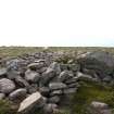
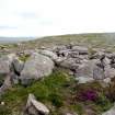
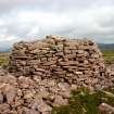
What appears to be a ruined cairn stands on the summit of Cnoc a’ Ghiubhais (297m OD), a prominent steep-sided hill 4km SSE of Cape Wrath. Measuring about 5.2m in diameter and up to 0.5m in height, it comprises a spread of slabs and boulders retained by a low boulder kerb still two courses high on the W. A large earthfast boulder or section of bedrock at the centre of the cairn has an irregularly-shaped hole, measuring up to 35mm across and at least 75mm in depth, at the centre of its upper face. This hole, which has been chiselled rather than drilled, may be a ‘witter hole’, a form of marker associated with medieval and post-medieval boundaries.
The W side of the cairn is partly overlain by a ruined pen (CWTC08 298).
(CWTC08 023 & 298)
Visited by RCAHMS (JRS, JH) 5 August 2008.


