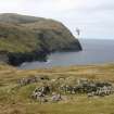
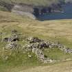
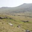
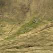
St Kilda, Hirta, Gleann Mor, Structure F
Cellular Building (Period Unassigned), Cleit(S) (Modern), Gathering Fold (Post Medieval), Shieling Hut (Medieval)
Site Name St Kilda, Hirta, Gleann Mor, Structure F
Classification Cellular Building (Period Unassigned), Cleit(S) (Modern), Gathering Fold (Post Medieval), Shieling Hut (Medieval)
Canmore ID 294884
Site Number NA00SE 17
NGR NA 08798 00093
Datum OSGB36 - NGR
Permalink http://canmore.org.uk/site/294884
- Council Western Isles
- Parish Harris
- Former Region Western Isles Islands Area
- Former District Western Isles
- Former County Inverness-shire
see NA00SE 1-2
Publication Account (1988)
Structure F (including 'Taigh na Banaghaisgeich', the 'Amazon's House'), Gleann Mór
NA 0879 0009 NA 00 SE 2
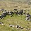
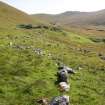
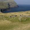
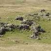
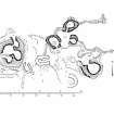
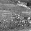
Occupying a sloping site at the foot of the steeper slopes of Mullach Mór, this is the most complex group of buildings in Gleann Mór. It consists of a ‘gathering fold’, the ‘Amazon’s House’, another structure of ‘Amazon’s House’ type, and three cleitean (416-418).
The fold at the upper (E) end consists of an open, kidney-shaped area, 4.11 m and 2.29 m in maximum length and width. It is enclosed by a vertically-faced wall and is fronted by a pari of styone dykes which run eastwards and northwards. The entrance-passage, which faces E and splays outward, is 0.61 m wide at the inner end.
Grouped around the fold are three corbelled and sub-circular cells (a-c). On the N side, Cell a measures 1.93 m in diameter and stands to a height of 1.02 m above floor-level; it is entered by a narrow passage 0.47m high and 0.58 m above ground-level. Cell b, which from s the S side of the entrance to the fold, is 1.32 m in diameter and 0.89 m high internally, its entrance being 0.31 m high and 0.71m above ground-level. Cell c, on the W side of the fold, has been reconstructed as a cleit (418). It is 2.52 m in maximum diameter, and in the E flank there is a small entrance 0.36 m high and 0.81 m above ground-level. The entrance to the cleit as rebuilt is at the S end.
On the slightly higher ground to the SE of the fold there is a relatively large and well-preserved corbelled cell, together with the remains of associated cellular structures. The main cell is roughly circular on plan, about 2.2 m in diameter, and stands to a height of 1.47 m. The entrance, which is in the NW sector, is spanned by two large lintels and is splayed externally. Immediately in from t of the cell are the footings of a subcircular structure with a W-facing entrance. To the NE are traces of a smaller cell, and a short distance to the SW is a subcircular foundation with an internal diameter of about 1.37m.
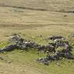
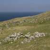
Further down the slope, to the W of the two cleitean (416-7), is a large mound containing a group of inter-communicating corbelled cells, of which one retains its roof. This structure gas been known since at least 1697 as the House of the Female Warrior (‘Taigh na Banaghaisgeich’), though by the 19th century it was referred to as the big shieling (‘Airigh Mhór’).
On the N flank of the mound an outward-splayed entrance, 0.48 m wide, leads into a small ovoid cell which is 1.7m in length and retains the remains of a corbelled roof rising to a height of about 0.76 m above floor-level. In the W flank is a short passage, now blocked by fallen stones, which formerly gave access to a large oval cell 2.7 m in maximum length. A surviving 1.67 m stretch of wall-face in the N sector shows that the cell was probably corbelled, and stony debris on the S side conceals an entrance to a passage which intercommunicates with a third cell, a large lintel and parts of the jambs of the entrance still being visible. This cell is almost circular on plan, 1.22 m in diameter, and its corbelled walls rise to a height of 0.99 m. There is evidence of an entrance on the W side. In the E flank of the mound there is an entrance to a fourth cell, also of ovoid plan and measuring 1.93m in length. The walls are corbelled and the crown of the roof is 1.58 m above floor-level. Above the door-lintel there is a ‘window’ or gap 0.46 m wide and 0.21 m high.
Around the base of the mound, especially on the S side, there are visible stretches of slightly battered wall face. Of the two cleitean to the E of the ‘Amazon’s House’, Cleit 416 is ovoid on plan, measuring 2.08 m by 1.17 m and 0.91 m in height. The doorway, which is at the N end, and the front of the cleit, have partially collapsed. Cleit 417 is rectangular on plan, its long axis aligned with the hill slope. Internally, it has a length of 2.54 m, a width of 0.81 m, and a height of 1.04 m. The entrance is at the E end, and there is a drain or vent in the rear wall.
RCAHMS 1988
Field Visit (3 September 2009)
This cellular building is incorporated into a later gathering fold which in turn is overlain by two cleits and the footings of a third.
(Hirta 417-8, 2290)
Visited by RCAHMS (ARG, SPH) 3 September 2009
Measured Survey (5 September 2009 - 9 September 2009)
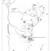
RCAHMS surveyed Gleann Mor, Hirta, St Kilda between 5-9 September 2008, using GPS data and ground observation, to produce a site plan at a scale of 1:500 across five survey sheets. These survey drawings were later used as the basis for a site plan redrawn in vector graphics software for publication at a scale of 1:2500 (Gannon and Geddes 2015,84)
Condition Survey (December 2012)
A monitoring survey of twenty structures in Gleann Mor was undertaken in 2012.
NTS 2012


![Gleann Mor, Structure F.
View of roofed cell with woman [Mary Harman?] within.](http://i.rcahms.gov.uk/canmore/l/SC01218072.jpg)










![Gleann Mor, Structure F.
View of roofed cell with woman [Mary Harman?] within.](http://i.rcahms.gov.uk/canmore/s/SC01218072.jpg)

