
St Kilda, Hirta, Gleann Mor, Structure B


Gathering Fold (Post Medieval)
Site Name St Kilda, Hirta, Gleann Mor, Structure B
Classification Gathering Fold (Post Medieval)
Canmore ID 294880
Site Number NF09NE 32
NGR NF 08570 99829
Datum OSGB36 - NGR
Permalink http://canmore.org.uk/site/294880


- Council Western Isles
- Parish Harris
- Former Region Western Isles Islands Area
- Former District Western Isles
- Former County Inverness-shire
Publication Account (1988)
A sample of structures within Gleann Mor was surveyed in detail by RCAHMS 1983-6. Each was provided with a detailed description and a plan.
Stell and Harman 1988
Field Visit (8 May 2009)
This gathering fold stands in a sheltered hollow immediately below a spring.
Visited by RCAHMS (SPH, ARG) 8 May 2009
Measured Survey (5 September 2009 - 9 September 2009)
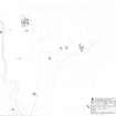
RCAHMS surveyed Gleann Mor, Hirta, St Kilda between 5-9 September 2008, using GPS data and ground observation, to produce a site plan at a scale of 1:500 across five survey sheets. These survey drawings were later used as the basis for a site plan redrawn in vector graphics software for publication at a scale of 1:2500 (Gannon and Geddes 2015,84)
Condition Survey (December 2012)
A monitoring survey of twenty structures in Gleann Mor was undertaken in 2012.
NTS 2012

