
Pricing Change
New pricing for orders of material from this site will come into place shortly. Charges for supply of digital images, digitisation on demand, prints and licensing will be altered.
Allt Corra-lairige


Farmstead (Medieval) - (Post Medieval)
Site Name Allt Corra-lairige
Classification Farmstead (Medieval) - (Post Medieval)
Alternative Name(s) Lair
Canmore ID 29488
Site Number NO16SW 30
NGR NO 13356 64005
Datum OSGB36 - NGR
Permalink http://canmore.org.uk/site/29488


- Council Perth And Kinross
- Parish Kirkmichael (Perth And Kinross)
- Former Region Tayside
- Former District Perth And Kinross
- Former County Perthshire
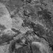
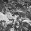
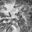
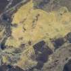
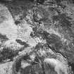
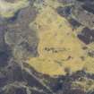
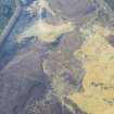
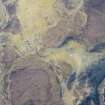
Field Visit (May 1988)
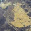
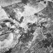
NO16SW 30 1334 6400.
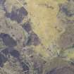
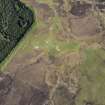
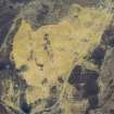
This farmstead comprises three buildings ranged around a yard. The buildings measure 8.3m by 4.6m, 8.2m by 4m and 9.9m by 4.5m respectively over walls reduced to little more than their stone footings. What may be a fourth building, measuring 8m by 4.3m over stone wall-footings lies on the opposite side of the Allt Corra-lairige.
Visited by RCAHMS (PC) May 1988.
RCAHMS 1990

