|
Prints and Drawings |
DC 14798 |
Records of the Royal Commission on the Ancient and Historical Monuments of Scotland (RCAHMS), Edinbu |
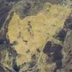
Overlay and base map showing distribution of sites in Glenkirlie 1:1250 ink NE Perth Inv 277 RCAHMS |
|
Item Level |
|
|
Photographs and Off-line Digital Images |
A 55343 |
RCAHMS Aerial Photography |
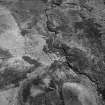
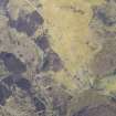
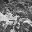
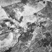
Oblique aerial view. |
1987 |
Item Level |
|
|
Photographs and Off-line Digital Images |
A 55344 |
RCAHMS Aerial Photography |
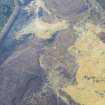
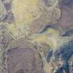
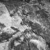
Oblique aerial view. |
1987 |
Item Level |
|
|
Photographs and Off-line Digital Images |
A 55345 |
RCAHMS Aerial Photography |
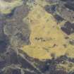
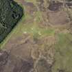
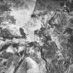
Oblique aerial view. |
1987 |
Item Level |
|
|
Photographs and Off-line Digital Images |
A 55346 |
RCAHMS Aerial Photography |
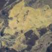
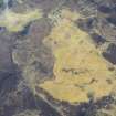
Oblique aerial view. |
1987 |
Item Level |
|
 |
On-line Digital Images |
SC 393483 |
RCAHMS Aerial Photography |
Oblique aerial view. |
1987 |
Item Level |
|
 |
On-line Digital Images |
DP 226118 |
RCAHMS Aerial Photography Digital |
Oblique aerial view of Pitcarmick buildings, a farmstead and cultivation remains at Lair, Glen Shee, looking SSE. |
10/3/2015 |
Item Level |
|
 |
On-line Digital Images |
DP 226119 |
RCAHMS Aerial Photography Digital |
Oblique aerial view of a the depopulated township of Corra-Lairig and cultivation remains, Glen Shee, looking SSE. |
10/3/2015 |
Item Level |
|
 |
On-line Digital Images |
DP 226120 |
RCAHMS Aerial Photography Digital |
Oblique aerial view of a the depopulated township of Corra-Lairig and cultivation remains, Glen Shee, looking SSE. |
10/3/2015 |
Item Level |
|
 |
On-line Digital Images |
DP 226121 |
RCAHMS Aerial Photography Digital |
Oblique aerial view of a cairn, a farmstead and cultivation remains at Allt Corra-Lairige, Glen Shee, looking N. |
10/3/2015 |
Item Level |
|
 |
On-line Digital Images |
DP 226122 |
RCAHMS Aerial Photography Digital |
Oblique aerial view of a cairn, a farmstead and cultivation remains at Allt Corra-Lairige, Glen Shee, looking NNW. |
10/3/2015 |
Item Level |
|
 |
On-line Digital Images |
DP 226323 |
RCAHMS Aerial Photography Digital |
Oblique aerial view of a Pitcarmick building, farmstead and rig at Lair in Glen Shee, looking SE. |
25/5/2015 |
Item Level |
|
 |
On-line Digital Images |
DP 226463 |
RCAHMS Aerial Photography Digital |
Oblique aerial view of a the depopulated township of Corra-Lairig and cultivation remains, Glen Shee, looking SSE. |
10/3/2015 |
Item Level |
|
 |
On-line Digital Images |
DP 226464 |
RCAHMS Aerial Photography Digital |
Oblique aerial view of a the depopulated township of Corra-Lairig and cultivation remains, Glen Shee, looking SSE. |
10/3/2015 |
Item Level |
|
 |
On-line Digital Images |
SC 1710988 |
RCAHMS Aerial Photography |
Oblique aerial view. |
1987 |
Item Level |
|
 |
On-line Digital Images |
SC 1710989 |
RCAHMS Aerial Photography |
Oblique aerial view. |
1987 |
Item Level |
|
 |
On-line Digital Images |
SC 1710990 |
RCAHMS Aerial Photography |
Oblique aerial view. |
1987 |
Item Level |
|
 |
On-line Digital Images |
SC 1710991 |
RCAHMS Aerial Photography |
Oblique aerial view. |
1987 |
Item Level |
|
 |
On-line Digital Images |
SC 2399369 |
Records of the Ordnance Survey, Southampton, Hampshire, England |
Allt Corra-Lairige, NO16SW 30, Ordnance Survey index card, Recto |
1958 |
Item Level |
|


