
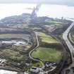
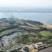
Inverkeithing, Dunfermline Golf Club


Golf Course (20th Century)
Site Name Inverkeithing, Dunfermline Golf Club
Classification Golf Course (20th Century)
Alternative Name(s) Jamestown
Canmore ID 294366
Site Number NT18SW 356
NGR NT 13090 81572
Datum OSGB36 - NGR
Permalink http://canmore.org.uk/site/294366


- Council Fife
- Parish Inverkeithing
- Former Region Fife
- Former District Dunfermline
- Former County Fife
Note (24 September 2015)
NT18SW 356
Inverkeithing, Dunfermline Golf Club
Golf Course
NT 13090 81572
A golf course is depicted on the 3rd edition of the OS 1:10560 map (1922). Enclosed ground and Cruiks Quarry is depicted on the current edition of the OS 1:10000 map.
Information from RCAHMS (RC) 24 September 2015.

