
Old Ferintosh


Fish Trap (Period Unassigned)
Site Name Old Ferintosh
Classification Fish Trap (Period Unassigned)
Alternative Name(s) Cromarty Firth
Canmore ID 294195
Site Number NH55NE 182
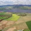
NGR NH 5722 5859
Datum OSGB36 - NGR
Permalink http://canmore.org.uk/site/294195


- Council Highland
- Parish Urquhart And Logie Wester
- Former Region Highland
- Former District Ross And Cromarty
- Former County Ross And Cromarty
NH55NE 182 5722 5859
Listed at NH 573 587 in MS 2776/1/8.
Fish trap (AP) - seen, not visited.
CFA/MORA Coastal Assessment Survey 1998.
Aerial Photographic Interpretation (1998)
Listed at NH 573 587 in MS 2776/1/8.
Fish trap (AP) - seen, not visited.
CFA/MORA Coastal Assessment Survey 1998.

