Scheduled Maintenance
Please be advised that this website will undergo scheduled maintenance on the following dates: •
Tuesday 3rd December 11:00-15:00
During these times, some services may be temporarily unavailable. We apologise for any inconvenience this may cause.
Brough Of Deerness
Chapel (Viking), Monastic Settlement (Viking)(Possible)
Site Name Brough Of Deerness
Classification Chapel (Viking), Monastic Settlement (Viking)(Possible)
Alternative Name(s) Chapel On The Brough
Canmore ID 2927
Site Number HY50NE 14
NGR HY 5955 0873
Datum OSGB36 - NGR
Permalink http://canmore.org.uk/site/2927
First 100 images shown. See the Collections panel (below) for a link to all digital images.
- Council Orkney Islands
- Parish St Andrews And Deerness
- Former Region Orkney Islands Area
- Former District Orkney
- Former County Orkney
HY50NE 14 5955 0873
For comparable site, see HU16SE 2.
(HY 5960 0873) Brough (NAT)
Chapel (NR) (In Ruins)
OS 25" map, Orkney, 1st ed., (1881)
Brough (NR): Chapel (NR) (In Ruins)
OS 6" map, Orkney, 2nd ed., (1903)
There are the remains of a Celtic monastery on the Brough of Deerness, a headland cut off by the remains of a wall still standing to 2ft 6ins in height at the west end, and originally about 3ft thick.
The isolated area measures 142yds N-S and averages 80yds in breadth E-W. In the centre are the remains of the chapel about 17ft by 9ft 9ins, within walls about 4ft thick, now not more than 4ft 9ins high, within a rectangular enclosure, the wall-foundations of which are 3ft thick. (J Anderson 1881; D MacGibbon and T Ross 1896-7).
The two circular huts on the edge of the west cliff and the cluster of 21 huts, about 10ft in diameter, at the SE corner, grouped round a possible rain-water catch-pit, are probably earlier than the chapel but the 19 rectangular buildings near the chapel, now showing as turf-covered foundations varying from about 12ft square to 39ft by 15ft are probably the domestic buildings of the monastery, coeval with the chapel.
There are the remains of an undatable building, showing as a low crescentic mound, at the SW corner of the site.
The place was a famous resort of pilgrims in the 16th (Macfarlane's Geographical Collections) and 17th (J Wallace 1700) centuries.
RCAHMS 1946, visited 1930; C A R Radford 1962
The site is generally as described above, but only the grass-covered footings of 17 circular depressions could be found. The two circular huts on the edge of the west cliff and the wall around the church could not be traced.
Surveyed at 1/2500.
Visited by OS (RD) 20 August 1964
The wall barring the approach averages 3.5m thick and may be earlier than the monastery (i.e. the outer face well down the slope is of typical Iron Age architecture indicating a defensive structure rather than a "vallum monasterii"). No inner face is evident and there is too much turf to confirm Anderson's observation of "5ft of earth backing the outer face." The chapel and monastic settlement are mainly as described and planned by the RCAHMS, but several other buildings can be identified.
The plan of the enigmatic building in the SW is not clear but there are indications of other walls in its vicinity and it may form part of a gatehouse immediately behind the entrance through the main wall (now collapsed and visible as a hollow.)
The two 'huts' on the W cliff could not be located.
Resurveyed at 1:2500.
Visited by OS (ISS) 21 May 1973
HY 596 087 (Dept of Environment) Further work on the enclosure revealed the stone wall boundary with its entrance on the S side. Outside the chapel five further graves, in poor condition, were examined; four proved to be of babies. Eithin the stone chapel post-holes and slots in the natural clay indicated a timber phase probably preceding the stone chapel and associated with the remains of a stone wall on the S side of the chapel below the standing walls.
C D Morris 1976
HY 596 087. Four small post-holes and other features in the natural clay outside the E wall of the chapel were located. A small portion of the core of the S wall of the chapel was examined, but no further stones of the earlier S wall were located. A completely new ground-survey of the site was made. Some new structures, presumed rectangular buildings, and circular depressions were surveyed.
C D Morris 1977
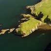
This cliff-promontory some 25m in height is situated on the rugged coast S of Mull Head and is almost an islet, separated from the mainland by a chasm and now approached by a steep cliff-path; in antiquity, however, it was evidently more easily accessible across a rock-bridge. 'Jo Ben' in the sixteenth century and Low in 1774 give vivid accounts of the custom of pilgrimage to the chapel there, a custom which endured long after the Reformation. The chapel, a simple stone building within a small rectangular enclosure, is surrounded by the turf-covered foundations of some thirty rectangular buildings which occupy most of the area of the promontory, within a strong wall or 'vallum' which runs along the land-facing edge. Before its recent clearance by the Scottish Development Department (SDD), the thick turf and high grass made survey difficult; Dryden's plan of 1866 and Calder's of 1930 show significantly less detail than Morris's made in 1975.
Excavation by Morris within the chapel and its enclosure has provided evidence for an earlier timber-built chapel with a timber altar, as well as showing that the existing stone church had a stone altar. The Brough of Deerness has frequently been quoted as an example of a 'Celtic' eremetic monastry, but a diagnostic cluster of 'circular huts' in the SE corner, surrounding the well (which is an authentic feature) seem to be shell craters resulting from naval practice in 1914-18 (they appear on Calder's plan but not on Dryden's). The remainder of the buildings, including the church, are probably of Norse and later medieval date.
'Jo Ben', text in G Barry 1805; G Low 1879; J Anderson 1881; J R Tudor 1883; D and T MacGibbon and Ross 1896-7; RCAHMS 1946; C A R Radford 1962; C D Morris 1976; RCAHMS 1987.
The work of 1975-7 is in process of publication. A series of provisional interim reports has been produced in fascicule form by C D Morris and his collaborators under the Durham University Viking and Early Settlement Archaeological Research Project. The fascicules are held in the Orkney Archaeological Record and NMRS, but carry a qualification that they do not constitute a publication.
(Undated) information in NMRS.
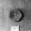
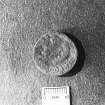
An Anglo-Saxon penny of Eadgar (959-75) was found during excavation of the chapel and enclosure in 1975-6 (C D Morris and N Emery 1987). Also found were 24 17th-century copper coins.
J D Bateson 1990.
Scheduled with HY50NE 31 as Brough of Deerness, chapel and settlement.
Information from Historic Scotland, scheduling document dated 17 December 1991.
Scheduled as Brough of Deerness, chapel and settlement... a Viking and Late Norse settlement and associated chapel on the Brough of Deerness.
Information from Historic Scotland, scheduling document dated 29 October 2003.
The excavation of "huts and vallum" are described in 'The Orcadian' newspaper in 1867.
Watching brief HY 595 087 The construction of a new access path within the area of the Scheduled Ancient Monument (HY50NE 14) was observed in January 2005. The new route lay almost entirely over bare rock or modern material and no disturbance of archaeologically sensitive deposits was recorded.
Report lodged with Orkney SMR and NMRS.
Sponsor: Orkney Islands Council.
D Lawrence 2005
HY 595 087 The site sits on a cliff promontory, separated from the mainland by a 25m deep chasm, and includes the remains of a chapel within a rectangular enclosure, a possible monastic settlement to the N and a number of enigmatic circular depressions to the S of the chapel. The latter have variously been interpreted as prehistoric huts or the result of naval shelling. Excavation of the chapel in the 1970s identified two phases of construction. The stone structure visible today is unlikely to predate the 11th century and overlies an earlier, probably pre-Norse, timber chapel. Gradiometer and resistance survey were carried out in May 2006 over all areas of the Brough that could be safely accessed in order to determine the character and extent of the archaeological deposits. In particular, it was hoped that the survey might reveal further structures not visible as extant earthworks, and provide data to interpret the hut circles/shell craters. As was to be expected from such a rich archaeological site, the survey has located a large range and number of archaeological features. It has highlighted a considerable number of features beyond those extant earthworks identified by the surveys by the Royal Commission in 1930 and the survey conducted by Bettess in 1977. The combination of resistance and gradiometer survey has been particularly useful in highlighting the range of responses from the visible structures across the top of the Brough. The different anomaly types provide some evidence to suggest that a number of construction techniques have been employed, although whether this variation is related to the status, purpose or period of the construction of the buildings cannot be ascertained. The survey also revealed a number of anomalies that while appearing rectilinear and structural in nature do not correspond with extant earthworks. This would seem to indicate earlier structures on the Brough that have been at least partially levelled by subsequent occupation of the site. The survey has raised further questions surrounding the interpretation of the group of depressions concentrated around the well. The almost complete absence of magnetic responses from these depressions would seem to preclude the interpretation as either shell holes or prehistoric huts. The depressions appear to coincide with some slightly low resistance anomalies, but this may be the result of the shape of these features causing greater moisture retention.
Archive lodged with Orkney College Geophysics Unit.
Sponsor: Orkney College Geophysics Unit.
James Moore, 2006.
Antiquarian Observation (1846 - 1870)
Plans and drawings by Sir Henry Dryden in folio titled 'Churches in Orkney and Shetland', dated 1846, 1851-2, 1855, 1863, 1866 and 1870 in the Society of Antiquaries of Scotland Collection.
Field Visit (20 August 1964)
The site is generally as described above, but only the grass-covered footings of 17 circular depressions could be found. The two circular huts on the edge of the west cliff and the wall around the church could not be traced.
Surveyed at 1/2500.
Visited by OS (RD) 20 August 1964
Field Visit (21 May 1973)
The wall barring the approach averages 3.5m thick and may be earlier than the monastery (i.e. the outer face well down the slope is of typical Iron Age architecture indicating a defensive structure rather than a "vallum monasterii"). No inner face is evident and there is too much turf to confirm Anderson's observation of "5ft of earth backing the outer face." The chapel and monastic settlement are mainly as described and planned by the RCAHMS, but several other buildings can be identified.
The plan of the enigmatic building in the SW is not clear but there are indications of other walls in its vicinity and it may form part of a gatehouse immediately behind the entrance through the main wall (now collapsed and visible as a hollow.)
The two 'huts' on the W cliff could not be located.
Resurveyed at 1:2500.
Visited by OS (ISS) 21 May 1973
Excavation (1976)
HY 596 087 (Dept of Environment) Further work on the enclosure revealed the stone wall boundary with its entrance on the S side. Outside the chapel five further graves, in poor condition, were examined; four proved to be of babies. Eithin the stone chapel post-holes and slots in the natural clay indicated a timber phase probably preceding the stone chapel and associated with the remains of a stone wall on the S side of the chapel below the standing walls.
C D Morris 1976
Excavation (1977)
HY 596 087. Four small post-holes and other features in the natural clay outside the E wall of the chapel were located. A small portion of the core of the S wall of the chapel was examined, but no further stones of the earlier S wall were located. A completely new ground-survey of the site was made. Some new structures, presumed rectangular buildings, and circular depressions were surveyed.
C D Morris 1977
Publication Account (1996)
This is one of the most spectacularly located monuments in Orkney, for it occupies the flat top of a large detached rock stack off a coast of precipitous cliffs. Inherent in its location is danger for the unwary visitor, although the character of the site can be appreciated from the adjacent mainland without crossing on to the stack itself. When the various structures were built and in regular use, it is likely that the Brough was accessible along a narrow neck of land, perhaps even at groundlevel, but now that land bridge has eroded away and the path leading up on to the Brough starts virtually on the beach.
A bank runs along the landward side of the Brough, with an entrance towards the south-west corner opposite the adjacent promontory. Such an attempt to control access to the site seems unnecessary today, but, if the Brough was connected to the mainland by a land-bridge, it would have been essential. The major upstanding feature is the chapel within its square enclosure, which was the focus for pilgrimage throughout the Middle Ages and as late as the mid 19th century, although its dedication is unknown. Its visibility from the mainland made it a convenient target for gun practice in the Second World War, resulting in the shell-holes that now pit the area between the bank and the chapel.
To the west and north of the chapel are many grassgrown foundations of rectangular buildings, most of which fall into two rows on either side of a 'street' along the west side of the Brough. These have been the subject of scholarly debate for many years: are they the remains of a monastery or are they simply domestic houses of the Norse or later period? Most prefer the latter interpretation, viewing the site as comparable to the settlement on the Brough of Birsay (no. 49). Only the chapel has been excavated, revealing not only that the existing chapel is probably Norse in date but also that it replaced an earlier version built in timber and stone, thought also to be Norse. It is thus likely that, whatever its status, this stack site was contemporary with the Norse farm at Skaill (see under no. 47).
Information from ‘Exploring Scotland’s Heritage: Orkney’, (1996).
Geophysical Survey (May 2006)
HY 595 087 The site sits on a cliff promontory, separated from the mainland by a 25m deep chasm, and includes the remains of a chapel within a rectangular enclosure, a possible monastic settlement to the N and a number of enigmatic circular depressions to the S of the chapel. The latter have variously been interpreted as prehistoric huts or the result of naval shelling. Excavation of the chapel in the 1970s identified two phases of construction. The stone structure visible today is unlikely to predate the 11th century and overlies an earlier, probably pre-Norse, timber chapel. Gradiometer and resistance survey were carried out in May 2006 over all areas of the Brough that could be safely accessed in order to determine the character and extent of the archaeological deposits. In particular, it was hoped that the survey might reveal further structures not visible as extant earthworks, and provide data to interpret the hut circles/shell craters. As was to be expected from such a rich archaeological site, the survey has located a large range and number of archaeological features. It has highlighted a considerable number of features beyond those extant earthworks identified by the surveys by the Royal Commission in 1930 and the survey conducted by Bettess in 1977. The combination of resistance and gradiometer survey has been particularly useful in highlighting the range of responses from the visible structures across the top of the Brough. The different anomaly types provide some evidence to suggest that a number of construction techniques have been employed, although whether this variation is related to the status, purpose or period of the construction of the buildings cannot be ascertained. The survey also revealed a number of anomalies that while appearing rectilinear and structural in nature do not correspond with extant earthworks. This would seem to indicate earlier structures on the Brough that have been at least partially levelled by subsequent occupation of the site. The survey has raised further questions surrounding the interpretation of the group of depressions concentrated around the well. The almost complete absence of magnetic responses from these depressions would seem to preclude the interpretation as either shell holes or prehistoric huts. The depressions appear to coincide with some slightly low resistance anomalies, but this may be the result of the shape of these features causing greater moisture retention.
Archive lodged with Orkney College Geophysics Unit.
Sponsor: Orkney College Geophysics Unit.
J Moore 2006
Excavation (2008)
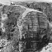
HY 5955 0873 The Brough of Deerness is a sea stack, the top of which holds the remains of a late Viking Age church and approximately 30 associated buildings. Past archaeological excavation by Christopher Morris and Norman Emery focussed on the church. Scheduled monument consent was granted for the excavation of two areas in 2008 in order to clarify the preservation, chronology and (as far as possible) function of the associated settlement. Most work in 2008 focussed on Structure 24 in Area A and on Area B.
Area A – An area of c13.6 x 5.8m was opened over Structures 23 and 24 as recorded in the survey of Morris,
Emery and Bettess (1977). Structure 23 was not visible on the surface in 2008, but Structure 24 was clear as a raised semicircular feature with a diameter of c4m. Excavation revealed the general outline of Structure 23 and showed that Structure 24 was a palimpsest of superimposed ancient features, rather than a single building or a large shell-hole from when the site was used for target practice during the First and Second World Wars.
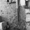
Structure 23 was rectilinear but irregular in plan, partly due to post-abandonment collapse, but also because it was apparently inserted into a space framed by pre-existing buildings and/or ruins. Internally it measured c7.2 x 3.5m. It had an inner wall face of unbonded masonry, partly cut into pre-existing deposits and partly set in what was otherwise an earth and rubble foundation (presumably for a turf superstructure). Its bioturbated upper floor level included much charcoal. A single small shell-hole was discovered near the middle of the building, associated with fragments of probable shell-casing. The structure may have had two opposing doorways near its western gable, but it was not excavated after we exposed its general outline so this
interpretation remains conjectural.
Structure 24 turned out to be a series of in situ features of differing dates. The lowest of these were midden deposits (with good preservation of animal bone) into which Structure 23 was inserted. The middens were examined in a small 2 x 1m sondage, but were found to overlie earlier structural features which prevented continued excavation in such a small trench. No clear dating evidence was recovered from Area A, but it is considered that the absence of Pictish or medieval ceramics in the areas excavated to date strongly implies a broadly Viking Age chronology.
Area B – An area of c14.6 x 9.8m was opened over Structure 20, one of a series of parallel buildings W of a
trackway running through the settlement. Before excavation it was thought likely to be single-phase, based on the clarity of its outline in the earthwork and resistance surveys and aerial photographs. Excavation demonstrated that it was a multi-phase house of Viking Age Scandinavian style that was abandoned in the 11th–12th centuries. Internally it measured c10.4 x 4.1m (after narrowing from a probable original width of c4.9m). House 20 overlaid an earlier feature, possibly another building, the remains of which were found extending
out from under its SE corner.
The earliest construction and occupation phases of House 20 itself have not yet been excavated. In its penultimate configuration, the building was a three-aisled house with two rows of roof-supporting posts and probably an internal crosswall of perishable material dividing its internal space into E and W rooms.
Its E room contained a central hearth, side aisles (marked out by the roof-supporting posts and small edge-set stones) and niches in the NE and SE corners (also demarcated by edge-set stones). At some point a small subsidiary hearth was also established near the E end of the building. The W room was mostly featureless, but may originally have had side aisles. The floors associated with this penultimate phase of the buildings use produced a glass bead of 11th-century date.
Additional finds from the exterior of House 20, or from the destruction of its walls, may be broadly contemporary with use of the building. These included a steatite loom weight or fishing weight and a steatite vessel sherd. It is probable that there were originally two entrances into the building, in the NW and NE ends of the N wall. The N wall itself was a rebuild, the original having collapsed earlier in the life of the house.
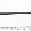
The internal posts were removed from House 20 near the end of its life, possibly to be replaced with timbers along the inside edge of its N and S walls. A new entrance was inserted in the centre of the S wall and a new earth floor with occasional paving slabs was laid. At this time, or shortly after, a copper alloy pin of 11th- to 12th-century date and an inscribed spindle whorl were lost in the building.
There were no shell-holes in Area B, although occasional pieces of possible shell-casing were recovered. Bone was not preserved in this area, with the exception of a few pieces in the ash of a hearth. The sediments were probably too acidic, presumably because the cultural deposits are shallower in Area B than in Area A and do not adequately buffer the naturally high pH. The closeness of House 20 to the cliff edge may also be relevant. Presumably much household refuse would have been discarded directly into the sea.
170 sediment samples were collected to allow the post-excavation study of botanical remains, small animal remains, micro-refuse and soil chemistry. Samples were collected from middens and features (such as hearths) and on a 0.50m grid across the best preserved floor level of Structure 20. Soil micromorphology samples were also collected from floor surfaces. Animal bone (where preserved) was carefully collected by hand from any sediment not otherwise sampled.
Funder: McDonald Institute for Archaeological Research, Orkney Islands Council, Royal Norwegian Embassy (London) and Norwegian Consulate General (Edinburgh).
James Barrett and Adam Slater, 2008
Measured Survey (July 2009)
HY 5955 0873 Following a geophysical survey over the Brough of Deerness in 2006 a topographic survey was undertaken in July 2009. The survey aimed to record any earthworks across the site relating to the monastic settlement. To facilitate good data coverage in a relatively short amount of time, data was collected at 0.5m intervals, along traverses c2m apart. The data collection was then repeated at right angles to the initial dataset to increase definition across the features. The strimming of vegetation in the northern part of the site and the use of Trimble DGPS 5800 in backpack mode seemed to reduce problems encountered previously when using a detail pole in extremely tussocky grass.
The data were processed to generate a topographic model of the site and this clearly showed slight topographic changes caused by the presence of archaeological features, together with much broader topographic changes. To increase the clarity of the small-scale features background topography was removed from the data set, leaving only earthworks of archaeological interest. Analysis of the data showed a number of features that had not been identified by a previous survey by Durham University in 1986 and redefined other features which had been identified in the earlier work. The use of a GPS rather than a plane table in this difficult vegetation/terrain is clearly advantageous and has yielded useful results.
Archive: OCGU
Funder: University of Cambridge
Mary Saunders – Orkney College Geophysics Unit
Excavation (6 July 2009 - 31 July 2009)
HY 5955 0873 The Brough of Deerness is a sea stack, the top of which holds the remains of a late Viking Age church and c30 associated buildings. Past archaeological research by Christopher Morris and Norman Emery focused on the church. In 2008 scheduled monument consent was granted for the excavation of two areas (A and B). In 2009 consent was granted for the excavation of a third trench (Area C), located to the E of Area A and joined to it by a small extension. Work on this area was undertaken 6–31 July 2009.
Area C An area of c13 x 7.6m was opened over an earthwork designated Structure 25 in a topographic survey
undertaken by Fred Bettess in 1977. In the SW corner a smaller area was opened to link Area C to Area A. Within the area of this extension the northern end of Structure 24 was also investigated.
Structure 24 proved to be a shallow building with little internal stratigraphy other than collapse/demolition
deposits. The excavated walls imply that it was 2.5m wide, greater than 4m long, and had at least one internal
subdivision and a heavily robbed paved floor. The date of the structure is uncertain. It is cut through midden deposits that are Pictish in date (based on two radiocarbon dates, and a Pictish bone pin recovered from the backfill of the building’s construction trench) and is truncated by a 20th-century shell hole. Analogy with other excavated structures on the Brough suggests that Structure 24 is of late Viking Age date. It may have served an ancillary, non-domestic, function given the absence of internal occupation deposits.
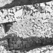
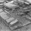
Structure 25 has proved to be a complex and well preserved dry stone building. Its earliest phases have not been investigated; however, it is cut through the same extensive Pictish midden deposits as Structure 24. In the earliest excavated phase Structure 25 was a rectangular dwelling house with a door in its S gable. Internally the building plan follows a layout characteristic of late Viking Age Scandinavian architecture in the North Atlantic region. It slopes appreciably from N–S. The southern end of the building was roughly paved with a stone-lined drain aligned NE-SW. Within the remainder of the building a central aisle or ‘long hearth’ consisted of deposits rich in charcoal and ash demarcated by edge-set stones. This central aisle produced an unusual segmented bone and stone (?lignite) bracelet and a small composite weight of copper alloy and lead. In the E, behind the edge-set stones, the deposits were stony and dark brown and this suggests that the eastern side of the building was a raised ‘bench’, which is now much reduced. To the W of the central aisle the floor deposits were mainly ashy and stone free suggesting this was an occupation surface. The NW corner of the building appears to have had a bin feature demarcated by a large edge-set stone slab. This phase of Structure 25 was sampled on a 0.5m grid for post-excavation analysis of soil chemistry, micro-refuse and botanical remains. Soil micro-morphology samples were also taken.
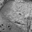
In the subsequent phase Structure 25 was converted from domestic use into a roughly paved building with no hearth. In the N the building was shortened (perhaps following a partial wall collapse) by the insertion of a cross wall and an infill of massive stone blocks. Within this fill a fragment of a 10th- to 11th-century comb was found. In the S of the building the door in the gable was blocked and much of the eastern wall line was rebuilt. A new entrance was created in the SE corner served by an external path. Internally a stone cross wall divided the shortened building into two rooms. The northern room was coherently paved and entered from the S by a door in the cross wall. The southern room was roughly paved and the bedding for this surface produced an unusual copper-alloy pendant with rune-like decoration. This phase of activity was succeeded by another episode of paving in the northern room. Contemporary paving in the southern room seems to have been robbed in antiquity.
The demolition/collapse of the building was comprehensive and resulted in the deposition of a thick layer of rubble over the two rooms. To the N of the secondary gable the rubble infill was covered by various midden deposits. One of these produced a residual sherd of blue vessel glass with white trails that is likely to be of 6th- to 7th-century date. Other finds included worked jet-like material (probably lignite), a copper-alloy pin, spindle whorls, a fragment of a schist hone and a copper-alloy strap end. The final phase of activity was represented by two small shell holes associated with considerable quantities of shrapnel. They derive from the use of the Brough as a gunnery range during WW1 and/or WW2. Orkney College Geophysics Unit was commissioned to undertake a GPS survey of the Brough’s summit.
Archive: RCAHMS (intended)
Funder: Society of Antiquaries of Scotland, Society of Antiquaries of London, The Russell Trust, Orkney Islands Council, Friends of St Ninian’s and the McDonald Institute for Archaeological Research
James Gerrard and James Barrett – University of Cambridge
Excavation (20 June 2011 - 29 July 2011)
HY 5955 0873 The Brough of Deerness is a sea stack with a Late Viking Age church and approximately 30 associated buildings on its summit. Excavation in the 1970s by Christopher Morris and Norman Emery focused on the church. In 2008 and 2009 three houses in the settlement were partly excavated. One of these, Structure 25 in Area C, was the focus of continued excavation from 20 June–29 July 2011, along with portions of associated outbuildings (Structures 24, 26a, 26b and 29) and middens. Structure 25 was excavated to its primary phase. It was originally a three-aisled dwelling house of semi-subterranean construction, with a central hearth and entryways in the N and S gables. The roof was probably supported on the side walls, unlike Structure 20 which originally had two rows of internal posts. The layout of Structure 25, combined with the discovery of half of a broken glass ‘linen smoother’ embedded in the floor, suggests a Late Viking Age date for its primary occupation.
To the SW of Structure 25 were several small buildings akin to pit houses that could not be excavated in their entirety (Structures 24, 26a and 26b). They appear to have been contemporary with Structure 25 during some of its use phases. All were dug into extensive pre-existing middens that produced bone pins of Pictish style in their upper horizons. The absolute dating of these deposits must await radiocarbon determinations, but an unstratified copper alloy mount of zoomorphic form found this year suggests the possibility of Middle (Roman) Iron Age occupation at the base of the sequence. The 2009 season had produced a fragment of 6th- to 7th-century vessel glass as a residual find (in a fill deposit of Late Viking Age date), implying that the site as a whole may have been occupied for much of the first millennium AD.
To the N of Area C another small building, Structure 29, was built after the northern gable door of Structure 25 had gone out of use. The new structure, perhaps another outbuilding, had a flagstone floor and lacked any significant occupation deposits.
Archive: RCAHMS (intended)
Funder: Higher Education Innovation Fund, Orkney Islands Council, Friends of St Ninian’s and the McDonald Institute for Archaeological Research
University of Cambridge, 2011
Note (23 February 2015 - 13 December 2016)
The Brough of Deerness is a cliff-girt promontory that was once linked to the mainland on the SW by a narrow neck, though this has long since eroded into a deep cleft. Extending along the broad SW or landward flank of the promontory above this cleft there is a thick wall, which is generally considered to be the vallum monasterii or boundary work of the monastic site that occupies the summit area; excavation in 1878 revealed an outer stone face to an earthen core (Anderson 1881, 101-4), and there was probably an entrance opposite the eroded neck. The interior measures about 140m from NE to SW by 70m transversely (0.94ha), and is covered with traces of thirty or so rectangular and bow-side Norse buildings around the well-known stone chapel, which had itself replaced a timber predecessor (Morris and Emery 1986). This was latterly a noted place of pilgrimage (Macfarlane 1908, iii, 318; Wallace 1700, 69), but the possibility that the monastic site occupied an earlier fort was first suggested in 1774 by George Low (1879, 55-6), and the most recent campaign of excavations has shown that the visible Norse buildings overlie Pictish middens, while unstratified finds include a copper-alloy zoomorphic mount of Roman date (Barrett 2011).
Information from An Atlas of Hillforts of Great Britain and Ireland – 13 December 2016. Atlas of Hillforts SC2840


