
Balnabroich


Burial Cairn (Bronze Age)
Site Name Balnabroich
Classification Burial Cairn (Bronze Age)
Canmore ID 29089
Site Number NO15NW 45
NGR NO 10489 57077
Datum OSGB36 - NGR
Permalink http://canmore.org.uk/site/29089


- Council Perth And Kinross
- Parish Kirkmichael (Perth And Kinross)
- Former Region Tayside
- Former District Perth And Kinross
- Former County Perthshire
Field Visit (18 January 1987)
NO15NW 45 1048 5708.
Formerly part of NO15NW 1.
This cairn is situated on the gentle S-facing slope of a ridge 400m E of the Grey Cairn. It measures about 12m in diameter over a rough kerb of boulders and a large cist has been exposed by antiquarian excavations immediately W of the centre (Stuart 1868). The cist is aligned NNW and SSE and measures a maximum of 1.15m along the E side by 0.8m across the N end; although these two slabs meet at right-angles, the cist is not rectangular and the W side measures 1.02m and the S end 0.72m. Originally the cist was probably no deeper than 0.55m, the maximum height of the N slab, but today it is about 0.65m deep. A notch in the top of the W side-slab, which is broken vertically, probably indicates where a crowbar was inserted under the cover, although no such stone is now visible on the site.
Fifteen stones of the kerb are visible, particularly around the S, and the cairn is no more than 0.3m high where it is undisturbed on the E. The cist had been emptied prior to the excavations of 1865 and nothing else was found.
Visited by RCAHMS (SH) 18 January 1987.
RCAHMS 1990.
Measured Survey (18 June 1987)
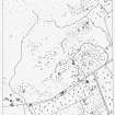
RCAHMS surveyed Balnabroich cairn by alidade and plane-table on 18 June 1987 at a scale of 1:125. The resultant plan was redrawn in ink and published at a scale of 1:250 (RCAHMS 1990, Fig. 9.3).
Measured Survey (1987)
RCAHMS surveyed the hut circles, field system and Pitcarmick-type buildings at Balnabroich in 1987 at a scale of 1:2500. The resultant plan was redrawn in ink and published at a scale of 1:5000 (RCAHMS 1990, Fig. 108A).

