Balnabroich
Field System (Prehistoric), Hut Circle(S) (Prehistoric)
Site Name Balnabroich
Classification Field System (Prehistoric), Hut Circle(S) (Prehistoric)
Alternative Name(s) Stylemouth
Canmore ID 29054
Site Number NO15NW 14
NGR NO 1021 5710
NGR Description Centred NO 102 571
Datum OSGB36 - NGR
Permalink http://canmore.org.uk/site/29054
- Council Perth And Kinross
- Parish Kirkmichael (Perth And Kinross)
- Former Region Tayside
- Former District Perth And Kinross
- Former County Perthshire
Field Visit (15 November 1973)
NO15NW 14 centred 102 571
See also NO05NE 147 and NO15NW 1.
The area around the Grey Cairn (NO15NW 1) is studded with cairns to the E and S and with groups of huts to the N and W. The latter often occur in groups of two and measure from 28' - 30' in diameter with walls from 2' - 3' thick. The entrances are in the S.
Excavation of a hut to the W produced charred wood and a fragment of bronze, like the pin of a brooch. One of the hut circles N of the Grey Cairn had a flagstone in the centre, and a small space near to it enclosed by stones was found to be filled with about 2' of black unctuous earth. The deposits in some of the hut circles of charred wood and fragments of burnt bones were so much the same as those in the cairns, as to suggest that burials may have taken place in them after they were used as huts.
(J Stuart 1868)
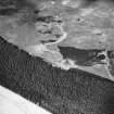
Centred at NO 102 571 is an extensive field system marked by stone clearance heaps, ruinous walls and lynchets, amongst which are 18 circular stone-walled huts, 4 cairns (NO 15 NW 1), a possible ring cairn (NO 15 NW 15), and a stone circle (NO 15 NW 16).
The huts are generally visible as level platforms set into the hillside edged by collapsed stone walls spread from two to three metres in width with occasionally inner and outer facing stones protruding. Entrances, where visible, are in the S quadrant. With the exception of nos. 9, 10, 12 and 16, all diameters are given between wall centres.
Hut 1 is 12.5m in diameter.
Hut 2 is 10.5m in diameter.
Hut 3 is 16.0m in diameter.
Hut 4 is 12.0m in diameter.
Hut 5, adjacent to 4, is 11.0m in diameter.
Hut 6 is 10.0m in diameter. On the W, 2.0m outside the house wall, another similar wall curves around the hut (in the Dalrulzion fashion) and terminates on cairn 'D' outside the N side of the hut.
Hut 7, adjacent to 6, is 12.5m in diameter.
Hut 8, is 11.0m in diameter. There is an unusually large inner facing slab in the SW.
Hut 9, in a grassy area, has an inner face of slabs on edge, particularly well-defined in the E. It measures 12.5m in internal diameter.
Hut 10, similar to 9, measures 11.5m internally.
Hut 11, ploughed and afforested, is about 11.0m in diameter. A vague hollow, 10.0m in diameter, on its NW side may be another destroyed hut. Hut 12, also afforested, shows several inner facing stones giving an internal diameter of 8.5m. The W side of the entrance extends S to form a windbreak. The E side is formed by a slab on edge. There is a ditch around the inside of the wall on the E and N, possibly due to excavation.
Hut 13 is 15.0m in diameter.
Hut 14, ploughed and afforested, is 10.5m in diameter.
Hut 15 is 13.5m in diameter. Abutting on the W side is a platform 12.0m in diameter encroached on by a small rectangular building foundation and two modern walls. This may be another ruinous hut.
Hut 16 shows several inner facing stones and is 9.0m in diameter internally.
Hut 17 is 13.5m in diameter.
Hut 18 is c. 12.0m in diameter. the SE arc is mutilated. A small rectangular level area on the W, bounded partly by a field wall, is probably a cultivation plot.
At several places amongst the clearance heaps are later rectangular foundations with associated walls and some rig and furrow cultivation, and at least three corn drying kilns. Some are barely visible and must be of considerable age. One at NO 1087 5683 is 17.0m x 6.0m with a central entrance in one of the heavily bowed longer walls. Extent of field system shown on 6" sheet.
Huts 9 and 10 surveyed at 1:2500; others at 1:10,000.
Visited by OS (AA) 15 November 1973
Field Visit (5 May 1987)
Nineteen hut-circles are scattered across a broad terrace of mixed moorland, pasture and woodland about 1km NE of Balnabroich steading. Hut-circles 3, 11-12, and 14 now lie within a dense forestry plantation and were not visited; the numbers given to the hut-circles are those originally allocated by the OS.
1. NO 1021 5723 This hut-circle has been levelled into the SW-facing slope and measures 10.8m in diameter within a wall up to 1.2m in thickness and 0.3m in height. Several inner facing-stones are visible and the wall at the rear bifurcates to form two inward facing scarps, one set above the other. The entrance is on the SSW.
2. NO 1013 5723 This double-walled hut-circle measures 10m in internal diameter and 19.6m overall. The inner wall is up to 1.5m thick and 0.4m high and a number of inner-facing stones are visible on the E; the outer wall is 1.5m thick and 0.2m high and there are several large outer facing-stones on the S. The entrance (2m wide) is on the S. The interior of the house has been trenched (probably by Stuart in the 1860s), and a possible saddle quern sits in the centre.
3. NO 1003 5707 This hut-circle now lies within a dense forestry plantation and was not visited.
4. NO 1007 5707 Situated immediately E of the head-dyke and about 60m NNE of the Grey Cairn (NO 15 NW 1), there are the remains of a badly damaged hut-circle measuring 10m in diameter within a low stony bank up to 2m in thickness and 0.3m in height. The entrance is on the SSE.
5. NO 1009 5708 Situated immediately NE of (4) there are the remains of a hut-circle measuring 10m in diameter within a bank up to 2m in thickness and 0.3m in height; the entrance is on the SE.
6. NO 1022 5711 This hut-circle is probably of two phases of construction and is also overlain by a well-preserved hut-circle (7) on the E. The later phase of construction is represented by an inner wall reduced to a stony bank up to 1.3m in thickness by 0.3m in height. The earlier hut-circle, which is incomplete, measures about 15.7m in overall diameter and its wall is reduced to a bank up to 1.2m in thickness and 0.3m in height. In both phases the entrance was on the S. The wall of the earlier phase appears to be overlain by a small cairn on the NW and its line is overlain by the adjacent hut-circle on the E. The cairn covered a probable burial in a pit and the apparent relationship between the wall and the cairn material may be the result of Stuart's excavation trench (1868).
7. NO 1023 5712 This hut-circle measures 10.2m in diameter within a wall measuring up to 2.7m in thickness and 0.4m in height; both wall-faces are defined by small boulders and the entrance (1.8m wide) is on the SSE.
8. NO 1033 5707 This hut-circle has been levelled into the slope and measures 10.1m in diameter within a wall about 2m in thickness and 0.3m in height. The inner face of large boulders is well-preserved, particularly on the E side of the entrance where the outer face is also well-preserved. A second phase of construction is represented by an arc of boulders, some set on edge, which extends across the interior to enclose an area measuring 8.2m E-W by 7m transversely. In both phases the entrance (1.5m wide), which is flanked by two massive boulders, was on the S.
9. NO 1002 5694 Levelled into the gentle SW-facing slope some 70m SSW of the Grey Cairn (NO 15 NW 1), there are the remains of a hut-circle measuring 12.3m in diameter within a wall up to 1.5m in thickness and 0.5m in height. On the SE, NW and NE an internal face of large boulders and slabs is visible, the largest measuring some 1.2m in length and 0.5m in height. There is an entrance (1.2m wide) on the S and to either side the wall thickness increases to about 2.7m; there is little trace of an outer wall-face and on the SE, where the wall climbs to the rear of an inner scarp, it has been reduced to no more than a rickle of stone.
10. NO 1000 5696 This hut-circle is situated some 70m SW of the Grey Cairn and its interior has also been levelled into the SW-facing slope. It measures 10.7m in diameter within a wall up to 2.8m in thickness and 0.4m in height. The N arc of the inner face includes several large boulders; where visible, the outer face is defined by small boulders but like (9) the emphasis has been placed on the inner face. The entrance (2m wide) is on the SSW and from its E side a low bank extends around the E arc of the wall.
11 and 12. NO 0948 5705 These hut-circles now lie within the dense forestry plantation and were not visited.
13. NO 0987 5701 This hut-circle is situated on a gentle slope about 190m W of the Grey Cairn and measures 12.9m in diameter within a turf-covered wall up to 1.9m in thickness and 0.3m in height. The interior has been levelled into the slope and the entrance (1.5m wide) is on the ESE. What may be fragments of two more hut-circles lie immediately to the S and ENE respectively.
14. NO 0993 5728 This hut-circle now lies within the dense forestry plantation and was not visited.
15. NO 0988 5763 This hut-circle measures 11m in diameter within a turf and heather-covered bank up to 2.2m in thickness and 0.4m in height; the entrance (1.5m wide) is on the SSW.
16. NO 0990 5764 Situated about 8.8m ENE of (15) there are the remains of a hut-circle displaying two periods of construction; in the later period it measured 9.3m in diameter within a wall up to 3m in thickness and 0.5m in height. A number of inner facing-stones are visible, particularly on the NW arc, and the 2m wide entrance is on the S. In the earlier period the hut-circle was slightly larger and the arc of the earlier wall is visible on the NE.
17. NO 0992 5767 Situated about 15m NNE of (16), there are the remains of a hut-circle measuring about 11.5m in diameter within a stone wall up to 1.8m in thickness and 0.4m in height. Boulders of both the inner and outer faces are visible and the entrance, which is poorly preserved, is on the S.
18. NO 0993 5768 This hut-circle lies 4m NNE of (17) and measures 10.8m in diameter within a wall up to 2.6m in thickness and 0.4m in height. The interior has been levelled into the slope and several inner facing-stones are visible on the N side; the entrance was not visible on the date of visit when the house was masked by a thick cover of heather. The level area to the W of the hut-circle noted by the OS, is a small cleared area of ground, defined on the SW by a low bank which springs from the NW side of the hut-circle.
19. NO 0987 5762 This hut-circle lies immediately WSW of (15) and is crossed by a stone dyke; it measures about 10m in diameter within a heather-covered bank about 1.8m in thickness and 0.3m in height. This wall is only visible on the NW and the rest of the house is largely defined by a rear scarp. The W half of the platform is obscured by the remains of a small rectangular structure which is also crossed by the later dyke. It measures 5.6m N-S by 3.3m over a low turf-covered wall up to 0.5m in thickness and 0.3m in height. The entrance is situated midway along the W side and is marked by a shallow dip in the bank beneath the stone dyke.
These hut-circles lie within a landscape littered with nearly 1000 small cairns; there are also a few stony banks which form no coherent pattern, and the lower slopes are covered with the remains of ridge-and-furrow. There is a central farmstead (NO05NE 39) which was abandoned by 1863 and several other buildings which may be of considerably earlier date. Whilst chronological depth is illustrated by the multi-period nature of some of the hut-circles, the various elements of the field-system cannot be broken down and associated with any particular period of occupation. The possible neolithic date for the Grey Cairn, and two ring-cairns, mean that the field-system at Balnabroich may have developed as early as the third millenium BC and this area continued until the 19th century AD.
Visited by RCAHMS (JRS) 5 May 1987.
RCAHMS 1990
Measured Survey (10 November 1987)
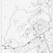
RCAHMS surveyed the hut circles (6/7, G, NO 1022 5711) at Balnabroich by self-reducing alidade and plane-table on 10 November 1987 at a scale of 1:250. The resultant plan was redrawn in ink and published at a scale of 1:500 (RCAHMS 1990, Fig. 108B).
Measured Survey (1987)
RCAHMS surveyed the hut circles, field system and Pitcarmick-type buildings at Balnabroich in 1987 at a scale of 1:2500. The resultant plan was redrawn in ink and published at a scale of 1:5000 (RCAHMS 1990, Fig. 108A).


