
Pricing Change
New pricing for orders of material from this site will come into place shortly. Charges for supply of digital images, digitisation on demand, prints and licensing will be altered.
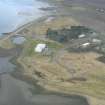
Alness Point


Building (Period Unassigned)
Site Name Alness Point
Classification Building (Period Unassigned)
Alternative Name(s) Cromarty Firth
Canmore ID 289280
Site Number NH66NE 129
NGR NH 6513 6775
NGR Description Centred NH 6513 6775
Datum OSGB36 - NGR
Permalink http://canmore.org.uk/site/289280

- Council Highland
- Parish Alness
- Former Region Highland
- Former District Ross And Cromarty
- Former County Ross And Cromarty
NH66NE 129 centred 6513 6775
Two roofed buildings on the 1st edition of the OS 6-inch (Ross and Cromarty, sheet lxv; 1880).
Only one building found. This has the stump of one end only 0.5m high, interior filled with rubble. A low mound of stones and mortar close by to the West may represent either the other end of the building or the other structure noted in 1880. No sign of other foundations on this dry area of grass with stagnant ponds inland. Lots of mussel and periwinkle shells in rabbit excavations nearby.
CFA/MORA Coastal Assessment Survey 1998.

