Herald Hill
Long Barrow (Neolithic)
Site Name Herald Hill
Classification Long Barrow (Neolithic)
Alternative Name(s) Hallhole; Hall Hole
Canmore ID 28531
Site Number NO13NE 62
NGR NO 1867 3961
Datum OSGB36 - NGR
Permalink http://canmore.org.uk/site/28531
- Council Perth And Kinross
- Parish Caputh
- Former Region Tayside
- Former District Perth And Kinross
- Former County Perthshire
NO13NE 62 1867 3961.
A possible long cairn, measuring 60m E-W; E end 18m across, W end 9m across.
Information from OS field surveyor, October 1970.
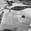
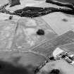
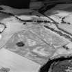
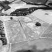
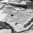
NO 1867 3961. The mound at Herald Hill (NMRS NO13NE 62) has often been interpreted as a possible long barrow, largely because of its 'classic' profile, with a raised E end. It measures about 70-80m in length, between 15-20m across, and up to 4m high at its higher (E) end, falling to less than 1m at the W.
In 1997 a 1m square test-pit was dug about 19m W of the summit and c 3m N of the axis of the mound, to determine if the mound was artificial. The uppermost metre of the profile appeared to be redeposited. Below that level was undisturbed subsoil. This suggests that the profile of the mound is substantially the product of human construction, but that the builders took advantage of a pre-existing low fluvio-glacial ridge. It seems probable, therefore, that the mound is a long barrow.
G J Barclay and G S Maxwell 1997.
(Scheduled as long barrow). The monument comprises a long barrow of prehistoric date, visible as a prominent mound on the summit of a low hill at around 50m OD. It consists of a long trapezoidal mound, measuring about 70m E-W, and about 18m across the E end and 9m across the W end. It appears to be aligned on the SE terminal of the nearby cursus monument known as the Cleaven Dyke.
Information from Historic Scotland, scheduling document dated 17 December 1998.
Field Visit (April 1989)
This alleged long cairn is nothing more than a long natural mound which has been augmented by the dumping of field-cleared stones.
Visited by RCAHMS (JRS) April 1989.
Field Visit (1 June 1992)
A long mound on the crest of Herald Hill is probably a natural feature. The E end of the mound would make a very impressive terminal for a long barrow, but the crest of the mound runs W in a gentle curve, reflecting the trend of the fluvio-glacial feature that extends some way into the adjacent field to the W. Field-gathered stones have also been dumped on the mound.
Visited by RCAHMS (AW, SH) June 1992.
Measured Survey (1997)
Following a request from Historic Scotland, a contour survey was carried out on the possible Neolithic long mound at Herald Hill, near Meikleour in south-east Perth.
RCAHMS (DES 1997, 88)


