Pricing Change
New pricing for orders of material from this site will come into place shortly. Charges for supply of digital images, digitisation on demand, prints and licensing will be altered.
Upcoming Maintenance
Please be advised that this website will undergo scheduled maintenance on the following dates:
Thursday, 9 January: 11:00 AM - 3:00 PM
Thursday, 23 January: 11:00 AM - 3:00 PM
Thursday, 30 January: 11:00 AM - 3:00 PM
During these times, some functionality such as image purchasing may be temporarily unavailable. We apologise for any inconvenience this may cause.
St Madoes, Pitfour
Cup Marked Stone (Prehistoric), Standing Stone(S) (Prehistoric)
Site Name St Madoes, Pitfour
Classification Cup Marked Stone (Prehistoric), Standing Stone(S) (Prehistoric)
Alternative Name(s) St Madoes Primary School; Glencarse; Pitfour Castle
Canmore ID 28207
Site Number NO12SE 20
NGR NO 19711 20992
Datum OSGB36 - NGR
Permalink http://canmore.org.uk/site/28207
- Council Perth And Kinross
- Parish St Madoes
- Former Region Tayside
- Former District Perth And Kinross
- Former County Perthshire
N012SE 20 1972 2098.
(NO 1972 2098) Standing Stones of St. Madoes (NR) (Three shown)
OS 6" map, (1959)
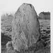
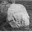
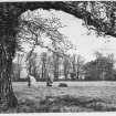
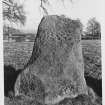
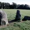
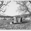
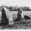
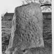
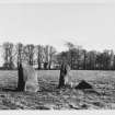
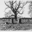
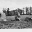
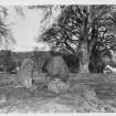
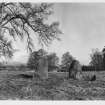
Three standing stones, aligned SSE, are 5ft 4ins, 5ft 3ins and 2ft 6ins high. The distances between them are 5ft 6ins and 2ft 3ins. The north stone has a number of cup marks.
J R Allen 1882.
Scheduled as St Madoes, standing stones 200m WNW of Pitfour Castle. Information from Historic Scotland, scheduling document dated 29 October 2003.
Publication Account (1882)
Three standing stones, aligned SSE, are 5ft 4ins, 5ft 3ins and 2ft 6ins high. The distances between them are 5ft 6ins and 2ft 3ins. The north stone has a number of cup marks.
J R Allen 1882.
Field Visit (9 June 1964)
These stones are as described by J R Allen (1882). They lie in line from NNW to SSE. The south stone is prostrate, the other two upright.
Visited by OS (W D J) 9 June 1964.
Field Visit (18 May 1989)
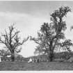
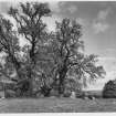
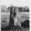
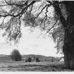
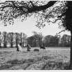
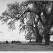
A probable pair of standing stones and a small recumbent boulder have been incorporated into a small heather garden in the playground of St Madoes primary school. The stones were not disturbed during the building of the school, but a low stone revetment has been constructed around the base of the setting, and the level of what is now the playground has been reduced by anything up to about 0.6m.
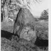
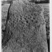
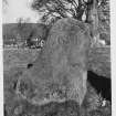
The N upright is an angular block which measures 1.1m by 1.1m and rises to a height of 1.6m; both its E and W faces are heavily cup-marked. The second upright (1.65m SSE of the first) is also a pointed block, measuring 1.1m by 0.9m and 1.5m in height. The recumbent stone (which may never have formed part of the setting) lies a further 0.65m to the SSE and measures 1.3m in length by 0.8m in breadth and 0.6m in thickness.
Excavation (by Dr M E C Stewart) revealed no stone-holes but evidence of previous disturbance.
Visited by RCAHMS (JRS) 18 May 1989.
M E C Stewart 1967.
Archaeological Evaluation (January 2001)
NO 1976 2100 An archaeological evaluation was undertaken in January 2001 in advance of the construction of housing. The proximity to the site to a group of three Scheduled prehistoric standing stones (NMRS NO12SE 20) prompted a planning condition on the development.
A 3% sample of the development area was investigated by means of machine-cut trenches. One pit was found close to the standing stones at the western edge of the site. A small fragment of a shale bracelet and three small sherds of prehistoric pottery were found, together with two small fragments of burnt bone and several fire-cracked stones. Four plough furrows and one small undated post-hole were found in the NE corner of the site.
Sponsor: McLaren Murdoch & Hamilton for Servite Housing Association (Scotland).
S Halliday 2001.


