Pricing Change
New pricing for orders of material from this site will come into place shortly. Charges for supply of digital images, digitisation on demand, prints and licensing will be altered.
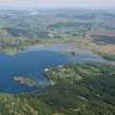
Crinan Harbour
Harbour (Period Unassigned)
Site Name Crinan Harbour
Classification Harbour (Period Unassigned)
Alternative Name(s) Loch Crinan; Eilean Da Mheinn; Eilean Da Mheine
Canmore ID 282025
Site Number NR79SE 65
NGR NR 7810 9419
Datum OSGB36 - NGR
Permalink http://canmore.org.uk/site/282025
- Council Argyll And Bute
- Parish North Knapdale
- Former Region Strathclyde
- Former District Argyll And Bute
- Former County Argyll
NR79SE 65.00 7810 9419
Crinan Harbour [NAT] (name centred NR 7810 9419)
OS 1:10,000 map, 1979.
NR79SE 65.01 NR 7895 9445 Quay
Not to be confused with Crinan (Canal) Basin at NR 78857 94334, for which see NR79SE 48.07.
See also:
NR79SE 26 NR 7880 9444 Crinan Hotel (Crinan Basin)
NR79SE 36 NR 78332 94072 Pyroligneous acid works
NR79SE 89 NR 78280 94070 1 Harbour House
NR79SE 90 NR 78284 94075 2 Harbour House
(Location cited as NR 783 940). Crinan: the Statistical Account of 1793 points to Loch Crinan as the best harbour in a long stretch of the western coast, stating that 'vast' numbers of craft from both Britain and Ireland were often detained there as they waited for a wind to take them to the Mull of Kintyre. The writer mentions two anchorages, below Duntroon [Duntrune Castle: NR 7936 9557] and the other behind Eilean da Mheine [Eilean da Mheinn: NR 781 943]; near the latter position a small harbour exists today. This state of affairs no doubt changed materially eight years later, when the Crinan Canal [NR79SE 48.00] opened, as thereafter Crinan's main function must have been to form that work's northern terminal. Steamers from Oban, Fort William, Inverness and the Outer Islands were calling at Crinan at least as early as 1844 (NSA).
Structure: the harbour sheltered by Eilean da Mheine, consists of a roadway along a quay, which has been out from the foot of a cliff about 100ft (30.5m) high. The rock spurs characteristic of this shoreline may have been cut or blasted away. The very slightly battered quay front is made of huge, rough, dark grey stone blocks, some measuring 2ft (0.6m) by 3ft (0.9m), of irregular shapes, fitted together with small stones. No old mortar is visible. Large rough blocks, keyed back at 3yd (2.7m) intervals, form a very uneven kerb. At the NE end of the quay, there is a projection 30ft (9.1m) square, from which a flight of stone stairs, nearly 6ft (1.8m) wide, descends back along the face of the quay. One step consists of a unique slab.
A Graham and J Gordon 1988.


