Pricing Change
New pricing for orders of material from this site will come into place shortly. Charges for supply of digital images, digitisation on demand, prints and licensing will be altered.
Upcoming Maintenance
Please be advised that this website will undergo scheduled maintenance on the following dates:
Thursday, 9 January: 11:00 AM - 3:00 PM
Thursday, 23 January: 11:00 AM - 3:00 PM
Thursday, 30 January: 11:00 AM - 3:00 PM
During these times, some functionality such as image purchasing may be temporarily unavailable. We apologise for any inconvenience this may cause.
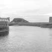
Dunure Harbour, West Pier, Light-tower
Beacon (19th Century)
Site Name Dunure Harbour, West Pier, Light-tower
Classification Beacon (19th Century)
Alternative Name(s) Dunure Harbour, South Pier; Port Rorie; Firth Of Clyde; Outer Clyde Estuary
Canmore ID 281844
Site Number NS21NE 24.03
NGR NS 25420 16056
NGR Description NS c. 25420 16056
Datum OSGB36 - NGR
Permalink http://canmore.org.uk/site/281844
- Council South Ayrshire
- Parish Maybole
- Former Region Strathclyde
- Former District Kyle And Carrick
- Former County Ayrshire
NS21NE 24.03 c. 25420 16056
(Dunure: location cited as NS 254 160). At end of S breakwater: 1811. Much-eroded cylindrical masonry tower with moulded string course. May have had lantern, but no trace surviving.
J R Hume 1997.
The location assigned to this record remains unverified. This beacon is not indicated on the current edition of the OS (GIS) AIB, and its location cannot be determined from the available map evidence.
Information from RCAHMS (RJCM), 26 June 2006.
Artificial harbour within a small headland formed in 1811 - Remains of round stone lighthouse at entrance. (Historic Scotland)
At end of S breakwater: 1811. Much-eroded cylindrical masonry tower with moulded string course. May have had lantern, but no trace surviving. (J R Hume 1997, RCAHMS)


